Karlstetten

Last updated • 1 min readFrom Wikipedia, The Free Encyclopedia
Karlstetten
20141018 1 Sommerlinde (Karlstetten) 4466.jpg
Town hall in the castle
AUT Karlstetten COA.jpg
Austria adm location map.svg
Red pog.svg
Karlstetten
Location within Austria
Coordinates: 48°15′N15°34′E / 48.250°N 15.567°E / 48.250; 15.567
Country Austria
State Lower Austria
District Sankt Pölten-Land
Government
   Mayor Josef Neumeyr
Area
[1]
  Total
28.26 km2 (10.91 sq mi)
Elevation
375 m (1,230 ft)
Population
 (2018-01-01) [2]
  Total
2,159
  Density76/km2 (200/sq mi)
Time zone UTC+1 (CET)
  Summer (DST) UTC+2 (CEST)
Postal code
3121
Area code 02741
Website http://www.karlstetten-dunkelsteinerwald.gv.at

Karlstetten is a community in the district of Sankt Pölten-Land in the Austrian state of Lower Austria. It has 2182 inhabitants.

Contents

Geography

Karlstetten is located in the Mostviertel in Lower Austria at the south-east border of the Dunkelsteinerwald. Karlstetten has an overall area of 28,21 km2, 43,15 percent of this area is forested.

Cadastral communities are: Karlstetten, Heitzing, Hausenbach, Weyersdorf, Lauterbach, Obermamau, Untermamau, Schaubing. Further villages are Dreihöf, Rosenthal, Wieshöf, Eglsee.

History

In ancient geography, Karlstetten was part of the province Noricum. On 9 September 1083, the village was first mentioned in the "Göttweiger Stiftungsurkunde". From 1459 to 1831, the family von Zinzendorf had been the ruler of the village. Their successors were Count Baudissin and Baron Candid von Suttner. In 1925 the manor was bought by Zacharias Frank, a German industrial. In 1945 it was seized by the Russian occupants as "German property". 1965 it was given into the hands of the community.

Population

Historical population
YearPop.±%
19711,578    
19811,723+9.2%
19911,787+3.7%
20011,999+11.9%

Politics

Mayor of the community is Anton Fischer, his substitute is Josef Hofbauer. In the council the seats are distributed as follows: ÖVP 10, SPÖ8, FPÖ 1. (March 2005)

Sports

The soccer team "SV Karlstetten/Neidling" plays in the "Gebietsliga West".

Economy and infrastructure

In 2001 there were 73 workplaces which were not agricultural. There were 75 agricultural ones. 974 people are employed in the village.

Karlstetten has the following institutions: kindergarten, elementary school, secondary modern school, general practitioner, dentist, musical school, musical society, gymnastics club.

Volunteer fire brigade

The market town Karlstetten has 3 volunteer fire brigades available: FF Karlstetten, FF Weyersdorf and FF Hausenbach. There is also a fire brigade youth group in Karlstetten.

Related Research Articles

<span class="mw-page-title-main">Au, Vorarlberg</span> Place in Vorarlberg, Austria

Au is a town in the Bregenz Forest in Vorarlberg (Austria).

<span class="mw-page-title-main">Mellau</span> Place in Vorarlberg, Austria

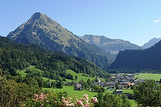
Mellau is a town in the Bregenz Forest in the westernmost Austrian state of Vorarlberg, part of the district of Bregenz.

<span class="mw-page-title-main">Krumbach, Lower Austria</span> Municipality in Lower Austria, Austria

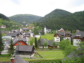
Krumbach is a market town in southern Lower Austria, Austria. It is part of the landscape Bucklige Welt.

<span class="mw-page-title-main">Hainburg an der Donau</span> Municipality in Lower Austria, Austria

Hainburg an der Donau is a town located in the Bruck an der Leitha district in the state of Lower Austria of eastern Austria. In 2021 it had a population of about 7,000.

Rohr im Gebirge is a village in the Wiener Neustadt-Land district of Lower Austria in Austria.

<span class="mw-page-title-main">Theresienfeld</span> Municipality in Lower Austria, Austria

Theresienfeld is a town in the Wiener Neustadt-Land district of Lower Austria, in eastern Austria. It lies 5 km (3 miles) north of Wiener Neustadt, in the southern part of the Vienna Basin. Of its 11.47 km2 area, 3.40% is forested.

<span class="mw-page-title-main">Waidmannsfeld</span> Municipality in Lower Austria, Austria

Waidmannsfeld is a municipality in the Wiener Neustadt-Land District, Lower Austria, Austria. The forested portion of the municipality amounts to 77.9% of its area. Waidmannsfeld consists of the cadastral communities Neusiedl and Waidmannsfeld.

<span class="mw-page-title-main">Schoppernau</span> Place in Vorarlberg, Austria

Schoppernau is a town in the Bregenzerwald Region of the Austrian state of Vorarlberg. Schoppernau has an area of 47.64 km2.

<span class="mw-page-title-main">Murfeld</span> Former municipality in Styria, Austria

Murfeld was the southernmost municipality of the Austrian district of Südoststeiermark. As of January 1, 2020, the Municipality was split between the Municipalities of Sankt Veit am Vogau and Straß in Steiermark, to the east, in the district of Leibnitz. The Catastral Subdivision of Seibersdorf bei Sankt Veit (289) merged with Sankt Veit am Vogau. The Catastral Subdivisions of Lichendorf (494), Oberschwarza (152), Unterschwarza (213) and Weitersfeld (527) merged with Straß in Steiermark.

<span class="mw-page-title-main">Pama, Austria</span> Municipality in Burgenland, Austria

Pama is a town in the district of Neusiedl am See in the Austrian state of Burgenland.

<span class="mw-page-title-main">Reichenau, Carinthia</span> Municipality in Austria

Reichenau is a municipality in the district of Feldkirchen in the Austrian state of Carinthia.

<span class="mw-page-title-main">Heiligenkreuz, Lower Austria</span> Municipality in Lower Austria, Austria

Heiligenkreuz is a municipality in the district of Baden, in the Austrian state of Lower Austria. It is known for the Cistercian monastery of Heiligenkreuz Abbey, the associated papal college Benedict XVI, commonly known as Hochschule Heiligenkreuz, and the Catholic Leopoldinum seminary.

<span class="mw-page-title-main">Hauskirchen</span> Municipality in Lower Austria, Austria

Hauskirchen is a town in the district of Gänserndorf in the Austrian state of Lower Austria.

<span class="mw-page-title-main">Rossatz-Arnsdorf</span> Municipality in Lower Austria, Austria

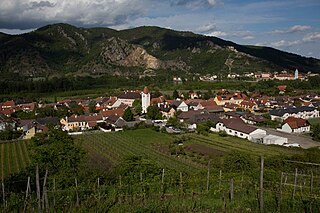
Rossatz-Arnsdorf is a town in the district of Krems-Land in the Austrian state of Lower Austria. It is located in the Wachau valley of the Danube, a popular destination for tourists, and has excellent views of the ruins of castle Dürnstein, where King Richard the Lion-Heart of England was held captive by Duke Leopold V.

<span class="mw-page-title-main">Gießhübl</span> Municipality in Lower Austria, Austria

Gießhübl is a town in the district of Mödling in the Austrian state of Lower Austria. It is located in the south of Vienna, the Austrian capital, neighboring the nature protection area Föhrenberge. With an altitude of 416 m, Gießhübl is the highest-located wine-growing district in Lower Austria. Originally Gießhübl was an agrarian village. Today it is mainly a residential area because of its vicinity to Vienna and the direct connection to the highway A21.

<span class="mw-page-title-main">Birgitz</span> Place in Tyrol, Austria

Birgitz is a community in the district of Innsbruck in Tyrol and lies on a terrace of the highlands 10 km south west of the capital. The nearest neighbouring village is Axams in the west and Götzens in the east.

<span class="mw-page-title-main">Prutz</span> Place in Tyrol, Austria

Prutz is a municipality in the Landeck district in the Austrian state of Tyrol. Located at the mouth of the Kauner valley on the upper Inn, it is 10 km south of the city of Landeck and 36 km north of Reschen Pass, that forms the border to Italy. The border to Switzerland is located 23 km away towards the south-west.

<span class="mw-page-title-main">Sautens</span> Place in Tyrol, Austria

Sautens is a municipality in the Imst district located 9 kilometres (6 mi) southeast of Imst on the lower course of the Ötztaler Ache. The village is located to catch the sun but is protected from the wind, which makes for an especially mild climate. The main source of income is agriculture. Fruit is especially important with a good part of the harvest used to make Schnapps.

<span class="mw-page-title-main">Langenegg</span> Place in Vorarlberg, Austria

Langenegg is a municipality with approx. 1,200 inhabitants in the westernmost Austrian state, Vorarlberg.

<span class="mw-page-title-main">Pischelsdorf am Kulm</span> Municipality in Styria, Austria

Pischelsdorf am Kulm is since 2015 a municipality in Weiz District in Styria, Austria. The area of the town covers 28.14 square kilometres (10.86 sq mi). In the Styria municipal structural reform, the new town was formed by merging Pischelsdorf in der Steiermark with the smaller villages of Reichendorf and Kulm bei Weiz, to reduce costs and ease election of town officials.

References

  1. "Dauersiedlungsraum der Gemeinden Politischen Bezirke und Bundesländer - Gebietsstand 1.1.2018". Statistics Austria. Retrieved 10 March 2019.
  2. "Einwohnerzahl 1.1.2018 nach Gemeinden mit Status, Gebietsstand 1.1.2018". Statistics Austria. Retrieved 9 March 2019.