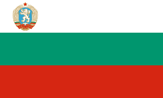
Bulgaria, officially the Republic of Bulgaria, is a country in Southeast Europe. Located west of the Black Sea and south of the Danube river, Bulgaria is bordered by Greece and Turkey to the south, Serbia and North Macedonia to the west, and Romania to the north. It covers a territory of 110,994 square kilometres (42,855 sq mi) and is the 16th largest country in Europe. Sofia is the nation's capital and largest city; other major cities include Burgas, Plovdiv, and Varna.
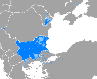
Bulgarian is an Eastern South Slavic language spoken in Southeast Europe, primarily in Bulgaria. It is the language of the Bulgarians.

The Balkan Wars were a series of two conflicts that took place in the Balkan states in 1912 and 1913. In the First Balkan War, the four Balkan states of Greece, Serbia, Montenegro and Bulgaria declared war upon the Ottoman Empire and defeated it, in the process stripping the Ottomans of their European provinces, leaving only Eastern Thrace under Ottoman control. In the Second Balkan War, Bulgaria fought against the other four original combatants of the first war. It also faced an attack from Romania from the north. The Ottoman Empire lost the bulk of its territory in Europe. Although not involved as a combatant, Austria-Hungary became relatively weaker as a much enlarged Serbia pushed for union of the South Slavic peoples. The war set the stage for the July crisis of 1914 and thus served as a prelude to the First World War.

The Balkans, corresponding partially with the Balkan Peninsula, is a geographical area in southeastern Europe with various geographical and historical definitions. The region takes its name from the Balkan Mountains that stretch throughout the whole of Bulgaria. The Balkan Peninsula is bordered by the Adriatic Sea in the northwest, the Ionian Sea in the southwest, the Aegean Sea in the south, the Turkish straits in the east, and the Black Sea in the northeast. The northern border of the peninsula is variously defined. The highest point of the Balkans is Musala, 2,925 metres (9,596 ft), in the Rila mountain range, Bulgaria.
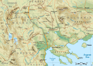
Macedonia is a geographical and historical region of the Balkan Peninsula in Southeast Europe. Its boundaries have changed considerably over time; however, it came to be defined as the modern geographical region by the mid-19th century. Today the region is considered to include parts of six Balkan countries: all of North Macedonia, large parts of Greece and Bulgaria, and smaller parts of Albania, Serbia, and Kosovo. It covers approximately 67,000 square kilometres (25,869 sq mi) and has a population of around five million. Greek Macedonia comprises about half of Macedonia's area and population.

Sofia is the capital and largest city of Bulgaria. It is situated in the Sofia Valley at the foot of the Vitosha mountain, in the western part of the country. The city is built west of the Iskar river and has many mineral springs, such as the Sofia Central Mineral Baths. It has a humid continental climate. Being in the centre of the Balkans, it is midway between the Black Sea and the Adriatic Sea and closest to the Aegean Sea.

Bulgarians are a nation and South Slavic ethnic group native to Bulgaria and its neighbouring region, who share a common Bulgarian ancestry, culture, history and language. They form the majority of the population in Bulgaria, while in North Macedonia, Ukraine, Moldova, Serbia, Albania, Romania, Hungary and Greece they exist as historical communities.
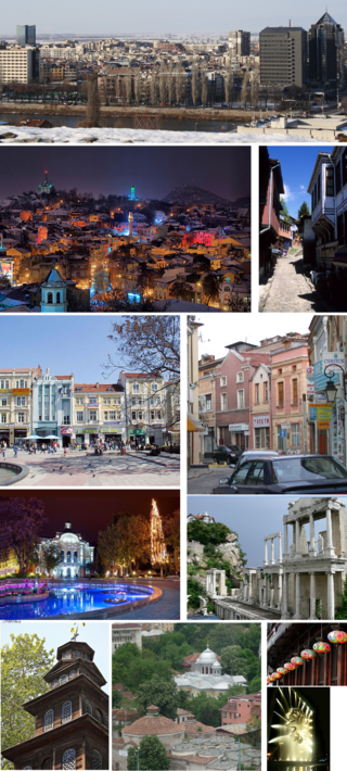
Plovdiv is the second-largest city in Bulgaria, 93 miles southeast of the capital Sofia. It had a population of 346,893 as of 2018 and 675,000 in the greater metropolitan area. Plovdiv is a cultural hub in Bulgaria and was the European Capital of Culture in 1999 and 2019. The city is an important economic, transport, cultural, and educational centre. Plovdiv joined the UNESCO Global Network of Learning Cities in 2016.

Simeon Borisov Saxe-Coburg-Gotha is a Bulgarian monarch and politician who reigned as the last Tsar of the Tsardom of Bulgaria as Simeon II from 1943 until 1946. In 1946, the monarchy was abolished by a referendum, forcing Simeon into exile. Following the fall of communism in Bulgaria, Simeon returned to his home country in 1996, and founded the National Movement Simeon the Second party. After winning the 2001 election as its leader, Sakskoburggotski proceeded to govern Bulgaria as Prime Minister from 2001 to 2005.

The Second Balkan War was a conflict that broke out when Bulgaria, dissatisfied with its share of the spoils of the First Balkan War, attacked its former allies, Serbia and Greece, on 16 (O.S.) / 29 (N.S.) June 1913. Serbian and Greek armies repulsed the Bulgarian offensive and counterattacked, entering Bulgaria. With Bulgaria also having previously engaged in territorial disputes with Romania and the bulk of Bulgarian forces engaged in the south, the prospect of an easy victory incited Romanian intervention against Bulgaria. The Ottoman Empire also took advantage of the situation to regain some lost territories from the previous war. When Romanian troops approached the capital Sofia, Bulgaria asked for an armistice, resulting in the Treaty of Bucharest, in which Bulgaria had to cede portions of its First Balkan War gains to Serbia, Greece and Romania. In the Treaty of Constantinople, it lost Adrianople to the Ottomans.

The Bulgaria national football team represents Bulgaria in men's international football, and is administered by the Bulgarian Football Union, a member association of UEFA.

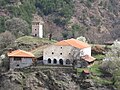
The Bulgarian Orthodox Church, legally the Patriarchate of Bulgaria, is an autocephalous Eastern Orthodox jurisdiction based in Bulgaria. It is the first medieval recognised patriarchate outside the Pentarchy and the oldest Slavic Orthodox church, with some 6 million members in Bulgaria and between 1.5 and 2 million members in a number of other European countries, Asia, the Americas, Australia, and New Zealand. It was recognized as autocephalous in 1945 by the Ecumenical Patriarchate of Constantinople.
The People's Republic of Bulgaria was the official name of Bulgaria when it was a socialist republic from 1946 to 1990, ruled by the Bulgarian Communist Party (BCP) together with its coalition partner, the Bulgarian Agrarian People's Union. Bulgaria was closely allied and one of the most loyal satellite states of the Soviet Union during the Cold War, sometimes being called the 16th Soviet Republic rather than an independent country. Bulgaria was also part of Comecon as well as a member of the Warsaw Pact. The Bulgarian resistance movement during World War II deposed the Tsardom of Bulgaria administration in the Bulgarian coup d'état of 1944 which ended the country's alliance with the Axis powers and led to the People's Republic in 1946.
The Second Bulgarian Empire was a medieval Bulgarian state that existed between 1185 and 1396. A successor to the First Bulgarian Empire, it reached the peak of its power under Tsars Kaloyan and Ivan Asen II before gradually being conquered by the Ottomans in the early 15th century.

The First Bulgarian Empire was a medieval state that existed in Southeastern Europe between the 7th and 11th centuries AD. It was founded in 680–681 after part of the Bulgars, led by Asparuh, moved south to the northeastern Balkans. There they secured Byzantine recognition of their right to settle south of the Danube by defeating – possibly with the help of local South Slavic tribes – the Byzantine army led by Constantine IV. During the 9th and 10th century, Bulgaria at the height of its power spread from the Danube Bend to the Black Sea and from the Dnieper River to the Adriatic Sea and became an important power in the region competing with the Byzantine Empire.
The Tsardom of Bulgaria, also known as the Third Bulgarian Tsardom, sometimes translated as the Kingdom of Bulgaria, or simply Bulgaria, was a constitutional monarchy in Southeastern Europe, which was established on 5 October 1908, when the Bulgarian state was raised from a principality to a tsardom.

The history of Bulgaria during World War II encompasses an initial period of neutrality until 1 March 1941, a period of alliance with the Axis Powers until 8 September 1944, and a period of alignment with the Allies in the final year of the war. Bulgarian military forces occupied with German consent parts of the Kingdoms of Greece and Yugoslavia which Bulgarian irredentism claimed on the basis of the 1878 Treaty of San Stefano. Bulgaria resisted Axis pressure to join the war against the Soviet Union, which began on 22 June 1941, but did declare war on Britain and the United States on 13 December 1941. The Red Army entered Bulgaria on 8 September 1944; Bulgaria declared war on Germany the next day.
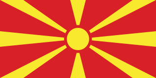
North Macedonia, officially the Republic of North Macedonia, is a landlocked country in Southeast Europe. It shares land borders with Greece to the south, Albania to the west, Bulgaria to the east, Kosovo to the northwest and Serbia to the north. It constitutes approximately the northern third of the larger geographical region of Macedonia. Skopje, the capital and largest city, is home to a quarter of the country's population of 1.83 million. The majority of the residents are ethnic Macedonians, a South Slavic people. Albanians form a significant minority at around 25%, followed by Turks, Roma, Serbs, Bosniaks, Aromanians and a few other minorities.

Professional Football Club Ludogorets 1945, commonly known as Ludogorets Razgrad or simply Ludogorets, is a Bulgarian professional association football club based in Razgrad, which currently competes in the First Professional Football League, the top tier of the Bulgarian football league system.
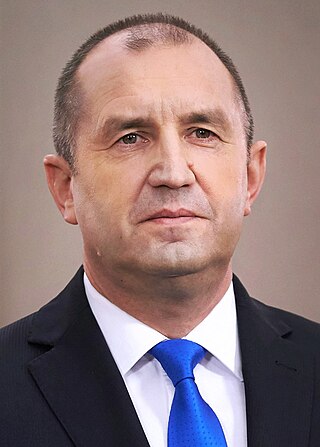
Rumen Georgiev Radev is a Bulgarian politician and former major general who has been the president of Bulgaria since 22 January 2017.