
Alahärmä is a former municipality of Finland. It was consolidated, together with Kortesjärvi and Ylihärmä, to Kauhava on 1 January 2009.
Artjärvi is a former municipality of Finland. It was consolidated with the town of Orimattila on January 1, 2011.

Töysä is a former municipality in Western Finland. It was consolidated to Alavus on 1 January 2013. It is part of the Southern Ostrobothnia region. The municipality had a population of 3,122 and covered an area of 309.66 square kilometres (119.56 sq mi) of which 11.91 km2 (4.60 sq mi) was water. The population density is 10.4853/km2 (27.157/sq mi). Most inhabitants speak Finnish, with hardly any other languages being spoken.
Juva is a municipality of Finland. It is located in the Southern Savonia region some 270 kilometres (170 mi) North-East of Helsinki. It was founded on 19 January 1442, and is the oldest parish/municipality in Finland whose exact date of birth is known. At the time, it was only the second parish in Eastern Finland, and later, several other parishes were separated from it, such as Sääminki,, Kuopio, Iisalmi, Pieksämäki, Joroinen, Leppävirta, Siilinjärvi, Lapinlahti and Maaninka. Secular municipal administration was established in 1868.
Joutsa is a municipality of Finland. It is located in the province of Western Finland and is part of the Central Finland region. Jyväskylä is located about 70 kilometres (43 mi) north of the Joutsa municipality.
Kesälahti is a former municipality of Finland. It was consolidated with Kitee on 1 January 2013.

Kiikoinen is a former municipality of Finland.

Kuhmalahti is a former municipality of Finland. It was consolidated with the municipality of Kangasala on January 1, 2011.

Kylmäkoski is a former municipality of Finland. It was consolidated with the town of Akaa on 1 January 2011. It was located in the Pirkanmaa region. The municipality had a population of 2,610 and covered a land area of 190.96 square kilometres (73.73 sq mi). At the end of 2011, the urban area of Kylmäkoski had 674 inhabitants. The population density was 13.67 inhabitants per square kilometre (35.4/sq mi). The municipality was unilingually Finnish.

Lapinlahti is a municipality of Finland. It is part of the Northern Savonia region, located 59 kilometres (37 mi) north of the city of Kuopio. The municipality has a population of 8,995 and covers an area of 1,245.16 square kilometres (480.76 sq mi) of which 148.58 km2 (57.37 sq mi) is water. The population density is 8.2 inhabitants per square kilometre (21/sq mi). The municipality is unilingually Finnish.

Liljendal is a former municipality of Finland.

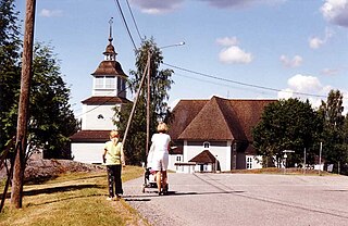
Oravais is a former municipality of Finland. It is located in the province of Western Finland and is part of the Ostrobothnia region. The municipality had a population of 2,189 and covered a land area of 203.98 square kilometres (78.76 sq mi). The population density was 10.73 inhabitants per square kilometre (27.8/sq mi). The municipality was consolidated with Vörå-Maxmo to form the new municipality of Vörå on 1 January 2011.

Perho is a municipality of Finland. It is located in the province of Western Finland and is part of the Central Ostrobothnia region. The distance between Perho and the regional center Kokkola is about 100 kilometres (62 mi). The municipality has a population of 2,591 and covers an area of 775.19 square kilometres (299.30 sq mi) of which 27.25 km2 (10.52 sq mi) is water. The population density is 3.46 inhabitants per square kilometre (9.0/sq mi).

Pieksämäki is a town and municipality of Finland. It is located in the Southern Savonia region, about 75 kilometres (47 mi) north of Mikkeli, 85 kilometres (53 mi) east of Jyväskylä and 95 kilometres (59 mi) south of Kuopio. The town has a population of 17,017 and covers an area of 1,836.22 square kilometres (708.97 sq mi) of which 266.76 km2 (103.00 sq mi) is water. The population density is 10.85 inhabitants per square kilometre (28.1/sq mi). Neighbour municipalities are Hankasalmi, Joroinen, Juva, Kangasniemi, Leppävirta, Mikkeli, Rautalampi and Suonenjoki.
Ristiina was a municipality of Finland. It was founded in 1649 and it was named after Kristina Stenbock, the wife of Governor General and Count Per Brahe. From the beginning of the year 2013 Ristiina is a part of Mikkeli city.

Sammatti is a former municipality of Finland. It was consolidated with the city of Lohja in the beginning of 2009.

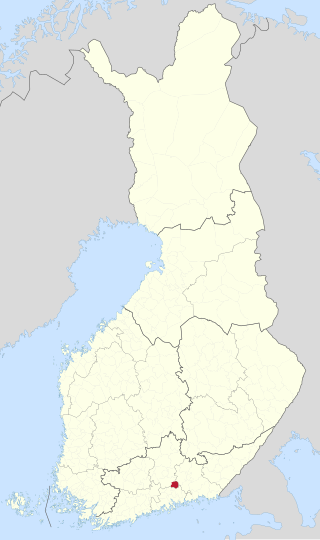
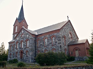
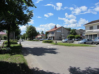
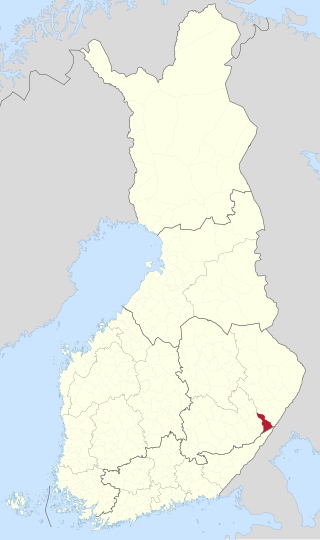
Suomenniemi is a former municipality of Finland. It was consolidated with Mikkeli on 1 January 2013.
Tohmajärvi is a municipality of Finland. It is located in the North Karelia region. The municipality has a population of 4,102 (30 September 2023) and covers an area of 895.36 square kilometres (345.70 sq mi) of which 57.62 km2 (22.25 sq mi) is water. The population density is 4.9 inhabitants per square kilometre (13/sq mi). The municipality is unilingually Finnish.

Varpaisjärvi is a former municipality of Finland. It was consolidated with the municipality of Lapinlahti on January 1, 2011.
Ylihärmä is a former municipality of Finland. It was consolidated, together with Alahärmä and Kortesjärvi, to Kauhava on 1 January 2009.


