Maaninka | |
---|---|
Former municipality | |
Maaningan kunta Maaninka kommun | |
Coordinates: 63°09.5′N027°18′E / 63.1583°N 27.300°E | |
Country | Finland |
Region | Northern Savonia |
Sub-region | Kuopio sub-region |
Charter | 1872 |
Merged | 2015 |
Government | |
• Municipal manager | Soile Lahti |
Area | |
• Total | 575.13 km2 (222.06 sq mi) |
• Land | 466.51 km2 (180.12 sq mi) |
• Water | 108.62 km2 (41.94 sq mi) |
Population (2014-11-30) [2] | |
• Total | 3,747 |
• Density | 6.5/km2 (17/sq mi) |
Time zone | UTC+2 (EET) |
• Summer (DST) | UTC+3 (EEST) |
Website | www.maaninka.fi |
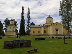
Maaninka (Swedish : Maaninka, also Maninga) is a former municipality in the region of Northern Savonia, in Finland. It was merged with the city of Kuopio on 1 January 2015.
The municipality had a population of 3,747 (30 November 2014) [2] and it covered an area of 575.13 square kilometres (222.06 sq mi) of which 108.62 square kilometres (41.94 sq mi) was water. [1] The population density was 8.03 inhabitants per square kilometre (20.8/sq mi).
The municipality is mostly rugged forestland. The tallest waterfall in Finland, at 36 metres (118 ft) high, is located in Maaninka. The site, called Korkeakoski, has been a tourist site since the 19th century. [3]
The municipality was unilingually Finnish.
Eurajoki is a municipality of Finland located in the region of Satakunta in the province of Western Finland. The municipality has a population of 9,143 and covers an area of 1,504.96 square kilometres (581.07 sq mi) of which 298.39 km2 (115.21 sq mi) is water. The population density is 17.75 inhabitants per square kilometre (46.0/sq mi).
Ylitornio is a municipality of Finland.
Posio is a municipality of Finland. It is located in the province of Lapland. The municipality has a population of 2,923 (31 December 2023) and covers an area of 3,544.90 square kilometres (1,368.69 sq mi) of which 506.14 km2 (195.42 sq mi) is water. The population density is 0.96 inhabitants per square kilometre (2.5/sq mi). Neighbour municipalities are Rovaniemi, Kemijärvi, Ranua, Salla, Kuusamo, Taivalkoski and Pudasjärvi.
Huittinen is a town and municipality in Finland. It is located in the Satakunta region, 63 kilometres (39 mi) southeast of Pori and 75 kilometres (47 mi) southwest of Tampere. The town has a population of 9,644 and covers an area of 539.59 square kilometres (208.34 sq mi) of which 6.97 km2 (2.69 sq mi) is water. The population density is 18.11 inhabitants per square kilometre (46.9/sq mi).
Juva is a municipality of Finland. It is located in the Southern Savonia region some 270 kilometres (170 mi) North-East of Helsinki. It was founded on 19 January 1442, and is the oldest parish/municipality in Finland whose exact date of birth is known. At the time, it was only the second parish in Eastern Finland, and later, several other parishes were separated from it, such as Sääminki,, Kuopio, Iisalmi, Pieksämäki, Joroinen, Leppävirta, Siilinjärvi, Lapinlahti and Maaninka. Secular municipal administration was established in 1868.
Ingå is a municipality in Finland, located in the southern coast of the country. Ingå is situated in the western part of the Uusimaa region. The population of Ingå is approximately 5,000, while the sub-region has a population of approximately 40,000. It is the 161st most populous municipality in Finland.
Juupajoki is a municipality of Finland. It is located in the Pirkanmaa region. The municipality has a population of 1,708, which makes it the smallest municipality in Pirkanmaa in terms of population. It covers an area of 274.95 square kilometres (106.16 sq mi) of which 16.47 km2 (6.36 sq mi) is water. The population density is 6.61 inhabitants per square kilometre (17.1/sq mi). Korkeakoski is the administrative center of the municipality.
Kaarina is a town in Finland, located in the region of Southwest Finland. It lies south of the regional capital, Turku. The population of Kaarina is approximately 36,000, while the sub-region has a population of approximately 347,000. It is the 32nd most populous municipality in Finland, and the second largest municipality in the Southwest Finland region after Turku.
Luhanka is a municipality of Finland. It is located in the Central Finland region. The municipality has a population of 701 and covers an area of 313.25 square kilometres (120.95 sq mi) of which 98.73 km2 (38.12 sq mi) is water.
Nilsiä is a former small town and a municipality of Finland. It joined the city of Kuopio at the beginning of year 2013.
Pielavesi is a municipality of Finland. It is part of the Northern Savonia region. The municipality has a population of 4,073 and covers an area of 1,406.51 square kilometres (543.06 sq mi) of which 253.27 km2 (97.79 sq mi) is water. The population density is 3.53 inhabitants per square kilometre (9.1/sq mi). The municipality is unilingually Finnish.
Pukkila is a municipality of Finland. It is located in the Uusimaa region. The municipality has a population of 1,781 and covers an area of 145.94 square kilometres (56.35 sq mi) of which 0.9 km2 (0.35 sq mi) is water. The population density is 12.28 inhabitants per square kilometre (31.8/sq mi).
Punkaharju is a former municipality of Finland. It was consolidated with the town of Savonlinna on January 1, 2013.
Tarvasjoki is a former municipality in the region of Southwest Finland, in Finland. It was merged with the municipality of Lieto on 1 January 2015.
Tervo is a municipality of Finland. It is located in the province of Eastern Finland and is part of the Northern Savonia region. The municipality has a population of 1,410, making it Northern Savonia's least populous municipality. It covers an area of 494.30 square kilometres (190.85 sq mi) of which 146.52 km2 (56.57 sq mi) is water. The population density is 4.05 inhabitants per square kilometre (10.5/sq mi).
Vörå is a municipality in Finland, located on the west coast of the country. Vörå is situated in Ostrobothnia, along the Gulf of Bothnia. The population of Vörå is approximately 6,000, while the sub-region has a population of approximately 110,000. It is the 149th most populous municipality in Finland.
Yli-Ii was a municipality of Finland. It was located in the province of Oulu and was part of the Northern Ostrobothnia region. Alongside Haukipudas, Kiiminki and Oulunsalo municipalities it was merged with the city of Oulu on 1 January 2013. The municipality had a population of 2,179 and covered an area of 793.27 square kilometres (306.28 sq mi) of which 24.12 km2 (9.31 sq mi) is water. The population density was 2.8330/km2 (7.3374/sq mi).
Ylikiiminki is a former municipality of Finland. It was consolidated with the city of Oulu on 1 January 2009.
The Kymi is a river in Finland. It begins at Lake Päijänne, flows through the provinces of Päijänne Tavastia, Uusimaa and Kymenlaakso, and discharges into the Gulf of Finland. The river passes the towns of Heinola and Kouvola. The town of Kotka is located on the river delta. The length of the river is 204 kilometres (127 mi), but its drainage basin of 37,107 square kilometres (14,327 sq mi) extends to almost 600 kilometres (370 mi) inside the Tavastia, Central Finland, Savonia and Ostrobothnia. The furthest source of the river is Lake Pielavesi, its furthest point being some 570 kilometres (350 mi) from the sea measured by flow route. The name of the river, itself, kymi, means "large river", in Old Finnish.
Kimitoön is a municipality and island of Finland. It was created on 1 January 2009, when the municipalities of Dragsfjärd, Kimito and Västanfjärd were consolidated into a single municipality.