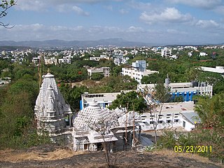
Kasara is a census town in Thane district in the Indian state of Maharashtra. The town is on the busy Mumbai–Nashik route, which is one of the four major routes that lead into Mumbai. Kasara is served by a railway station on the Mumbai Suburban Railway, and is the final stop in the north-east sector of the Central Line and important railway station. That is for abbreviation for Kasara Local is set as "N" means North side Local's Last Station. Town is also known for the winding Thal Ghat or better known as Kasara Ghats.
Khunavade is a village in the Palghar district of Maharashtra, India. It is located in the Dahanu taluka.
Gaurwadi is a village in the Palghar district of Maharashtra, India. It is located in the Dahanu taluka.
Kalamdevi is a village in the Palghar district of Maharashtra, India. It is located in the Dahanu taluka.
Chimbave is a village in the Palghar district of Maharashtra, India. It is located in the Dahanu taluka.

Kosbad is a village in the Palghar district of Maharashtra, India. It is located in the Dahanu taluka.
Dehane is a village in the Palghar district of Maharashtra, India. It is located in the Dahanu taluka.
Kankradi is a village in the Palghar district of Maharashtra, India. It is located in the Dahanu taluka.
Ghadane is a village in the Palghar district of Maharashtra, India. It is located in the Dahanu taluka.
Bodgaon is a village in the Palghar district of Maharashtra, India. It is located in the Dahanu taluka.
Ganeshbag is a village in the Palghar district of Maharashtra, India. It is located in the Dahanu taluka.
Deur is a village in the Palghar district of Maharashtra, India. It is located in the Dahanu taluka.
Bhisenagar is a village in the Palghar district of Maharashtra, India. It is located in the Dahanu taluka.
Karanjvira is a village in the Palghar district of Maharashtra, India. It is located in the Dahanu taluka.
Dhumket is a village in the Palghar district of Maharashtra, India. It is located in the Dahanu taluka.
Ghol is a village in the Palghar district of Maharashtra, India. It is located in the Dahanu taluka.
Charoti is a village in the Palghar district of Maharashtra, India. It is located in the Dahanu taluka.
Chandranagar is a village in the Palghar district of Maharashtra, India. It is located in the Dahanu taluka.
Khambale is a village in the Palghar district of Maharashtra, India. It is located in the Dahanu taluka.
Kosesari is a village in the Palghar district of Maharashtra, India. It is located in the Dahanu taluka. It is in rural part of Palghar, and it is one of the 173 villages of Dahanu Block of Palghar district.


