Kaskawulsh Glacier

Last updated
Kaskawulsh Glacier
Kaska junction.png
Kaskawulsh Glacier junction from the air, August 2004
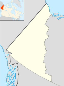
Location map Yukon 2.png
Red pog.svg
Yukon
TypeValley glacier
Location Canada
Coordinates 60°48′N138°36′W / 60.800°N 138.600°W / 60.800; -138.600 Coordinates: 60°48′N138°36′W / 60.800°N 138.600°W / 60.800; -138.600
Length78 kilometers (48 mi)
Terminussealevel
Statusretreating

The Kaskawulsh Glacier is a vast, temperate valley glacier nestled in the St. Elias Mountains, within Kluane National Park in the Canadian territory of Yukon. [1]

Contents

Geography

Located approximately 6,000–9,000 ft (1,800–2,700 m) above sea level, the glacier covers more than 15,000 sq mi (39,000 km2) of the surrounding landscape. [2] It terminates at the head of two river valleys, the Slims and the Kaskawulsh River, which feed the Yukon River (via Kluane Lake) and Alsek River systems respectively. [3] The Kaskawulsh is the result of two converging outlet glaciers, the Central and North Arms, and is an impressive 3–4 mi (4.8–6.4 km) wide at its broadest point. [2]

Waterflow

Until 2016, abundant melt water from the Kaskawulsh was channeled by ice dam to drain through the Slims River, north to Kluane Lake, and ultimately to the Bering Sea. In 2016, as the glacier receded, the predominant flow abruptly switched to the Kaskawulsh River, flowing east and then south to Alsek River and to the Gulf of Alaska. [4] [5] As the water level at Kluane Lake continues to drop, researchers expect this will become an isolated lake cut off from any outflow. [6]

Tourism

Backpackers can visit the Kaskawulsh along the popular Slims River West Trail, which follows the Slims River south for 19.9 mi (32.0 km) before ending at the summit of Observation Mountain near the toe of the glacier. [7] [8] [9] Backpackers can also follow the Slims River East Route to reach the toe of the glacier, also known as the glacier terminus.

Related Research Articles

<span class="mw-page-title-main">Kluane National Park and Reserve</span> National park and park reserve in Northwest Territories, Canada

Kluane National Park and Reserve are two protected areas in the southwest corner of the territory of Yukon. The National Park Reserve was set aside in 1972 to become a national park, pending settlement of First Nations land claims. It covered an area of 22,013 square kilometres. When agreement was reached with the Champagne and Aishihik First Nations over an eastern portion of the Reserve, that part—about 5,900 square kilometres —became a national park in 1993, and is a unit of the national park system administered co-operatively with Parks Canada. The larger western section remains a Reserve, awaiting a final land claim settlement with the Kluane First Nation. The park borders British Columbia to the south, while the Reserve borders both British Columbia to the south, and the United States (Alaska) to the south and west.

<span class="mw-page-title-main">Saint Elias Mountains</span> Mountain range in Canada and USA

The Saint Elias Mountains are a subgroup of the Pacific Coast Ranges, located in southeastern Alaska in the United States, Southwestern Yukon and the very far northwestern part of British Columbia in Canada. The range spans Wrangell-St. Elias National Park and Preserve in the United States and Kluane National Park and Reserve in Canada and includes all of Glacier Bay National Park in Alaska. In Alaska, the range includes parts of the city/borough of Yakutat and the Hoonah-Angoon and Valdez-Cordova census areas.

<span class="mw-page-title-main">Glacier Bay National Park and Preserve</span> National park in Alaska, United States

Glacier Bay National Park and Preserve is an American national park located in Southeast Alaska west of Juneau. President Calvin Coolidge proclaimed the area around Glacier Bay a national monument under the Antiquities Act on February 26, 1925. Subsequent to an expansion of the monument by President Jimmy Carter in 1978, the Alaska National Interest Lands Conservation Act (ANILCA) enlarged the national monument by 523,000 acres on December 2, 1980, and created Glacier Bay National Park and Preserve. The national preserve encompasses 58,406 acres of public land to the immediate northwest of the park, protecting a portion of the Alsek River with its fish and wildlife habitats, while allowing sport hunting.

<span class="mw-page-title-main">Alsek River</span> River in Yukon Territory, British Columbia, and Alaska

The Alsek River is a wilderness river flowing from Yukon into Northern British Columbia and into Alaska. It enters the Gulf of Alaska at Dry Bay.

<span class="mw-page-title-main">Ice field</span> Large area of interconnected glaciers

An ice field is a mass of interconnected valley glaciers on a mountain mass with protruding rock ridges or summits. They are often found in the colder climates and higher altitudes of the world where there is sufficient precipitation for them to form. The higher peaks of the underlying mountain rock that protrude through the icefields are known as nunataks. Ice fields are larger than alpine glaciers, but smaller than ice caps and ice sheets. The topography of ice fields is determined by the shape of the surrounding landforms, while ice caps have their own forms overriding underlying shapes.

<span class="mw-page-title-main">Geography of Yukon</span>

Yukon is in the northwestern corner of Canada and is bordered by Alaska and the Northwest Territories. The sparsely populated territory abounds with natural scenic beauty, with snowmelt lakes and perennial white-capped mountains, including many of Canada's highest mountains. The territory's climate is Arctic in territory north of Old Crow, subarctic in the region, between Whitehorse and Old Crow, and humid continental climate south of Whitehorse and in areas close to the British Columbia border. Most of the territory is boreal forest with tundra being the main vegetation zone only in the extreme north and at high elevations.

<span class="mw-page-title-main">Tatshenshini-Alsek Provincial Park</span> Provincial park in the Stikine Region of British Columbia, Canada

Tatshenshini-Alsek Park or Tatshenshini-Alsek Provincial Wilderness Park is a provincial park in British Columbia, Canada 9,580 km2 (3,700 sq mi). It was established in 1993 after an intensive campaign by Canadian and American conservation organizations to halt mining exploration and development in the area, and protect the area for its strong natural heritage and biodiversity values.

<span class="mw-page-title-main">Kluane Lake</span> Body of water

Kluane Lake is located in the southwest area of the Yukon. It is the largest lake contained entirely within Yukon at approximately 408 km2 (158 sq mi), and 81 km (50 mi) long.

<span class="mw-page-title-main">Stream capture</span> Geomorphological phenomenon

Stream capture, river capture, river piracy or stream piracy is a geomorphological phenomenon occurring when a stream or river drainage system or watershed is diverted from its own bed, and flows instead down the bed of a neighbouring stream. This can happen for several reasons, including:

<span class="mw-page-title-main">Alsek Ranges</span>

The Alsek Ranges are the southeasternmost subdivision of the Saint Elias Mountains of the Pacific Cordillera. They span the region between the Alsek River, Glacier Bay and the Kelsall River. Their western boundary is the Grand Pacific Glacier, beyond which is the Fairweather Range, another subdivision of the St. Elias Mountains. To their east is the northernmost section of the Boundary Ranges, the northernmost subdivision of the Coast Mountains and which are also known as the Alaska Boundary Range, and which run south to the Nass River and form, as their name indicates, the spine of the boundary between the American state of Alaska and the Canadian province of British Columbia.

<span class="mw-page-title-main">Kluane / Wrangell–St. Elias / Glacier Bay / Tatshenshini-Alsek</span> International park system in British Columbia, Canada, and Alaska, USA; a UNESCO World Heritage site

Kluane / Wrangell–St. Elias / Glacier Bay / Tatshenshini-Alsek is an international park system located in Canada and the United States, at the border of Yukon, Alaska and British Columbia.

<span class="mw-page-title-main">Slims River</span>

The Slims River was a glacially fed river in the Canadian territory of Yukon. Until 2016, it originated in the Kaskawulsh Glacier, then ran approximately 15 mi (24 km) into the southern terminus of Kluane Lake.

<span class="mw-page-title-main">Kaskawulsh Mountain</span>

Kaskawulsh Mountain is a 2,969-metre (9,741-foot) mountain summit of the Saint Elias Mountains in Kluane National Park of Yukon, Canada. Surrounded by ice on all sides, the mountain is situated in the notch where the main arm of the Kaskawulsh Glacier merges with its south arm. The Stairway Glacier lies to the west, and the Atrypa Glacier to the south. The mountain cannot be seen from any roads, but can be seen by plane, or by hiking to the summit of Observation Mountain which is located at the head of the Slims River valley. The nearest higher peak is GJ43, 3.8 km (2.4 mi) to the west.

<span class="mw-page-title-main">Mount Maxwell</span> Summit of the Saint Elias Mountains in Kluane National Park of Yukon, Canada

Mount Maxwell is a 3,020-metre (9,910-foot) mountain summit of the Saint Elias Mountains in Kluane National Park of Yukon, Canada. The mountain is situated at the toe of the Kaskawulsh Glacier. The mountain cannot be seen from any roads, but can be seen from the Slims River valley. The nearest higher peak is Mount Leacock, 9.2 km (5.7 mi) to the south. The "Mt Maxwell" designation is misplaced five kilometres to the northeast of the actual summit on the topographic map. The mountain was named by John Oliver Wheeler, a Canadian geologist with the Geological Survey of Canada who climbed Maxwell in 1954. The Maxwell name was approved in 1960, and was made official in 1981 by the Geographical Names Board of Canada. However, it remains a mystery who Maxwell was. Based on the Köppen climate classification, Mount Maxwell is located in a subarctic climate with long, cold, snowy winters, and mild summers.

<span class="mw-page-title-main">Mount Cairnes</span> Mountain in Yukon, Canada

Mount Cairnes is a 2,810-metre (9,220-foot) mountain summit in the Saint Elias Mountains on the boundary line of Kluane National Park in Yukon, Canada. The mountain is situated 44 km (27 mi) west of Haines Junction, 18 km (11 mi) southeast of Kluane Lake, and can be seen from the Alaska Highway midway between the two. Its nearest higher peak is Mount Maxwell, 27.7 km (17.2 mi) to the southwest. The mountain's name was officially adopted February 3, 1981, by the Geographical Names Board of Canada. Clive Elmore Cairnes (1892–1954) was active with the Geological Survey of Canada as well as the Geographic Board of Canada until his retirement in 1953. He was related to noted geologist DeLorme Donaldson Cairnes (1879–1917), for whom this mountain is named.

<span class="mw-page-title-main">Mount Archibald</span>

Mount Archibald is a prominent 2,588-metre (8,491-foot) mountain summit located in the Kluane Ranges of the Saint Elias Mountains in Yukon, Canada. The mountain is situated 21 km (13 mi) west of Haines Junction, 5.9 km (4 mi) south of Mount Decoeli, and 27 km (17 mi) east-southeast of Mount Cairnes, which is the nearest higher peak. Set on the boundary line of Kluane National Park, Archibald can be seen from the Alaska Highway, weather permitting. The mountain was named after Edgar Archibald (1885-1968), a Canadian agricultural scientist. The mountain's name was officially adopted August 12, 1980, by the Geographical Names Board of Canada. On a clear day, the summit offers views deep into Kluane National Park of giants such as Mt. Logan, Mt. Vancouver, and Mt. Kennedy.

<span class="mw-page-title-main">Mount Martha Black</span>

Mount Martha Black, elevation 2,512-metre (8,241-foot), is the highest point in the Auriol Range of the Saint Elias Mountains in Yukon, Canada. The multi-summit massif is situated 11 km (7 mi) southwest of Haines Junction, 16 km (10 mi) northwest of Mount Worthington, and 18.6 km (12 mi) southeast of Mount Archibald, which is the nearest higher peak. Set within Kluane National Park, Mount Martha Black can be seen from the Alaska Highway, weather permitting. The mountain was named after Martha Black (1866-1957), the second woman elected to the House of Commons of Canada. The mountain's name was officially adopted August 12, 1980, by the Geographical Names Board of Canada.

References

  1. Norah Foy; Luke Copland; Christian Zdanowicz; Mike Demuth; Chris Hopkinson (7 July 2011). "Recent volume and area changes of Kaskawulsh Glacier, Yukon, Canada" (PDF). Journal of Glaciology. 57 (203): 515–525. Bibcode:2011JGlac..57..515F. doi: 10.3189/002214311796905596 . Retrieved 2016-01-17.
  2. 1 2 "Kaskawulsh Glacier - Canadian Glacier Inventory Project". cgip.wikifoundry.com. Retrieved 2016-01-17.
  3. Garry K. C. Clarke; Gerald Holdsworth (27 November 2002). "Glaciers of North America — Glaciers of Canada: Glaciers of the St. Elias Mountains" (PDF). U.S. Geological Survey Professional Paper 1386–J–1. Retrieved 2016-01-17.
  4. Devlin, Hannah (17 April 2017). "Receding glacier causes immense Canadian river to vanish in four days". The Guardian . Retrieved 24 April 2017.
  5. Shugar, Daniel H.; Clague, John J.; Best, James L.; Schoof, Christian; Willis, Michael J.; Copland, Luke; Roe, Gerard H. (2017-04-17). "River piracy and drainage basin reorganization led by climate-driven glacier retreat". Nature Geoscience. advance online publication (5): 370–375. doi:10.1038/ngeo2932. ISSN   1752-0908.
  6. "Retreating Yukon glacier caused a river to disappear" . Retrieved 2017-04-17.
  7. "Slims River West trail to Observation Mountain, Kluane National Park". philarmitage.net. Retrieved 2016-01-17.
  8. "Slims River West | Yukon, Canada, 1998 | The Hiking Life". thehikinglife.com. Retrieved 2016-01-17.
  9. "Slim's River West | Hiking, skiing, and snowshoeing trails in the Yukon | yukonhiking.ca". yukonhiking.ca. Retrieved 2016-01-17.