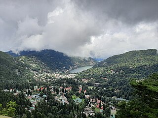
Nainital is a town and headquarters of Nainital district of Kumaon division, Uttarakhand, India. It is the judicial capital of Uttarakhand, the High Court of the state being located there and is the headquarters of an eponymous district. It also houses the Governor of Uttarakhand, who resides in the Raj Bhavan. Nainital was the summer capital of the United Provinces.
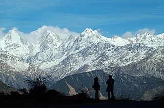
Kumaon is a revenue and administrative division in the Indian State of Uttarakhand. It spans over the eastern half of the state and is bounded on the north by Tibet, on the east by Nepal, on the south by the state of Uttar Pradesh, and on the west by Garhwal. Kumaon comprises six districts of the state: Almora, Bageshwar, Champawat, Nainital, Pithoragarh and Udham Singh Nagar.
Bhabar or Bhabhar is a region south of the Lower Himalayas and the Sivalik Hills in Kumaon, India. The Bhabhar region contains some of the largest cities of Kumaon and Garhwal : Haldwani, Ramnagar, Tanakpur and Kotdwar. It is the alluvial apron of sediments washed down from the Sivaliks along the northern edge of the Indo-Gangetic Plain.

Uttarakhand, formerly known as Uttaranchal, is a state in northern India. It is often referred to as the "Devbhumi" due to its religious significance and numerous Hindu temples and pilgrimage centres found throughout the state. Uttarakhand is known for the natural environment of the Himalayas, the Bhabar and the Terai regions. It borders the Tibet Autonomous Region of China to the north; the Sudurpashchim Province of Nepal to the east; the Indian states of Uttar Pradesh to the south and Himachal Pradesh to the west and north-west. The state is divided into two divisions, Garhwal and Kumaon, with a total of 13 districts. The winter capital, and largest city of the state is Dehradun, which is also a rail head. On 5 March 2020, Bhararisain, a town in the Gairsain Tehsil of the Chamoli district, was declared as the summer capital of Uttarakhand. The High Court of the state is located in Nainital, but is to be moved to Haldwani in future.

Almora is a district in the Kumaon Division of Uttarakhand state, India. The headquarters is at Almora. It is 1,638 meters above sea level. The neighbouring regions are Pithoragarh district to the east, Chamoli district to the west, Bageshwar district to the north and Nainital district to the south.

Haldwani is the largest city of Kumaon. It is also the third most populous city and largest commercial market in the Indian state of Uttarakhand. Haldwani is said to be the financial capital of Uttarakhand, having the most commercial, economic and industrial activities of the state. Haldwani is located in the Nainital District, and is one of its eight Subdivisions. The Haldwani Urban agglomeration has 232,060 people as of 2011, and is the third most populous UA in Uttarakhand, after Dehradun and Haridwar. Being situated in the immediate foothills of Kumaon Himalayas, the Kathgodam neighbourhood of Haldwani is known as the "Gateway to Kumaon".

Mukteshwar is a village and tourist destination in the Nainital district of Uttarakhand, India. It sits high in the Kumaon Hills at an altitude of 2171 meters (7500 feet), 51 km from Nainital, 72 km from Haldwani, and 343 km from Delhi.

Nainital district is a district in Kumaon division which is a part of Uttarakhand state in India. The headquarters is at Nainital.

The Gaula River, or Gola River, is a river in India originating in the Lesser Himalayas. It is approximately 500 km (310 mi) long. The river is also known by the names of Kichha and Baigul in its lower course. It originates in the Paharpani Village of Uttarakhand state, and flows south past Kathgodam, Haldwani, Kichha and Shahi, finally joining the Ramganga River about 15 km (9.3 mi) northwest of Bareilly in Uttar Pradesh, Ramganga in turn is a tributary of the river Ganges. It is mainly a spring fed river; this river is source of water for Haldwani and Kathgodam. A beautiful dam exists over this river in Kathgodam.

Bhowali is a town and a municipal board in Nainital District in the state of Uttarakhand, India. It is situated at a distance of 11 km (6.8 mi) from the city of Nainital, the district headquarters; at an average elevation of 1,654 m (5,427 ft) from sea level. It is the seat of Bhowali tehsil, one of the eight subdivisions of Nainital district.
Rudrapur is a city that serves as the headquarters of the Udham Singh Nagar district in the Indian state of Uttarakhand. Located at a distance of about 250 km (160 mi) northeast of New Delhi and 250 km (160 mi) south of Dehradun, Rudrapur is located in the fertile Terai plains in the southern part of Kumaon division over an area of 27.65 km2. With a population of 140,857 according to the 2011 census of India, it is the 5th most populous city of Uttarakhand.

Sitarganj is a city and a municipal board in Udham Singh Nagar district in the Indian state of Uttarakhand. Now it is home to the Integrated Industrial Estate Sitarganj (IIE) being developed by State Industrial Development Corporation of Uttarakhand Limited (SIDCUL).

Berinag is a hill station, located 124 km from Pithoragarh city in the Pithoragarh district, which is the easternmost Himalayan district in the state of Uttarakhand, India. It is one of the six Administrative Subdivisions (tehsil) of Pithoragarh district. National Highway 309A passes through Berinag. Closest prominent villages include Garawon, Dhanoli, Bana, Bhattigaon, Banoli, Quarali, Tripuradevi and Sangarh.

Ramnagar is a town and municipal board in the Nainital district of Kumaon, India. It is located approximately 65 kilometres (40 mi) from Nainital, the headquarters of the district.

Baijnath is a small town on the banks of the Gomati river in the Bageshwar district in Kumaon division of Uttarakhand, India. The place is most noted for its ancient temples, which have been recognized as Monuments of National Importance by the Archaeological Survey of India in Uttarakhand. Baijnath has been selected as one of the four places to be connected by the 'Shiva Heritage Circuit' in Kumaon, under the Swadesh Darshan Scheme of the Government of India.

Naukuchiatal or "lake of nine corners" is a small hill station, near Nainital Town in Nainital district of Kumaon, Uttarakhand, India. The chairman is Devendra Singh chanotiya.
Betalghat is a small town and tehsil in Nainital district, Uttarakhand, India. As of 2011, it had a total population of 21265 spread over 4357 households.
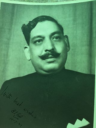
Thakur Dan Singh Bisht was a philanthropist from Kumaon, Uttarakhand, India.
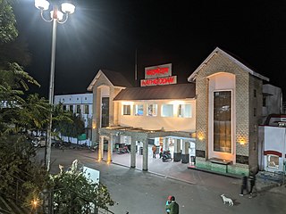
Kathgodam railway station is railway station located in Kathgodam town near Haldwani, just 35 km from Nainital Town in Nainital district of Uttarakhand State of India.
National Highway 109, , is a highway in India which runs in the Indian state of Uttarakhand. It is one of the most important routes, connecting the entire Kumaon region to the state as well as the country. It is also the major route towards the hill stations such as Nainital, Kausani, Ranikhet, Mukteswar and Almora from Delhi. Previously known as NH 87, it was renumbered as NH 109 in 2010. The northern terminal is at NH 7 near Karnaprayag and the southern terminal is at National Highway 9 near Rudrapur. More than 10,000 vehicles travel through NH-109 in tourist season.


