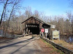
Convis Township is a civil township of Calhoun County in the U.S. state of Michigan. It is part of the Battle Creek, Michigan Metropolitan Statistical Area. The population was 1,508 at the 2020 census.

Masonville Township is a civil township of Delta County in the U.S. state of Michigan. The population was 1,734 at the 2010 census, down from 1,877 at the 2000 census.
Arcada Township is a civil township of Gratiot County in the U.S. state of Michigan. As of the 2020 census, the township population was 1,671.
Berlin Township is a civil township of Ionia County in the U.S. state of Michigan. As of the 2020 census, the township population was 2,138.
Danby Township is a civil township of Ionia County in the U.S. state of Michigan. The population was 2,953 at the 2020 census.
Orange Township is a civil township of Ionia County in the U.S. state of Michigan. The population was 1,012 at the 2020 census.

Rollin Township is a civil township of Lenawee County in the U.S. state of Michigan. The population was 3,176 at the 2000 census.
Ashland Township is a civil township of Newaygo County in the U.S. state of Michigan. As of the 2020 census, the township population was 2,764. The city of Grant is adjacent to the township. The township was established in 1854.
Ensley Township is a civil township of Newaygo County in the U.S. state of Michigan. The population was 2,474 at the 2000 census.
Greenwood Township is a civil township of Oceana County in the U.S. state of Michigan. As of the 2000 census, the township population was 1,154.
Cedar Township is a civil township of Osceola County in the U.S. state of Michigan. The population was 406 at the 2000 census.

Georgetown Charter Township is a charter township of Ottawa County in the U.S. state of Michigan. The population was 54,091 at the time of the 2020 census. The city of Hudsonville is adjacent to the township and the unincorporated community of Jenison is within the township, which includes about half the township's population.
Polkton Charter Township is a charter township of Ottawa County in the U.S. state of Michigan. The population was 2,565 at the 2020 census. It was organized in 1845.
Wheatland Township is a civil township of Sanilac County in the U.S. state of Michigan. The population was 416 at the 2020 census.
Florence Township is a civil township of St. Joseph County in the U.S. state of Michigan. The population was 1,436 at the 2000 census. It was organized in 1837.
Arlington Township is a civil township of Van Buren County in the U.S. state of Michigan. As of the 2020 census, the township population was 1,958. Arlington Township was established in 1842.
Bangor Township is a civil township of Van Buren County in the U.S. state of Michigan. As of the 2010 census, the township population was 2,147. The City of Bangor is located in the northeast corner of the township, but is administratively autonomous. Bangor Township was organized in 1853.

Greenwood Township is a civil township of Wexford County in the U.S. state of Michigan. The population was 633 at the 2020 census.
Leonidas Township is a civil township of St. Joseph County in the U.S. state of Michigan. The population was 1,239 at the 2000 census.
Lockport Township is a civil township of St. Joseph County in the U.S. state of Michigan. The population was 3,814 at the 2000 census.


