Kemune

Last updated
Kemune
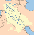
Iraq physical map.svg
Archaeological site icon (red).svg
Shown within Iraq
Location Nineveh Governorate, Iraq
Coordinates 36°46′7″N42°43′55″E / 36.76861°N 42.73194°E / 36.76861; 42.73194
Typesettlement
History
Foundedcirca 1600 BC
AbandonedMiddle 2nd millennium BC
Periods Bronze Age
Cultures Mitanni period
Site notes
Excavation dates2018, 2022
ArchaeologistsHasan Ahmed Qasim, Ivana Puljiz, Peter Pfälzner
ConditionRuined
OwnershipPublic
Public accessNo

Kemune (thought to be the ancient city of Zakhiku) [1] is an archaeological site discovered during a low water level in the reservoir of the Mosul Dam in the Nineveh Governorate, part of the Kurdistan region of Iraq in 2013. [2] The Mitanni era city was destroyed by an earthquake around 1350 BC. [3] [4]

Contents

Archaeology

The site was first excavated by German and Kurdish archaeologists in Autumn 2018. The excavation was led by Ivana Puljiz of the University of Tübingen. The work concentrated on the remains of the palace. Ten Mitanni-era tablets were discovered. [5] In 2021 extremely low water levels in the reservoir, due to a severe drought, again exposed the site. In January and February 2022 the Kurdistan Archaeology Organization and University of Tübingen conducted additional emergency rescue excavations. In addition to mapping the majority of the site, about 100 cuneiform tablets were recovered. The tablets date from the early Middle Assyrian period, just after the destruction of the city by an earthquake. The site has now again flooded. [6]

The site held a palace constructed on the banks of the Tigris River during the days of the Mitanni Empire rule over Assyria. [7] The remains of the palace conserved to a height of about seven meters. According to Dr. Ivana Puljiz, the two usage phases are clearly noticeable, indicating that the building has been in use for a very long time. Archaeologists unearthed several rooms inside the palace and partially reviewed eight of them. They also uncovered big, fired bricks that were used as floor slabs in some places. Ten cuneiform clay tablets belonged to Mittani people and were translated by Betina Faist of Heidelberg University. According to one of the tablets, Kemune was probably the ancient city of Zakhiku. [8] Well-preserved wall paintings were also found in some rooms, which are two meters thick and more than two meters high. [9]

See also

Related Research Articles

<span class="mw-page-title-main">Nineveh</span> Ancient Assyrian city

Nineveh, also known in early modern times as Kouyunjik, was an ancient Assyrian city of Upper Mesopotamia, located in the modern-day city of Mosul in northern Iraq. It is located on the eastern bank of the Tigris River and was the capital and largest city of the Neo-Assyrian Empire, as well as the largest city in the world for several decades. Today, it is a common name for the half of Mosul that lies on the eastern bank of the Tigris, and the country's Nineveh Governorate takes its name from it.

<span class="mw-page-title-main">Hurrians</span> Historical ethnic group of Southwest Asia

The Hurrians were a people who inhabited the Ancient Near East during the Bronze Age. They spoke the Hurrian language, and lived throughout northern Syria, upper Mesopotamia and southeastern Anatolia.

<span class="mw-page-title-main">Mitanni</span> Ancient Hurrian-speaking state in northern Syria and southeast Anatolia

Mitanni, earlier called Ḫabigalbat in old Babylonian texts, c. 1600 BC; Hanigalbat or Hani-Rabbat in Assyrian records, or Naharin in Egyptian texts, was a Hurrian-speaking state in northern Syria and southeast Anatolia with Indo-Aryan linguistic and political influences. Since no histories, royal annals or chronicles have yet been found in its excavated sites, knowledge about Mitanni is sparse compared to the other powers in the area, and dependent on what its neighbours commented in their texts.

<span class="mw-page-title-main">Umma</span> Ancient Sumerian city in modern-day Iraq

Umma (Sumerian: 𒄑𒆵𒆠ummaKI; in modern Dhi Qar Province in Iraq, was an ancient city in Sumer. There is some scholarly debate about the Sumerian and Akkadian names for this site. Traditionally, Umma was identified with Tell Jokha. More recently it has been suggested that it was located at Umm al-Aqarib, less than 7 km to its northwest or was even the name of both cities. One or both were the leading city of the Early Dynastic kingdom of Gišša, with the most recent excavators putting forth that Umm al-Aqarib was prominent in EDIII but Jokha rose to preeminence later. The town of KI.AN was also nearby. KI.AN, which was destroyed by Rimush, a ruler of the Akkadian Empire. There are known to have been six gods of KI.AN including Gula KI.AN and Sara KI.AN.

<span class="mw-page-title-main">Nuzi</span> Ancient city in Mesopotamia

Nuzi was an ancient Mesopotamian city southwest of the city of Arrapha, located near the Tigris river. The site consists of one medium-sized multiperiod tell and two small single period mounds.

<span class="mw-page-title-main">Alalakh</span> Archaeological site in Reyhanlı, Hatay, Turkey

Alalakh is an ancient archaeological site approximately 20 kilometres (12 mi) northeast of Antakya in what is now Turkey's Hatay Province. It flourished, as an urban settlement, in the Middle and Late Bronze Age, c. 2000-1200 BC. The city contained palaces, temples, private houses and fortifications. The remains of Alalakh have formed an extensive mound covering around 22 hectares. In Late Bronze Age, Alalakh was the capital of the local kingdom of Mukiš.

<span class="mw-page-title-main">Dur-Kurigalzu</span> Archaeological site in Iraq

Dur-Kurigalzu was a city in southern Mesopotamia, near the confluence of the Tigris and Diyala rivers, about 30 kilometres (19 mi) west of the center of Baghdad. It was founded by a Kassite king of Babylon, Kurigalzu I and was abandoned after the fall of the Kassite dynasty. The city was of such importance that it appeared on toponym lists in the funerary temple of the Egyptian pharaoh, Amenophis III at Kom el-Hettan". The prefix Dur is an Akkadian term meaning "fortress of", while the Kassite royal name Kurigalzu is believed to have meant "shepherd of the Kassites". The tradition of naming new towns Dur dates back to the Old Babylonian period with an example being Dūr-Ammī-ditāna. The city contained a ziggurat and temples dedicated to Mesopotamian gods, as well as a royal palace which covered 420,000 square meters.

<span class="mw-page-title-main">Assur</span> Former Assyrian capital, now archaeological site in Iraq

Aššur (; Sumerian: 𒀭𒊹𒆠 AN.ŠAR2KI, Assyrian cuneiform: Aš-šurKI, "City of God Aššur"; Syriac: ܐܫܘܪ Āšūr; Old Persian: 𐎠𐎰𐎢𐎼 Aθur, Persian: آشور Āšūr; Hebrew: אַשּׁוּר ʾAššūr, Arabic: اشور), also known as Ashur and Qal'at Sherqat, was the capital of the Old Assyrian city-state (2025–1364 BC), the Middle Assyrian Empire (1363–912 BC), and for a time, of the Neo-Assyrian Empire (911–609 BC). The remains of the city lie on the western bank of the Tigris River, north of the confluence with its tributary, the Little Zab, in what is now Iraq, more precisely in the al-Shirqat District of the Saladin Governorate.

<span class="mw-page-title-main">Adab (city)</span> Ancient Sumerian city between Girsu and Nippur

Adab or Udab was an ancient Sumerian city between Girsu and Nippur. It was located at the site of modern Bismaya or Bismya in the Wasit Province of Iraq. The city-god of Adab was Parag'ellilegarra (Panigingarra) "The Sovereign Appointed by Ellil".

Tushhan, also known as Ziyaret Tepe, was an ancient city in Mesopotamia and was a provincial capital in the upper Tigris river valley, on the south bank and inhabited since the Mitanni period, and mainly during the Neo-Assyrian period during the Iron Age.

<span class="mw-page-title-main">Girsu</span> Sumerian city

Girsu was a city of ancient Sumer, situated some 25 km (16 mi) northwest of Lagash, at the site of what is now Tell Telloh in Dhi Qar Governorate, Iraq.

Tell al-Rimah is an archaeological settlement mound, in Nineveh Province (Iraq) roughly 80 kilometres (50 mi) west of Mosul and ancient Nineveh in the Sinjar region. It lies 15 kilometers south of the site of Tal Afar. Its ancient name in the 2nd Millennium BC is thought have been Karana though the name of Qattara has also been suggested. In any case Karana and Qattara were very close together and thought to be part of a small kingdom. It has also been suggested that the site's name in the 1st Millennium BC was Zamaḫâ. It is near the circular walled similar archaeological sites of Tell Hadheil, a large Early Dynastic site with Old Babylonian and Neo-Assyrian occupation, and Tell Huweish. Tell Hamira, known earlier as Tell Abu Hamira, is 16 kilometers to the east and has also been suggested as the site of Karana. Currently, archaology leans toward Qattara as the ancient name of Tell Al-Rimah.

Tell Billa is an archaeological site near Bashiqa in Nineveh Province (Iraq) 20 kilometers northeast of Mosul. Beginning in Middle Assyrian times the ancient city, not far from Assur, was named Shibaniba. Its earlier name is not known. In 2022 it was proposed that Tell Billa was the site of the Ur III period Hurrian city Šimānum.

Tell Shemshara is an archaeological site located along the Little Zab in Sulaymaniyah Governorate, northeastern Iraq. The site was inundated by Lake Dukan until recently.

Bassetki is a small village in Iraq, in Dohuk Governorate of autonomous Kurdistan Region. The village is associated with several archaeological finds.

<span class="mw-page-title-main">Bakr Awa</span>

Bakr Awa is a tell, or archaeological settlement mound, in Iraq. It is located near Halabja in the Shahrizor Plain in Iraqi Kurdistan. The site is 40 metres (130 ft) high and consists of a central settlement mound surrounded by a lower city measuring 800 by 600 metres.

Mardaman was a northern Mesopotamian city that existed between ca.2200 and 1200 BC. It was uncovered in 2018 after translation of 92 cuneiform tablets. The tablets were discovered in summer 2017, near the Kurdish village of Bassetki, by a team of archaeologists. The team hailed from Tübingen's Institute for Ancient Near Eastern Studies, and were led by Prof. Dr. Peter Pfälzner of the University of Tübingen. The city-god of Mardaman was the Hurrian goddess Shuwala. After the time of Assyrian occupation it is uncertain if this continued. It is thought that later in the 1st millennium BC a temple of Gula was at Mardaman.

Tall Bazi, is an ancient Near East archaeological site in Raqqa Governorate of Syria in the same general area as Mari and Ebla. It is located on the Euphrates river in upper Syria, about 60 kilometers south of Turkey near the abandoned town of Tall Banat. Tall Bazi has been proposed as the location of Armanum, known from texts of Sargon and Naram-Sin in the Akkadian period, during the reign of Naram-Sin of Akkad. It was occupied into the Mitanni period at which time it was destroyed. In the Late Roman Empire a large building was constructed at the top of the main mound, using the remaining Late Bronze Age fortification walls. The modern village of Tell Banat is adjacent to the site.

Tall Al-Hamidiya is an ancient Near Eastern archeological site the upper Hābūr region of modern-day Syria in the Al-Hasakah Governorate on a loop of the Jaghjagh River. It is located just to the north of the site of Tell Barri, just to the east of the ancient site of Tell Arbid, just to the west of Tell Farfara and 20 kilometers north of Tell Brak. It has been suggested as the location of Ta'idu/Taite. If so, it was mentioned as Ta'idu in early 2nd millennium BC Ebla and Mari texts. Later it was a provincial capital of the Middle Bronze Age Mitanni Empire. This identification is based primarily on a few Middle Assyrian Neo-Assyrian sources, as Taite, and the proximity of Kahat, known to have been nearby. Other locations have been proposed for Ta'idu/Taite.

References

  1. "Dwindling water levels reveal another surprise: An ancient lost city". news.yahoo.com. Retrieved 2022-06-03.
  2. Sconzo, Paola, Francesca Simi, and Andrea Titolo, "Drowned Landscapes: The Rediscovered Archaeological Heritage of the Mosul Dam Reservoir", Bulletin of the American Society of Overseas Research 389.1, pp. 165-189, 2023
  3. "Archaeologists uncover palace of the Mittani Empire in the Duhok province of the Kurdistan Region/ Iraq". Eberhard Karls University Tübingen. 27 June 2019.
  4. Titolo, Andrea (January 2021). "Use of Time-Series NDWI to Monitor Emerging Archaeological Sites: Case Studies from Iraqi Artificial Reservoirs". Remote Sensing. 13 (4): 786. doi: 10.3390/rs13040786 . ISSN   2072-4292.
  5. Puljiz, Ivana, et al., (2019). "A New Mittani Centre On the Middle Tigris (Kurdistan Region): Report On the 2018 Excavations At Kemune", in: Zeitschrift Für Orient-Archäologie 12, pp. 10-43.
  6. Tübingen, University of. "A 3,400-year-old city emerges from the Tigris River". phys.org. Retrieved 2022-06-03.
  7. "Ancient palace emerges from drought-hit Iraq reservoir". CNN.com. Retrieved 2009-06-28.
  8. de Martino, Stefano, "The Mittanian Cuneiform Documents: The Interplay between Content, Language, Material, Format, and Sealing Practices", The Ancient World Revisited: Material Dimensions of Written Artefacts 37, pp. 207-219, 2024
  9. Nield, David. "Archaeologists at Tigris Uncover Grand Palace Ruins of a Mysterious Ancient Empire". ScienceAlert. Retrieved 2020-09-17.