Keren | |
|---|---|
 | |
| Country | |
| Region | Anseba |
| Capital | Keren |
| Time zone | UTC+3 (GMT +3) |
Keren subregion (Cheren subregion) is a subregion in the northwestern Anseba region (Zoba Anseba) of Eritrea. Its capital lies at Keren (Cheren).
Keren | |
|---|---|
 | |
| Country | |
| Region | Anseba |
| Capital | Keren |
| Time zone | UTC+3 (GMT +3) |
Keren subregion (Cheren subregion) is a subregion in the northwestern Anseba region (Zoba Anseba) of Eritrea. Its capital lies at Keren (Cheren).

Anseba region is an administrative region of Eritrea, located in northern Eritrea. The capital and the most populous city in the region is Keren. The region is named after Anseba River, which passed through most parts of the region. The average elevation in the region is around 1,800 m (5,900 ft) to 2,100 m (6,900 ft). The hottest month is May recording temperatures up to 30 °C (86 °F), while the coldest month is December to February when it reaches freezing temperature. The region received around 508 mm (20.0 in) of rainfall and the soil is conducive for agriculture.
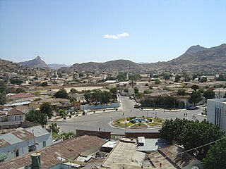
Keren, historically known as Sanhit, is the second-largest city in Eritrea. It is situated around 91 kilometres (57 mi) northwest of Asmara at an elevation of 1,590 metres (5,220 ft) above sea-level. The city sprawls on a wide basin surrounded by granitic mountains on all sides. It serves as the capital of the Anseba Region, and is home to a number of ethnic groups including the Bilen people and Tigre people.
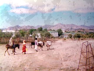
Nakfa, Tigrinya: ናቕፋ, is a town in the Northern Red Sea region of Eritrea. It is also the name of a sub region of Eritrea.

The six regions of Eritrea are divided into administrative subregions.
Keren may refer to:
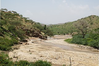
The Anseba River is a tributary of the Barka River in Eritrea with a length of 346 kilometres. It rises in the Eritrean Highlands outside Asmara and flows in a northwestern direction through Keren. It merges with the Barka River near the border with Sudan.
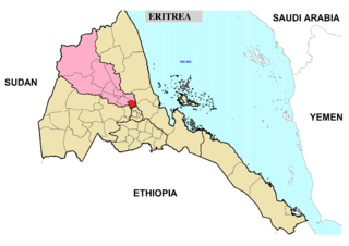
Adi Tekelezan subregion is a subregion in the northwestern Anseba region of Eritrea. The capital lies at Adi Tekelezan.

Asmat subregion is a subregion in the northwestern Anseba region of Eritrea. Its capital lies at Asmat.

Elabered subregion is a subregion in the northwestern Anseba region of Eritrea. Its capital lies at Elabered.

Geleb subregion is a subregion in the northwestern Anseba region of Eritrea. Its capital lies at Geleb.
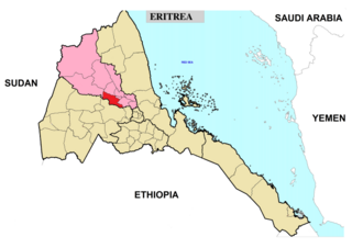
Hagaz subregion is a subregion in the northwestern Anseba region of Eritrea. Its capital lies at Hagaz (Hagat).

Halhal subregion is a subregion in the northwestern Anseba region of Eritrea. Situated 12 km north of Keren (Cheren), its capital lies at Halhal.
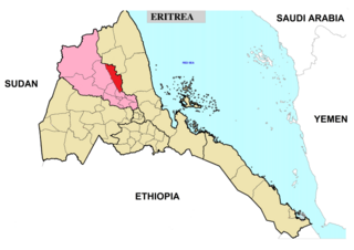
Habero subregion is a subregion in the northwestern Anseba region of Eritrea. Its capital lies at Habero.

Kerkebet subregion or Carcabat district is a subregion in the northwestern Anseba region of Eritrea. Its capital lies at Kerkebet (Carcabat).

Sela subregion is a subregion in the northwestern Anseba region of Eritrea. Its capital lies at Sela.
Logo Anseba subregion is a subregion in the eastern Gash-Barka Region of Eritrea. Its capital lies at Logo Anseba.
Hazega is a Historical village in Central Eritrea located in the Maekel/Central Region or the former province of Hamasien. It is located approximately 10 mi (16 km) north-west from the capital city, Asmara, and 50 mi (80 km) south-east of Keren. It is an entirely Christian village inhabited by the Tigrinya speaking people of Eritrea. The village is located some kilometres west of Emba Derho close to the Anseba river and east of Tsazega at an altitude of 2,323m. In the village there one and among the oldest Orthodox church's of Eritrea (Debre-Tsion kidisti Mariam- was built by Tesfatsion with his family.
Halhal, also spelled Hal-Hal, is a town in the Anseba region of Eritrea. It is the capital of the Halhal subregion, and is sometimes known as Fisho to distinguish it from the subregion as a whole. It is chiefly populated by the Bet Tawqe subtribe of the Bilen people. The president of halhal is The town and surrounding area saw intense fighting during the Eritrean War of Independence. In 1968, the Ethiopian Army commando post there was attacked by Omer Ezaz of the Eritrean Liberation Front (ELF); Ezaz and about 70 of his soldiers were killed. The town was later taken by the ELF, and was controlled by the ELF from 1970 to 1981, when as a result of the Second Eritrean Civil War, control passed to the Eritrean People's Liberation Front. From 1983 to Eritrean independence in 1991, the town was controlled by the Ethiopian Army, except for a brief period of EPLF control in the spring of 1988 following the Battle of Afabet.
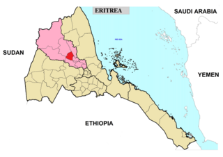
Hamelmalo subregion is a subregion in the northwestern Anseba region of Eritrea.

St. Michael's Cathedral is a Catholic cathedral located in Keren, Anseba, Eritrea, the seat of the Eritrean Catholic Eparchy of Keren.