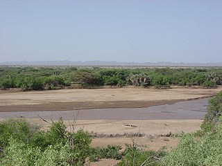
The Kerio River is a river in Turkana County, Kenya. It flows northward into Lake Turkana. It is one of the longest rivers in Kenya, originating near the equator.
The Nilotic peoples are peoples indigenous to the Nile Valley who speak Nilotic languages. They inhabit South Sudan, Sudan, Ethiopia, Uganda, Kenya, DR Congo and Tanzania. Among these are the Burun speaking peoples, Karo peoples, Luo peoples, Ateker peoples, Kalenjin peoples, Datooga, Dinka, Nuer, Atwot, Lotuko and the Maa-speaking peoples.

The Kalenjin are a group of Southern Nilotic peoples indigenous to East Africa, residing mainly in what was formerly the Rift Valley Province in Kenya. They number 6,358,113 individuals as per the Kenyan 2019 census. They are divided into 11 culturally and linguistically related clans: Kipsigis, Nandi, Keiyo, Marakwet, Sabaot, Pokots, Tugen, Terik,Sengwer, Lembus, and Ogiek. They speak Kalenjin languages, which belong to the Nilotic language family.
Tugen may also refer to Tugen Hills in Kenya.
The Arrors or Northern Tugen are the inhabitants of the Tugen Hills stretching from the western shores of Lake Baringo on the East to the foot of the Keiyo escarpment along the Kerio Valley to the west, north of Baringo District, Rift Valley Province, Kenya. As of 2019 their population was 92,470.
Kipsigis is part of the Kenyan Kalenjin dialect cluster, It is spoken mainly in the Kericho district of the Rift Valley Province in Kenya. The Kipsigis people are the most numerous tribe of the Kalenjin in Kenya, accounting for 60% of all Kalenjin speakers. Kipsigis is closely related to Nandi, Keiyo, South Tugen (Tuken), and Cherangany.
The Keiyo are an ethnic group that is part the larger Kalenjin ethnic group of Nilotic origin. Currently they live near Eldoret, Kenya in the highlands of the former Keiyo District now part of the larger Elgeyo Marakwet County. The Elgeyo originally settled at the foot hills of elgeyo escapement. The area between kerio river to the east and escapment to the west. Due to drought and famine at the valley, the keiyos started to climb the escapment and started to settle on the highland east of uasin gishu plateau. When the british came, the keiyos where pushed to settle in cluster which was called reserves. The Keiyo subsist mainly on grain, milk, blood and meat provided by their cattle, sheep and goats.
The Marakwet are one of the groups forming the ethnolinguistic Kalenjin community of Kenya, they speak the Markweta language. The Marakwet live in five territorial sections namely Almoo, Cherangany, Endoow, Sombirir (Borokot) and Markweta. Cutting across these territorial groups are a number of clans to which each Marakwet belongs. There were 119,969 Marakwet people in 2019.

The Iraqw or Irakw are a Cushitic-speaking ethnic group inhabiting the Great Lakes region of East Africa. They live in the Arusha and Manyara regions of north-central Tanzania, near the Rift Valley wall and south of Ngorongoro Crater.
Keiyo District is a defunct administrative district in the former Rift Valley Province of Kenya. The district was formed in 1994, when Elgeyo/Marakwet-District was split into two - the other half was Marakwet District. Keiyo District had a population of 143.865. Its capital was located in the Iten/Tambach town. In 2010, the districts were re-joined as Elgeyo-Marakwet County.
Kapatarakwa is a growing centre in Elgeyo-Marakwet County, Kenya. Kaptarakwa is located about 37 km from the town of Eldoret in the Kenyan highlands. Notable natives include athletes Albert Chepkurui, Sammy Kipketer, Viola Kibiwott, Jonathan Kandie, Geofrey Kamworor, and Vivian Cheruiyot. Former powerful minister Hon. Nicholas Kipyator Biwott was a resident. Kaptarakwa is about 8,000 feet (2,400 m) above sea level. Nearby is the Kerio Escarpment which drops down to 1,000 feet (300 m) above sea level. It is a beautiful place to visit, with fresh water emanating from the forest.
Elgeyo escarpment is a fault-scarp caused by post-Miocene faulting. Miocene beds are still visible. The escarpment is part of the western wall of the Great Rift Valley.
Kimwarer is a village in Elgeyo-Marakwet County, Kenya. It is located along the B54 Road between Eldoret and Tenges, in the southern part of Kerio Valley and in the drainage basin area of the Kerio River. One of the nearest villages is Kaptagat, located 10 kilometres west of Kimwarer on the Highlands. The nearest larger town, Eldoret, is 50 kilometres west of Kimwarer. Electorally Kimwarer is part of the Soy ward of Keiyo South Constituency and Keiyo County Council.

The Kerio Valley National Reserve is a protected area in the Kerio Valley, Kenya, a branch of the Great Rift Valley. The 66 square kilometres (25 sq mi) reserve was created in 1983 and is managed by the Kenya Wildlife Service.

Elgeyo-Marakwet County is one of Kenya's 47 counties. Elgeyo Marakwet County is located in the former Rift Valley Province. Its capital and largest town is Iten. It borders the counties of West Pokot to the north, Baringo County to the east, southeast and south, Uasin Gishu to the southwest and west, and Trans Nzoia to the northwest.
Traditional Kalenjin society is the way of life that existed among the Kalenjin speaking people prior to the advent of the colonial period in Kenya and after the decline of the Chemwal, Lumbwa and other Kalenjin communities in the late 1700s and early 1800s.
The Chemwal people were a Kalenjin-speaking society that inhabited regions of western and north-western Kenya as well as the regions around Mount Elgon at various times through to the late 19th century. The Nandi word Sekker was used by Pokot elders to describe one section of a community that occupied the Elgeyo escarpment and whose territory stretched across the Uasin Gishu plateau. This section of the community appears to have neighbored the Karamojong who referred to them as Siger, a name that derived from the Karimojong word esigirait. The most notable element of Sekker culture appears to have been a dangling adornment of a single cowrie shell attached to the forelock of Sekker women, at least as of the late 1700s and early 1800s.
The Sirikwa culture was the predominant Kenyan hinterland culture of the Pastoral Iron Age, c.2000 BP. Seen to have developed out of the Elmenteitan culture of the East African Pastoral Neolithic c.3300-1200 BP, it was followed in much of its area by the Kalenjin, Maa, western and central Kenyan communities of the 18th and 19th centuries.
The Siger people were a community commonly spoken of in the folklore of a number of Kenyan communities that inhabited regions of northwestern Kenya at various points in history.


