Adelaide railway station is the central terminus of the Adelaide Metro railway system. All lines approach the station from the west, and it is a terminal station with no through lines, with most of the traffic on the metropolitan network either departing or terminating here. It has nine below-ground platforms, all using broad gauge track. The station is located on the north side of North Terrace, west of Parliament House.

Keswick railway station was a station on the Adelaide-Wolseley line and served by Adelaide Metro Belair, Noarlunga and Tonsley line services. It was located in the inner western Adelaide suburb of Keswick, 3.8 kilometres from Adelaide station.
Port Wakefield Highway is an important South Australian highway, connecting Adelaide to the Yorke Peninsula, Port Augusta, northern and western South Australia, the Northern Territory and Western Australia. It is designated National Highway A1 and a part of the National Highway. It is named after Port Wakefield, the first government town north of Adelaide.

The first railway in colonial South Australia was a line from the port of Goolwa on the River Murray to an ocean harbour at Port Elliot, which first operated in December 1853, before its completion in May 1854.

The Belair line is a suburban rail commuter route in the city of Adelaide, South Australia, that runs from the Adelaide station to Belair in the Adelaide Hills via the Adelaide-Wolseley line using diesel 3000/3100 class railcars. Prior to 1995, this part of Adelaide-Wolseley was a two-track broad gauge line. In 1995, Adelaide-Wolseley was converted to standard gauge meaning Adelaide to Belair is now effectively two separate single-track lines running in parallel: the Belair commuter line and the Adelaide-Wolseley standard gauge freight line.
Keswick is an inner south-western suburb of Adelaide, adjacent to the park lands, and located in the City of West Torrens. The suburb is home to the Keswick Barracks, the headquarters of the Royal District Nursing Service, the Keswick Cricket Club and Richmond Primary School.
South Road and its southern section as Main South Road outside of Adelaide is a major north–south conduit connecting Adelaide and the Fleurieu Peninsula, in South Australia. It is one of Adelaide's most important arterial and bypass roads. As South Road, it is designated part of route A2 within suburban Adelaide. As Main South Road, it is designated part of routes A13 and B23.

Goodwood Road is a major north–south arterial road, approximately 10 kilometres long, in Adelaide, South Australia. It runs between the Adelaide city centre and Adelaide's southern suburbs of Pasadena and Panorama.

Cross Road is a major arterial road that travels east–west through the inner southern suburbs of the Australian city of Adelaide. It is designated route A3.

Anzac Highway is an 8.7-kilometre-long (5.4 mi) main arterial road heading southwest from the city of Adelaide, the capital of South Australia, to the beachside suburb of Glenelg.

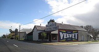
Wolseley is a small South Australian town near the Victorian border. It is five kilometres south of the Dukes Highway and 13 kilometres east of Bordertown. It was first proclaimed a town in 1884.

Until 1958, trams formed a network spanning most of Adelaide, South Australia, with a history dating back to 1878. Adelaide ran horse trams from 1878 to 1914 and electric trams from 1909, but has primarily relied on buses for public transport since the mid-20th century. Electric trams, and later trolleybuses, were Adelaide's main method of public transport throughout the life of the electric tram network. The tram network was progressively closed down through the 1950s with the last lines closing in 1958; the Glenelg tram line was the only line to survive these closures and has remained in operation ever since and has been progressively upgraded and extended since 2005.
The Adelaide–Wolseley railway line is a 313 kilometre line running from Adelaide to Wolseley on the Australian Rail Track Corporation network. It is the South Australian section of the Melbourne–Adelaide railway.
Adelaide has two city ring routes, that loop around the Adelaide city centre and North Adelaide, known as the Inner and Outer Ring Routes.
Keswick Barracks is a barracks of the Australian Army in Keswick, South Australia. The barracks are located on Anzac Highway adjacent to the Adelaide Showground. The base is separated from the showgrounds by the Adelaide-Wolseley railway line.

Tailem Bend railway station is located on the Adelaide-Wolseley line in Tailem Bend, South Australia. It is also the junction point for the Loxton and Pinnaroo lines.

Murray Bridge railway station is located on the Adelaide to Wolseley line serving the South Australian town of Murray Bridge.
The Mount Gambier railway line was a railway line on the South Australian Railways network. Opened in stages from 1881, it was built to narrow gauge and joined Mount Gambier railway station, which was at that time the eastern terminus of a line to Beachport. It connected at Naracoorte to another isolated narrow gauge line joining Naracoorte to Kingston SE, and to the broad gauge Adelaide-Wolseley line at Wolseley, at around the same time that was extended to Serviceton to become the South Australian part of the interstate Melbourne–Adelaide railway. Since its closure in 1995 following the standardisation of the interstate main line, there have been varying calls for standardisation of the railway between Wolseley and Heywood.
The Goodwood Overpass carries the Glenelg tram line over the Adelaide-Wolseley railway line in Adelaide, Australia.


