
Ernest I was the last sovereign duke of Saxe-Coburg-Saalfeld and, from 1826, the first sovereign duke of Saxe-Coburg and Gotha. He was the father of Albert, Prince Consort, who was the husband of Queen Victoria. Ernest fought against Napoleon Bonaparte, and through construction projects and the establishment of a court theatre, he left a strong imprint on his residence town, Coburg.
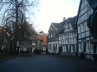
Wülfrath is a town in the district of Mettmann (district), in North Rhine-Westphalia, Germany.
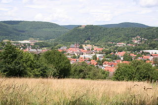
Amorbach is a town in the Miltenberg district in the Regierungsbezirk of Lower Franconia (Unterfranken) in Bavaria, Germany, with some 4,000 inhabitants. It is situated on the small river Mud, in the northeastern part of the Odenwald.

Coburg is a town located on the Itz river in the Upper Franconia region of Bavaria, Germany. Long part of one of the Thuringian states of the Wettin line, it joined Bavaria by popular vote only in 1920. Until the revolution of 1918, it was one of the capitals of the Duchy of Saxe-Coburg and Gotha and the Duchy of Saxe-Coburg-Saalfeld.
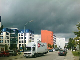
Martinsried is one of Munich's two science suburbs. It is a section of Planegg municipality in the district of Munich in Bavaria, Germany.
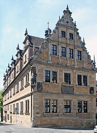
The Casimirianum, known to the students as the "Casi", is a Gymnasium in Coburg, Bavaria. It was founded in 1605 by Johann Casimir, the Duke of Saxe-Coburg (1564–1633), and named after him. Today the Casimirianum is a linguistic and humanistic high school with the curriculum including Latin from 5th Grade, English from 6th Grade, and Italian, Greek, French or Spanish as the third compulsory foreign language. With the school year of 2009–10, the program was expanded with a scientific-technological branch with Latin as a second language. The Casimirianum was once involved with a German pilot program, "The European Gymnasium" and was one of 44 Model Schools of "MODUS21", but both programs were closed by 2009.

Vöhringen is a town in the district of Neu-Ulm in Bavaria, Germany. It is located on the Iller, approximately 18 km south of Ulm and 40 km north of Memmingen. It is in the Donau-Iller Region in Central Swabia.

Ahn is a wine-growing village in the municipality of Wormeldange in the district and canton of Grevenmacher in the southeastern side of the Grand Duchy of Luxembourg. In 2005, the population is 208.

Markt Schwaben is a town in Bavaria, Germany. It lies roughly 23 km east of Munich on the northern edge of the Upper Bavarian district of Ebersberg. Neighbouring communities are Anzing, Forstinning, Pliening and Poing, as well as Finsing, Ottenhofen and Pastetten.
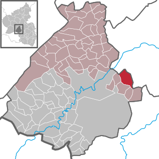
Schmidthachenbach is an Ortsgemeinde – a municipality belonging to a Verbandsgemeinde, a kind of collective municipality – in the Birkenfeld district in Rhineland-Palatinate, Germany. It belongs to the Verbandsgemeinde Herrstein-Rhaunen, whose seat is in Herrstein.

Heimbach is an Ortsgemeinde – a municipality belonging to a Verbandsgemeinde, a kind of collective municipality – in the Birkenfeld district in Rhineland-Palatinate, Germany. It belongs to the Verbandsgemeinde of Baumholder, whose seat is in the like-named town.

Glanbrücken is an Ortsgemeinde – a municipality belonging to a Verbandsgemeinde, a kind of collective municipality – in the Kusel district in Rhineland-Palatinate, Germany. It belongs to the Verbandsgemeinde Lauterecken-Wolfstein.

Volksdorf is a quarter of Hamburg. It is situated in the north east of the city, about 15 km from the centre of the city.

Landestheater Coburg is a medium-sized three-division theatre in Coburg, Bavaria, Germany. Located on Schlossplatz, a central square, the Neoclassical building has 550 seats. In 2008, the theatre employed 250 permanent staff and 100 part-time employees.

The Veste Coburg is one of the best-preserved medieval fortresses of Germany. It is situated on a hill above the town of Coburg, in the Upper Franconia region of Bavaria.

Schloss Ketschendorf is a Gothic Revival residence, located in Ketschendorf, at the foot of the Buchberg, in the town of Coburg, in the state of Bavaria, Germany.

The Free State of Coburg emerged from the Duchy of Saxe-Coburg and Gotha at the end of the First World War. It existed from November 1918 until its union with the Free State of Bavaria on 1 July 1920.

Creidlitz is a southern suburb of 1705 inhabitants of the city of Coburg in the county of Upper Franconia in the state of Bavaria in Germany.

Arkonaplatz is a 1.5-hectare square in Berlin's Mitte district of the same name and is part of the historic Rosenthaler Vorstadt district. It was created in the middle of the 19th century.


