Grand Canyon National Park, located in northwestern Arizona, is the 15th site in the United States to have been named as a national park. The park's central feature is the Grand Canyon, a gorge of the Colorado River, which is often considered one of the Wonders of the World. The park, which covers 1,217,262 acres of unincorporated area in Coconino and Mohave counties, received more than six million recreational visitors in 2017, which is the second highest count of all American national parks after Great Smoky Mountains National Park. The Grand Canyon was designated a World Heritage Site by UNESCO in 1979. The park celebrated its 100th anniversary on February 26, 2019.

The Grand Canyon is a steep-sided canyon carved by the Colorado River in Arizona, United States. The Grand Canyon is 277 miles (446 km) long, up to 18 miles (29 km) wide and attains a depth of over a mile.

Coconino County is a county in the north-central part of the U.S. state of Arizona. Its population was 145,101 at the 2020 census. The county seat is Flagstaff. The county takes its name from Cohonino, a name applied to the Havasupai people. It is the second-largest county by area in the contiguous United States, behind San Bernardino County, California. It has 18,661 sq mi (48,300 km2), or 16.4% of Arizona's total area, and is larger than each of the nine smallest states in the U.S.

Mohave County is in the northwestern corner of the U.S. state of Arizona. As of the 2020 census, its population was 213,267. The county seat is Kingman, and the largest city is Lake Havasu City. It is the fifth largest county in the United States.

Williams is a city in Coconino County, Arizona, United States, located west of Flagstaff. Its population was 3,023 at the 2010 census. It lies on the routes of Historic Route 66 and Interstate 40. It is also the southern terminus of the Grand Canyon Railway, which takes visitors to Grand Canyon Village. There are numerous inns, motels, restaurants and gas stations catering to the large influx of tourists rather than local residents, especially during the summer and holiday seasons.
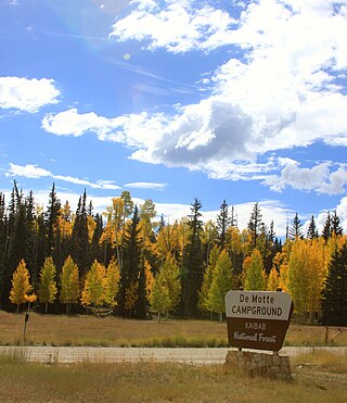
At 1.6 million acres the Kaibab National Forest borders both the north and south rims of the Grand Canyon, in north-central Arizona. It is divided into two major sections: the North Kaibab Ranger District and the South Kaibab and are managed by the United States Forest Service. The South Kaibab is further divided into two districts, the Tusayan Ranger District, and the Williams Ranger District. Grand Canyon National Park separates the North Kaibab and the South Kaibab. The South Kaibab covers 1,422 square miles (3,680 km2) and the North Kaibab stretches over 1,010 square miles (2,600 km2). Elevations vary on the forest from 5,500 feet in the southwest corner to 10,418 feet at the summit of Kendrick Peak on the Williams Ranger District. The forest as a whole is headquartered in Williams.

The Bright Angel Trail is a hiking trail located in Grand Canyon National Park in the U.S. state of Arizona.

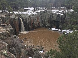
Red Butte is a butte located in the Kaibab National Forest in Coconino County, Arizona. It is known to the Havasupai nation as Wii'i Gdwiisa, "clenched fist mountain," and is regarded as a sacred site.

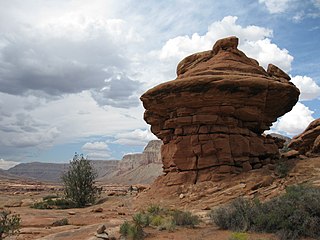
The Arizona Strip is the part of Arizona lying north of the Colorado River. Despite being larger in area than several U.S. states, the entire region has a population of fewer than 10,000 people. Consisting of northeastern Mohave County and northwestern Coconino County, the largest settlements in the Strip are Colorado City, Fredonia, and Beaver Dam, with smaller communities of Scenic, Littlefield and Desert Springs. The Kaibab Indian Reservation lies within the region. Lying along the North Rim of the Grand Canyon creates physical barriers to the rest of Arizona. Only three major roads traverse the region, I-15 crosses the northwestern corner while Arizona State Route 389 and U.S. Route 89A crosses the northeastern part of the strip, US 89A crosses the Colorado River via the Navajo Bridge, providing the only direct road connection between the strip and the rest of the state. The nearest metropolitan area is the St. George, Utah metro area, to which the region is more connected than to the rest of Arizona.
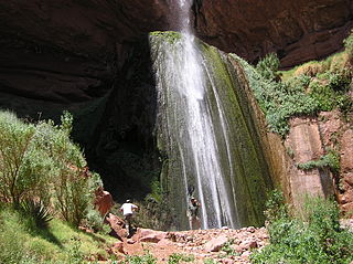
The North Kaibab Trail is a hiking trail in the North Rim side of the Grand Canyon, in Grand Canyon National Park, located in the U.S. state of Arizona.

The River Trail is a hiking trail in Grand Canyon National Park, located in the U.S. state of Arizona. This trail connects the end of the Bright Angel Trail with Phantom Ranch and the South Kaibab Trail.
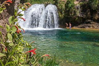
Fossil Creek is a perennial stream accessed by forest roads near the community of Camp Verde in the U.S. state of Arizona. Primary access is from Forest Road 708 off Arizona State Route 260 east of Camp Verde. A tributary of the Verde River, Fossil Creek flows from its headwaters on the Mogollon Rim to meet the larger stream near the former Childs Power Plant.

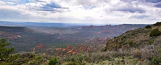
Sycamore Canyon is the second largest canyon in the Arizona redrock country, after Oak Creek Canyon. The 21-mile (34 km) long scenic canyon reaches a maximum width of about 7 miles (11 km). It is in North Central Arizona bordering and below the Mogollon Rim, and is located west and northwest of Sedona in Yavapai and Coconino counties.
Sycamore Canyon Wilderness is a 56,000-acre wilderness area in the Coconino, Kaibab and Prescott national forests in the U.S. state of Arizona. Encompassing Sycamore Canyon and its surrounds from south of Williams to the confluence of Sycamore Creek with the Verde River, the wilderness is about 40 miles (64 km) southwest of Flagstaff. The canyon is one of several in Arizona that cut through the Mogollon Rim. Relevant United States Geological Survey (USGS) map quadrangles are Davenport Hill, White Horse Lake, May Tank Pocket, Perkinsville, Sycamore Basin, and Clarkdale. Red Rock-Secret Mountain Wilderness borders Sycamore Canyon Wilderness on the east.
Kanab Creek Wilderness is a 75,300-acre (305 km2) wilderness area located along the Coconino/Mohave County line in the U.S. state of Arizona, approximately 30 miles (48 km) south of Fredonia. 68,600 acres (278 km2) of the Wilderness are located in the North Kaibab Ranger District of the Kaibab National Forest, the remaining 6,700 acres (27 km2) are administered by the Arizona Bureau of Land Management.
The Great Western Trail is a north-south long distance multiple use route which runs from Canada to Mexico through five western states in the United States. The trail has access for both motorized and non-motorized users and traverses 4,455 miles (7,170 km) through Arizona, Utah, Idaho, Wyoming, and Montana. It was designated a National Millennium Trail in 1999.

The Black Suspension Bridge spans the Colorado River in the inner canyon of Grand Canyon National Park. The span length is 440 feet (130 m). The bridge is part of the South Kaibab Trail and is the river crossing used by mules going to Phantom Ranch. The Black Bridge and Silver Bridge, located about 700 metres (2,300 ft) downstream, are the only spans in hundreds of river miles.
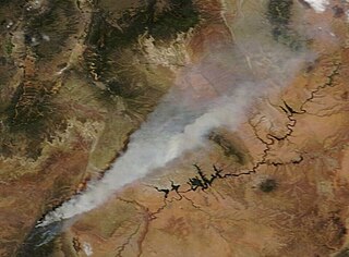
The Mangum Fire was a wildfire burning in Kaibab National Forest in Arizona in the United States. The fire, which started on June 8, 2020 approximately 16 miles north of the North Rim of Grand Canyon National Park, burned a total of 71,450 acres (28,915 ha). The fire threatened the community of Jacob Lake, Arizona, resulting in its evacuation. Select highways were closed, including Highway 67, which resulted in closure of the North Rim of the Grand Canyon. Additionally, areas of the Paria Canyon-Vermilion Cliffs Wilderness were inaccessible due to closures. Four buildings were destroyed, including two historic cabins. The exact cause of the fire remains under investigation, however, fire officials have confirmed it was human caused.