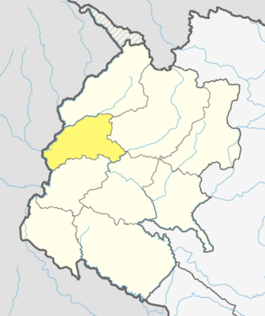
Baitadi District, historical name “Bairath” (बैराथ), a part of Sudurpashchim Province, is one of the 77 districts of Nepal. It is a Hill district. Baitadi, with Dasharathchand as its headquarters, covers an area of 1,519 km2 (586 sq mi) and has a population of 250,898 according to the census (2011). The Baitadi district entails 56 village development councils (VDCs) and two municipality in the past. Now, by federal policy there are 10 local units; 4 Municipalities and 6 Rural Municipalities. Baitadi falls into the farthest western regional district of Nepal touching Jhulaghat, India, Nepal's neighboring country, to its border.

Darchula District (Nepali: दार्चुला जिल्लाpronounced [ˈdaɾt͡sula], a part of Sudurpashchim Province, is one of the nine districts of province and one of seventy-seven districts of Nepal. The district, with Khalanga as its district headquarters, covers an area of 2,322 km2 and has a population of 133,274. Darchula Lies in the west-north corner of the country.
Khalanga may refer to several places in Nepal:

Dasharathchand is a municipality and the district headquarter of Baitadi District in Sudurpashchim Province of Nepal. It is a hill station above Mahakali River close to the Indian border. At the time of the 2011 Nepal census it had a population of 34,575 people living in 7,257 individual households.
Durgasthan is a village development committee in Baitadi District in the Mahakali Zone of western Nepal. At the time of the 2011 Nepal census it had a population of 3995 and had 726 houses in the town. It had a male population of 1784 and a female population of 2211.
Gajari is a village development committee in Baitadi District in the Mahakali Zone of western Nepal. At the time of the 1991 Nepal census it had a population of 3,190 and had 480 houses in the town.
Gokuleshwar is a Village Development Committee in Baitadi District in the Mahakali Zone of western Nepal. At the time of the 1991 Nepal census it had a population of 3,444 and had 601 houses in the town.
Gurukhola is a village development committee (VDC) in Baitadi District in the Mahakali Zone of western Nepal. At the time of the 1991 Nepal census it had a population of 3,481 and had 600 houses in the town.
Kataujpani is a village development committee in Baitadi District in the Mahakali Zone of western Nepal. At the time of the 1991 Nepal census it had a population of 3,705 and had 634 houses in the town.
Kotila is a village development committee in Baitadi District in the Mahakali Zone of western Nepal. At the time of the 1991 Nepal census it had a population of 2,713 and had 472 houses in the town.
Kotpetara is a village development committee in Baitadi District in the Mahakali Zone of western Nepal. At the time of the 1991 Nepal census it had a population of 4549 and had 751 houses in the town.
Kulau is a village development committee in Baitadi District in the Mahakali Zone of western Nepal. At the time of the 1991 Nepal census it had a population of 3,376 and had 378 houses in the town.
Kuwakot is a Village Development Committee in Baitadi District in the Mahakali Zone of western Nepal. At the time of the 1991 Nepal census it had a population of 3804 and had 644 houses in the town.
Mahadevsthan is a village development committee in Baitadi District in the Mahakali Zone of western Nepal. At the time of the 1991 Nepal census it had a population of 3,291 and had 599 houses in the town.
Maharudra is a village development committee in Baitadi District in the Mahakali Zone of western Nepal. At the time of the 1991 Nepal census it had a population of 3,182 and had 588 houses in the town.
Malladehi is a village development committee in Baitadi District in the Mahakali Zone of western Nepal. At the time of the 1991 Nepal census it had a population of 3,440 and had 594 houses in the town.
Melauli is a Municipality in Baitadi District in the Mahakali Zone in Sudurpaschim province of far-western Nepal. At the time of the 2011 Nepal census it had a population of 22,545 and had 1500 houses in the town.
Patan is a municipality in Baitadi District in the Mahakali Zone in Sudurpaschim Province of Far-western Nepal. The new municipality was formed by merging six existing villages Sakar, Silanga, Bhumeswor Gujar Basantapur and Patan on 2 December 2014. The office of the municipality is that of the former Patan village development committee.
Khalanga is the Headquarters of the Jajarkot District located in Karnali province of Nepal. Formerly it was a village development committee which incorporated to Bheri Municipality in 2015 when a new municipality was established.
Khalanga is a town and the district headquarters of the Darchula District in the Sudurpashchim Province province of Nepal. It is part of the Mahakali Municipality in the Mahakali Zone. The town is located on the bank of Mahakali River and the border with Uttarakhand state, India. The town on the Indian side of the border also has similar name, spelt as Dharchula.

