Related Research Articles

Yellandu is a town in Bhadradri Kothagudem district of the Indian state of Telangana. It is located in Yellandu mandal of Kothagudem revenue division.
Kodad is a town in Suryapet district of the Indian state of Telangana. It is a municipality and the mandal headquarters of Kodad mandal in Kodad revenue division. It lies on the National Highway 65 between Hyderabad and Vijayawada. It is 44 km away from the district headquarters Suryapet

Manuguru is a census town and mandal in Bhadradri Kothagudem district in the Indian state of Telangana. It comes under Mahaboobabad parliamentary constituency and Pinapaka Assembly constituency. Manuguru is an urban area, situated on the banks of Godavari River. The town is famous for Singareni coal mines. The singareni had provided many employment opportunities. Since there is a availability of coal the TS government has taken an action to construct a power plant(BTPS) in the coal city MANUGURU Pin code of Manuguru is 507117.
Tadepalle mandal is one of the 57 mandals in Guntur district of the Indian state of Andhra Pradesh. It is under the administration of Guntur Revenue Division and the headquarters are located at Tadepalle town. The mandal is situated on the banks of Krishna River, bounded by Thullur and Mangalagiri mandals. from the mandal are under the jurisdiction of Andhra Pradesh Capital City.
Nizamabad mandal is one of the 27 mandals within Nizamabad District in the Indian state of Telangana. It is located in the revenue division of Nizamabad, while the headquarters are located in the city of the same name. The mandal is bordered by those of Mosra, Chandur, Yedpalle, Navipet, Makloor, Gandhari, and Dichpalle.

Jaggayyapeta mandal is one of the 50 mandals in Krishna district of the state of Andhra Pradesh in India. It is under the administration of Vijayawada revenue division and the headquarters are located at Jaggayyapeta town. Krishna River flows through the mandal and is bounded by Penuganchiprolu, Nandigama, Chandarlapadu mandals of Krishna district, some part of Guntur district, Nalgonda and Khammam districts of Telangana.

Gampalagudem mandal is one of the 50 mandals in Krishna district of the state of Andhra Pradesh in India. It is under the administration of Nuzvid revenue division and the headquarters are located at Gampalagudem town. The mandal is bounded by Tiruvuru, A. Konduru mandals of Krishna district in Andhra Pradesh and Khammam district of Telangana state.

Sattenapalle mandal is one of the 57 mandals in Guntur district of the Indian state of Andhra Pradesh. It is under the administration of Guntur revenue division and the headquarters are located at Sattenapalle. The mandal is bounded by Krosuru, Pedakurapadu, Rajupalem, Medikonduru, Muppalla and Phirangipuram.And it is a part of APCRDA also comes under capital region

Dwaraka Tirumala mandal is one of the 48 mandals in West Godavari district of the Indian state of Andhra Pradesh. It is under the administration of Eluru revenue division and the headquarters are located at Dwaraka Tirumala. The mandal is bounded by Jangareddygudem, Koyyalagudem, Kamavarapukota, Nallajerla, Pedavegi, Unguturu, Denduluru and Bhimadole mandals.

Bhattiprolu mandal is one of the 57 mandals in Guntur district of the Indian state of Andhra Pradesh. It is under the administration of Tenali revenue division and the headquarters are located at Bhattiprolu. The mandal is situated on the banks of Krishna River, bounded by Kollur, Vemuru, Cherukupalle, Nagaram and Repalle mandals. The mandal headquarters ten villages are included in Andhra Pradesh Capital Region.
Kodad mandal is one of the 23 mandals in Suryapet district of the Indian state of Telangana. It is under the administration of Kodad revenue division with its headquarters at Kodad. The mandal is located on the banks of Paler river and is bounded by Nadigudem, Munagala, Chilkur, Huzurnagar, Mellachervu mandals. A portion of it also borders Khammam district and the state of Andhra Pradesh.

Macherla mandal is one of the 57 mandals in Guntur district of the Indian state of Andhra Pradesh. It is under the administration of Gurazala revenue division and the headquarters are located at Macherla. The mandal is bounded by Rentachintala, Durgi and Veldurthi mandals and a portion of the mandal also borders the state of Telangana.
Adilabad mandal is one of the 52 mandals in Adilabad district of the Indian state of Telangana. It is under the administration of Adilabad revenue division and the headquarters are located at Adilabad. The mandal is bounded by Jainad, Bela, Inderavelly, Gudihatnur, Talamadugu and Tamsi mandals.
Medak mandal is one of the 46 mandals in Medak district of the Indian state of Telangana. It is under the administration of Medak revenue division and the headquarters are located at Medak. The mandal is bounded by Ramayampet, Shankarapet (R), Kulcharam, Papannapet mandals and a portion of it also borders Nizamabad district.
Karimnagar mandal is one of the mandal in Karimnagar district of the Indian state of Telangana. It is under the administration of Karimnagar revenue division and the headquarters are located at Karimnagar.
Warangal mandal is one of the 11 mandals in Warangal (urban) district of the Indian state of Telangana. It is under the administration of Warangal revenue division and has its headquarters at Warangal. The mandal is bounded by Hanamkonda and Hasanparthy mandals.
Mahabubnagar mandal is one of the 64 mandals in Mahabubnagar district of the Indian state of Telangana. It is under the administration of Mahabubnagar revenue division and the headquarters are located at Mahabubnagar. The mandal is bounded by Nawabpet, Jadcherla, Bhoothpur, Addakal, Hanwada, Koilkonda and Devarakadra mandals.
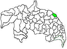
Bhadradri Kothagudem district is a district in the eastern region of the Indian state of Telangana. The town of Kothagudem is the district headquarters. It was a part of the Khammam district prior to the re-organisation of districts in the state.
T. Narasapuram Mandal is one of the 46 mandals in West Godavari district of the Indian state of Andhra Pradesh. The headquarters are located in T. Narasapuram town. The mandal is bordered by Jangareddygudem Mandal and Jeelugumilli to the north, Kamavarapukota Mandal to the east, Chintalapudi Mandal to the south and Khammam district to the west.
References
- ↑ "Census 2011". The Registrar General & Census Commissioner, India. Retrieved 21 May 2016.
- 1 2 "District Census Handbook – Khammam" (PDF). Census of India. pp. 14, 380. Retrieved 22 May 2016.
- ↑ "Khammam District Mandals" (PDF). Census of India. p. 145. Retrieved 22 May 2016.
- ↑ "Mandals in Khammam district". aponline.gov.in. Archived from the original on 10 May 2016. Retrieved 22 May 2016.
- ↑ "Delimitation of Parliamentary and Assembly Constituencies Order, 2008" (pdf). Election Commission of India. p. 16,30. Retrieved 21 May 2016.
- ↑ "Abbreviations used". censusindia.gov.in. Archived from the original on 17 June 2007. Retrieved 26 May 2014.
| Authority control |
|
|---|