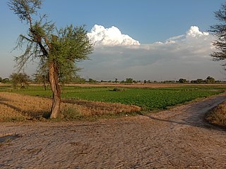
Bhiwani district is one of the 22 districts of the northern Indian state of Haryana. Created on 22 December 1972, the district was the largest district of the state by area, before the creation of Charkhi Dadri as a separate district, as it occupied an area of 4,778 square kilometres (1,845 sq mi) and administered 442 villages with a population of 1,634,445. Sirsa is now the largest district of the state.
Phillaur is a town and a municipal council as well as a tehsil in Jalandhar district in the Indian state of Punjab. The city is situated 20 km from Ludhiana, 45 km from Jalandhar and 140 km from Amritsar. Situated on Doaba and Puadh regions Border. Phillaur is in Doaba region.

Doaba, also known as Bist Doab or the Jalandhar Doab, is the region of Punjab, India that lies between the Beas River and the Sutlej River. People of this region are given the demonym "Doabia". The dialect of Punjabi spoken in Doaba is called "Doabi". The term "Doaba" or "Doab" is derived from Persian دو آب meaning "land of two rivers". The river Sutlej separates Doaba from the Malwa region to its south and the river Beas separates Doaba from the Majha region to its north.

Kasur District, is a district located in Lahore Division of Punjab, Pakistan. It came into existence on 1 July 1976. Prior to its creation, it was a tehsil of the Lahore District.
Shahkot is a small city and one of the five tehsils of Jalandhar district in Punjab, India. Shahkot is situated on Jalandhar-Moga-Barnala-Sirsa National Highway 703. Shahkot is administered by the Municipal Committee. About 176 villages belong to Shahkot tehsil. Shahkot was famous for its red chili peppers; but now, its main crops are Wheat, Paddy, Maize, potato, etc. Agricultural land is not suitable for paddy. But with the use of pesticides and tubewell water; paddy is grown.
Sunam Udham Singh Wala is a town and a tehsil, near city of Sangrur in Sangrur district in the Indian state of Punjab. The city of Sunam Udham Singh Wala, which falls in Sunam Udham Singh Wala tehsil, was previously known only as Sunam. The Government of Punjab renamed it after the Indian freedom fighter and martyr Udham Singh in 2006.

Depalpur Tehsil, is an administrative subdivision (tehsil) of Okara District in the Punjab province of Pakistan, headquartered at the city of Depalpur.
Khudian Khas, is a large town and Municipal Committee of Kasur District in the Punjab province of Pakistan..Khudian is part of Kasur Tehsil and is at an altitude of 177 meters (583 feet) above sea level. The Sutlej River, which flows on the India-Pakistan border, is 20 kilometers from Khudian. It is 33 kilometers from India-Pakistan border of Ganda Singh Wala.
Wazirabad Tehsil, is an administrative subdivision (tehsil) of Wazirabad District in the Punjab province of Pakistan. The tehsil is headquartered at the city of Wazirabad and is administratively subdivided into 36 Union Councils.
Dhaunkal, is a town and Union Council in Wazirabad Tehsil, Wazirabad District, Punjab, Pakistan. It is located on the Lahore-Islamabad Highway, Only 0.5 kilometers away from the district capital, Wazirabad and about 15 kilometres from Gujrat. Dhaunkal is one of the biggest and oldest towns in Wazirabad Tehsil. The population of Dhaunkal is 25000, of which 10000 registered to vote. Due to access to transportation, it is possible to get to Dhaunkal from all over Pakistan in 24 hours because NHA provides full access.
Behak Mekan is a small town located in the Sargodha District ضلع سرگودھا of the Punjab province, Pakistan, that was formed when the area was part of the British Empire. The town is placed 16.5 kilometres (10.3 mi) away from the city of Sargodha and 10 kilometres (6.2 mi) away from Dhreema. Due to the town's ecological site, the British Royal Air Force (RAF) built an airstrip near "godhay wala" that become of great significance to the Pakistan Air Force after the Pakistan Movement independence of Pakistan.
Maujia is a village in the tehsil and district of Mansa in Punjab, India. It is a notable village of the area as a huge operation between the Indian Army and Babbar Khalsa members took place here in September, 1991.
Jherian Wali is a village in Sardulgarh tehsil of Mansa district in Punjab, India.
Mian, also known as Karam Singh Wala Mian is a village in Sardulgarh tehsil of Mansa district in Punjab, India.
Chanot (चैनत) is a village in Hansi -1 tehsil of Hisar district, in the Indian state of Haryana. The majority is of Duhan Clan of Jaat caste.
Karahe Wala is a small village in Moga district of Punjab state of India.
Sagwara tehsil is one of five tehsils in Dungarpur District of Rajasthan, India. It is in the southeast part of the district and borders on the Mahi River. The town of Sagwara is the headquarters of the tehsil.
Hassan Wali also known as Dhupai, officially the Dhupai Hassan Wali. Hassan Wali or Dhupai s a small village located in Wazirabad Tehsil, Gujranwala District, Punjab, Pakistan.

Badoki Saikhwan or Baddoki Sekhwan is a village of Tehsil Nowshera Virkan, District Gujranwala, Punjab, Pakistan. It has historical remnants of the Mughal Empire and the Sikh Empire. It is located at 32°8' N 74°1' E, west of Gujranwala, the district capital. Its population was estimated to be 2500 in December 2020. It lies near the Gujranwala-Hafizabad road, 35 km west of the Gujranwala.


