
Cape Town is the legislative capital of South Africa. It is the country's oldest city and the seat of the Parliament of South Africa. It is the country's second-largest city, after Johannesburg, and the largest in the Western Cape. The city is part of the City of Cape Town metropolitan municipality.

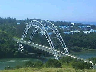
East London is a city on the southeastern coast of South Africa, in the Buffalo City Metropolitan Municipality, Eastern Cape Province. The city lies on the Indian Ocean coast, largely between the Buffalo River and the Nahoon River, and hosts the country's only river port. As of 2011, East London had a population of over 267,000 with over 755,000 in the surrounding metropolitan area.

The Eastern Cape is one of the nine provinces of South Africa. Its capital is Bhisho, and its largest city is Gqeberha. Due to its climate and nineteenth-century towns, it is a common location for tourists. It is also known for having been home to many anti-apartheid activists, including Nelson Mandela.

Paarl is a town with 285,574 inhabitants in the Western Cape province of South Africa. It is the largest town in the Cape Winelands. Due to the growth of the Mbekweni township, it is now a de facto urban unit with Wellington. It is situated about 60 kilometres (37 mi) northeast of Cape Town in the Western Cape Province and is known for its scenic environment and viticulture and fruit-growing heritage. Paarl is a colonial town founded by Dutch colonists who seized Khoikhoi lands, many Khoi died in the colonisation process. Paarl's colonial society was dependent on enslaved people.

Plettenberg Bay, nicknamed Plett, is the primary town of the Bitou Local Municipality in the Western Cape Province of South Africa. According to the census of 2001, the town had a population of 29,149. It was originally named Bahia Formosa by early Portuguese explorers and lies on South Africa's Garden Route 210 km from Port Elizabeth and about 600 km from Cape Town.
Port Edward is a small resort town situated on the south coast of KwaZulu-Natal in South Africa and lies on the border between KwaZulu-Natal and the Eastern Cape. It is situated on the R61 road between Port Shepstone and Lusikisiki.
Kingsburgh is a coastal resort town along the South Coast of KwaZulu-Natal, South Africa, approximately 32 kilometres south-west of Durban.

Warrenton is an agricultural town of approximately 22,588 people in the Northern Cape province of South Africa, situated 70 kilometres (40 mi) north of Kimberley on the Vaal River.

Makhanda, also known as Grahamstown, is a town of about 75,000 people in the Eastern Cape province of South Africa. It is situated about 125 kilometres (80 mi) northeast of Gqeberha and 160 kilometres (100 mi) southwest of East London. It is the largest town in the Makana Local Municipality, and the seat of the municipal council. It also hosts Rhodes University, the Eastern Cape Division of the High Court, the South African Library for the Blind (SALB), a diocese of the Anglican Church of Southern Africa, and 6 South African Infantry Battalion. Furthermore, located approximately 3 km south-east of the town lies Waterloo Farm, the only estuarine fossil site in the world from 360 million years ago with exceptional soft-tissue preservation.

Gqeberha, formerly known as Port Elizabeth and colloquially referred to as P.E., is a major seaport and the most populous city in the Eastern Cape province of South Africa. It is the seat of the Nelson Mandela Bay Metropolitan Municipality, South Africa's second-smallest metropolitan municipality by area. It is the sixth-most populous city in South Africa and is the cultural, economic and financial hub of the Eastern Cape.

Qonce, formerly King William's Town, is a town in the Eastern Cape province of South Africa along the banks of the Buffalo River. The town is about 60 kilometres (37 mi) northwest of the Indian Ocean port of East London. It has a population of around 35,000 inhabitants and forms part of the Buffalo City Metropolitan Municipality.

Khayelitsha is a township in Western Cape, South Africa, on the Cape Flats in the City of Cape Town Metropolitan Municipality. The name is Xhosa for New Home. It is reputed to be one of the largest and fastest-growing townships in South Africa.

Langa is a township in Cape Town, South Africa. Its name in Xhosa means "sun". The township was initially built in phases before being formally opened in 1927. It was developed as a result of South Africa's 1923 Urban Areas Act, which was designed to force Africans to move from their homes into segregated locations. Similar to Nyanga, Langa is one of the many areas in South Africa that were designated for Black Africans before the apartheid era. It is the oldest of such suburbs in Cape Town and was the location of much resistance to apartheid.

Dutywa, also known as Idutywa, is a town in Mbashe Local Municipality, Eastern Cape province, South Africa, that was founded in 1858 as a military fort after a dispute between a Natal Colony raiding party and its local people. It is named after the Dutywa River, a tributary of the Mbhashe River. The name means "place of disorder" in the Xhosa language; its spelling was officially changed from "Idutywa" to "Dutywa" on 16 July 2004. The settlement was laid out in 1884 and was made a municipality in 1913. The town is the birthplace of former South African President, Thabo Mbeki.
Bizana is a town in the Eastern Cape province of South Africa. It is the seat of the Winnie Madikizela-Mandela Local Municipality.

The Xhosa people, or Xhosa-speaking people are a Bantu ethnic group native to South Africa. They are the second largest ethnic group in South Africa and are native speakers of the isiXhosa language.

Chintsa, alternatively rendered Cintsa, is a village in the Wild Coast region of the Eastern Cape province, South Africa. It is situated 38 km north-east of East London and 10 km north of Gonubie, at the mouth of the Chintsa River.

Molteno is a town in the Eastern Cape province of South Africa.

Coffee Bay is a town on the Wild Coast of the Eastern Cape Province of South Africa. It is located about 250 kilometres south-west of the city of Durban and has a population of 258 people.
Border is a region of Eastern Cape province in South Africa, comprising roughly the eastern half of the province. Its main centre is East London.


