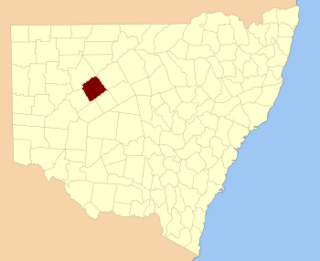
Donalroe Parish in Cobar Shire is a civil parish of Rankin County,; a Cadastral division of New South Wales.

Budda Parish in Cobar Shire is a civil parish of Rankin County,; a Cadastral division of New South Wales.

Tankarrok Parish in Cobar Shire is a civil parish of Rankin County,; a Cadastral division of New South Wales.

Buckinbe Parish in Cobar Shire is a civil parish of Rankin County,; a Cadastral division of New South Wales.

Wallandra Parish in Cobar Shire is a civil parish of Rankin County, a Cadastral division of New South Wales. The Parish is on the Darling River upstream of Wilcannia, New South Wales and is located at 30.5511°N 144.3351°E. The only town of the parish is Tilpa, New South Wales.

Dunlop Parish is a civil parish, of Yanda County, a cadasteral division of New South Wales; a Cadastral division of New South Wales.
Marra Parish is a Civil Parish of Killara County, New South Wales.

Bonny Parish, New South Wales is a civil parish of Killara County, in Central Darling Shire.

Towri Parish is a civil parish of Killara County, located in Central Darling Shire at Latitude 31°03′38″S and 144°05′36″E.

Tallandra is a civil parish of Killara County, located in Central Darling Shire at Latitude -31°24′11″S and Longitude 143°40′25″E.

Geigle Parish is a civil parish of Killara County, New South Wales and is located in Central Darling Shire at Latitude -31°23′18″S 143°52′21″E and Longitude 143°52′21″E.

Dolora Parish is a civil parish of Killara County, located in Central Darling Shire of NSW at Latitude 31°20′07″S and 143°59′32″E.

Jamison Parish is a civil parish of Killara County, located in Central Darling Shire at 31°15′20″S 143°57′33″E.

Walker Parish is a civil parish of Killara County, located in Central Darling Shire at Latitude 31°03′38″S and 144°05′36″E.
Myali Parish is a civil parish of Killara County, located in Central Darling Shire at Latitude 31°03′38″S and 144°05′36″E.

Hay Parish is a civil parish of Killara County, located in Central Darling Shire at Latitude 31°06′35″S and Longitude144°08′50″E.

Graham Parish in the County of Killara is a civil parish of New South Wales located in Central Darling Shire at Latitude 31°01′12″S and Longitude 143°40′20″E.

Muntawa Parish in the County of Killara is a civil parish of New South Wales located in Central Darling Shire at Latitude 31°01′12″S and Longitude 143°40′20″E.
Pulacarra is a rural locality and civil parish of Killara County located at Latitude -30.730499267 and Longitude 144.070999145

Moollawoolka is a rural locality and a civil parish of Killara County, in New South Wales


