External links
![]() Media related to Kiln Green, Berkshire at Wikimedia Commons
Media related to Kiln Green, Berkshire at Wikimedia Commons
Coordinates: 51°29′55″N0°49′49″W / 51.49870°N 0.83019°W
| | This Berkshire location article is a stub. You can help Wikipedia by expanding it. |
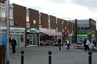
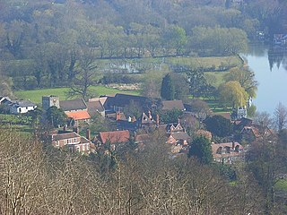
Kiln Green is a small village in the civil parish of Wargrave in the English county of Berkshire. It is at grid reference SU813784 on the A4 Bath Road between Knowl Hill to the east and Hare Hatch to the west. The village includes Linden Hill to the north and Scarletts to the south. It is the location of Castle Royle Golf Country Club , which includes a gym, a swimming pool and a golf course.
![]() Media related to Kiln Green, Berkshire at Wikimedia Commons
Media related to Kiln Green, Berkshire at Wikimedia Commons
Coordinates: 51°29′55″N0°49′49″W / 51.49870°N 0.83019°W
| | This Berkshire location article is a stub. You can help Wikipedia by expanding it. |

Oxfordshire is a landlocked county in the far west of the government statistical region of South East England. The ceremonial county borders Warwickshire to the north-west, Northamptonshire to the north-east, Buckinghamshire to the east, Berkshire to the south, Wiltshire to the south-west and Gloucestershire to the west.

The Berkshires are a highland geologic region located in the western parts of Massachusetts and northwest Connecticut. The term "Berkshires" is normally used by locals in reference to the portion of the Vermont-based Green Mountains that extend south into western Massachusetts; the portion extending further south into northwestern Connecticut is grouped with the Connecticut portion of the Taconic Mountains and referred to as either the Northwest Hills or Litchfield Hills.

The Greenbelt is a 203.5-square-kilometre (78.6 sq mi) protected green belt traversing Ottawa, Ontario, Canada. It includes green space, forests, farms, and wetlands from Shirleys Bay in the west and to Green's Creek in the east. The National Capital Commission (NCC) owns and manages 149.5 square kilometres (57.7 sq mi), and the rest is held by other federal government departments and private interests. Real estate development within the Greenbelt is strictly controlled.
Tilehurst is a suburb of the town of Reading in the English county of Berkshire. It lies to the west of the centre of Reading, and extends from the River Thames in the north to the A4 road in the south. The suburb is partly within the boundaries of the Borough of Reading and partly in the district of West Berkshire. The part within West Berkshire forms part of the civil parish of Tilehurst, which also includes the northern part of Calcot and a small rural area west of the suburb. The part within the Borough of Reading includes the Reading electoral ward of Tilehurst, together with parts of Kentwood and Norcot wards.
Streatley is a village and civil parish on the River Thames in Berkshire, England. The village faces Goring-on-Thames. The two places share in their shops, services, leisure, sports and much of their transport; across the river is Goring & Streatley railway station and the village cluster adjoins a lock and weir. The west of the village is a mixture of agriculture and woodland plus a golf course. The village has a riverside hotel. Much of Streatley is at steeply varying elevations, ranging from 51m AOD to 185m at Streatley Warren, a hilltop point on its western border forming the eastern end of the Berkshire Downs. This Area of Outstanding Natural Beauty is topped by the 87-mile The Ridgeway path, which crosses the Thames at Goring and Streatley Bridge.

The North Wessex Downs Area of Outstanding Natural Beauty (AONB) is located in the English counties of Berkshire, Hampshire, Oxfordshire and Wiltshire. The name North Wessex Downs is not a traditional one, the area covered being better known by various overlapping local names, including the Berkshire Downs, the North Hampshire Downs, the White Horse Hills, the Lambourn Downs, the Marlborough Downs, the Vale of Pewsey and Savernake Forest.

The Test Way is a 44-mile (71 km) long-distance footpath in England from Walbury Hill in West Berkshire to Eling in Hampshire, which follows much of the course of the River Test.

Burnt Hill is a hamlet in Berkshire, England. It is just north of the M4 motorway in West Berkshire, in the civil parish of Yattendon, which is also the closest village, and lies in the North Wessex Downs area of outstanding natural beauty (AONB).

Checkendon is a village and civil parish about 6 miles (10 km) west of Henley-on-Thames in South Oxfordshire and about 9 miles (14 km) north west of Reading in Berkshire on a mid-height swathe of the Chilterns.

Avonlea is a village in the Canadian province of Saskatchewan within the RM of Elmsthorpe No. 100 and Census Division No. 2. The village is approximately 82 km (51 mi) south-west of the City of Regina. The Southern Rails Cooperative maintains its head office in the village.

Swinley Forest is a large expanse of Crown Estate woodland mainly within the civil parishes of Windlesham in Surrey and Winkfield and Crowthorne in Berkshire, England.

Batts Combe quarry, grid reference ST460550 is a limestone quarry on the edge of Cheddar village on the Mendip Hills, Somerset, England.

Eye and Dunsden is a largely rural civil parish in the most southern part of the English county of Oxfordshire. It includes the villages of Sonning Eye, Dunsden Green and Playhatch and borders on the River Thames with the village of Sonning in Berkshire connected via multi-span medieval Sonning Bridge. Before 1866, Eye & Dunsden was part of the trans-county parish of Sonning.

Crazies Hill is a hamlet in the English county of Berkshire. It adjoins the hamlet of Cockpole Green. For local government purposes, the village is within the civil parish of Wargrave, which in turn is within the unitary authority of Wokingham. Crazies Hill Church of England Primary School is located in the village. About 0.6 miles (1 km) on the road to Wargrave is Hennerton Golf Club. The Village Hall was originally built to serve also as a Mission church and still contains the paraphernalia of an altar etc. behind folding doors.
Pincent's Kiln is a 0.2-hectare (0.49-acre) geological Site of Special Scientific Interest north-east of Theale in Berkshire. It is a Geological Conservation Review site.
The Emmer Green (Hanover) Chalk Mine is an extensive abandoned subterranean chalk mine at Emmer Green, north of Reading in Berkshire, located just north of the junction of Peppard Road and Kiln Road. The mine is so named because the land is now owned by the Hanover Housing Association who have a development adjacent at Wordsworth Court. The mine is one of a number of known mines in the Emmer Green and Reading area where chalk mining was often done in conjunction with brick making as chalk and clay are found together in the area and chalk was use in the making of bricks. It is likely other abandoned mines remain undiscovered. The area was once known as Rose Hill and contained brickfield and chalk mining works.

Bacombe and Coombe Hills is a 76.4 hectare biological Site of Special Scientific Interest in Upper Bacombe in Buckinghamshire. Bacombe Hill was formerly owned by Buckinghamshire County Council, which transferred it to Berkshire, Buckinghamshire and Oxfordshire Wildlife Trust in 2014. Coombe Hill is owned by the National Trust.

Grangelands and Pulpit Hill is a 25.5 hectare biological Site of Special Scientific Interest in Cadsden in Buckinghamshire. It lies within the Chilterns Area of Outstanding Natural Beauty, and the planning authorities are Wycombe District Council and Buckinghamshire County Council.