
Bethnal Green is an area in the East End of London 1 mile (1.6 km) northeast of Liverpool Street station. It has two Overground stations and one Underground station. It currently also gives its name to an electoral ward of the London Borough of Tower Hamlets and co-encompasses St Peter's ward. Part of the area holds conservation area status, chiefly due to protected small, public greens and listed buildings. The area emerged from the hamlet which developed around the Green, much of which survives today as Bethnal Green Gardens, beside Cambridge Heath Road.

Palmers Green is a suburban area and electoral ward in Enfield, North London, England. It is located within the N13 postcode district, around 8 miles (13 km) north of Charing Cross. It is home to the largest population of Greek Cypriots outside Cyprus and is often nicknamed "Little Cyprus" or "Palmers Greek".

Penge is an area of South East London, England, within the London Borough of Bromley. It is located 3.5 miles west of Bromley, 3.7 miles north east of Croydon and 7.1 miles south east of Charing Cross, the traditional centre of London.

Wood Green is a suburban district in the borough of Haringey in London, England. Its postal district is N22, with parts in N8 or N15. The London Plan identifies it as one of the metropolitan centres in Greater London, and today it forms a major commercial district of North London.
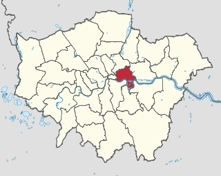
The London Borough of Tower Hamlets is a London borough located in East London; it covers much of the traditional East End. It was formed in 1965 from the merger of the former metropolitan boroughs of Stepney, Poplar and Bethnal Green. The new authority's unusual name was taken from an alternative title for the Tower Division; the area of south-east Middlesex, focused on the area of the modern borough, which owed military service to the Tower of London.

East Dulwich is an area of South East London, England in the London Borough of Southwark. It forms the eastern part of Dulwich, with Peckham to the east and Camberwell to the north. This South London suburb was first developed in the nineteenth century on land owned by the College of God's Gift.

Walton is a hamlet in the parish of Aylesbury, in Buckinghamshire, England. Although Aylesbury has grown to such an extent that it completely surrounds Walton by a couple of miles in each direction, the hamlet is still marked on modern maps.

Linslade is an English town located on the Bedfordshire side of the Bedfordshire-Buckinghamshire border. It borders the town of Leighton Buzzard, with which it forms the civil parish of Leighton-Linslade. Linslade was transferred from Buckinghamshire in 1965. Before then, it was a separate urban district. It remained a part of the Diocese of Oxford until 2008 when it joined Leighton Buzzard in the Diocese of St Albans.

West Ealing is a district in the London Borough of Ealing, in West London. The district is about three-quarters of a mile (1.2 km) west of Ealing Broadway. Although there is a long history of settlement in the area, West Ealing in its present form is less than one hundred years old. West Ealing falls under the postcode district W13 and neighbours Hanwell, Ealing, Perivale and Northfields

Spencers Wood is a village in the civil parish of Shinfield, Berkshire, England, 4 miles (6.4 km) south of Reading. The village of Three Mile Cross adjoins it to the north. To the west lies the village of Grazeley.
Often referred to as Mt. Airy neighborhood is situated immediately south of Furnace Woods and north of Croton, and is partially situated in both unincorporated Cortlandt and the village of Croton-on-Hudson.

Shinfield is a village and civil parish in the English county of Berkshire, just south of Reading. It contains 4,313 acres (17.45 km2) and is administered by the unitary authority of Wokingham District. Shinfield Park is the northern part of the parish, becoming physically separated when the M4 motorway was constructed in 1971.

Knotty Green was once a rural hamlet in the Buckinghamshire Chiltern Hills. It is characterised by large houses set in their own extensive grounds and though it remains within the civil parish of Penn today it has become contiguous with the market town of Beaconsfield. Houses in the area of Knotty Green are often some of the most expensive in the country with houses often exceeding 6,000 sq ft, and £3 million in value.
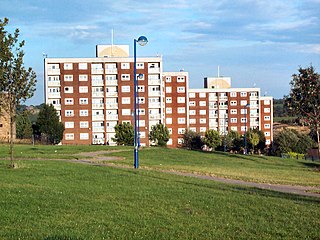
Holme Wood is a housing estate in Bradford, West Yorkshire, England.

West Green is an area of north London, England, in the United Kingdom and part of the London Borough of Haringey. It is located 5.7 miles (9.22 km) north of Charing Cross.

Sutton cum Duckmanton is a civil parish in Derbyshire, England, between Bolsover and Chesterfield in the district of North East Derbyshire.
Oakbank School is a coeducational secondary school located in the hamlet of Ryeish Green in Berkshire, England.

Yardley Wood is an area of Birmingham, United Kingdom, covering the easternmost quadrant of postcode area B14, and is located across the wards of Billesley and Highter's Heath in the south of the city. Historically it lay within Worcestershire.

Broomhouse is a residential area in Glasgow, Scotland. It is about 6 miles (10 km) east of the city centre. Historically a small mining village and later the site of the Glasgow Zoo, in the early 21st century it grew substantially as an affluent commuter suburb.
