Rand McNally is an American technology and publishing company that provides mapping, software and hardware for consumer electronics, commercial transportation and education markets. The company is headquartered in Chicago, with a distribution center in Richmond, Kentucky.

New York State Route 12D (NY 12D) is a north–south state highway located in the northern part of New York in the United States. The southern terminus of the route is in the Oneida County village of Boonville, where it intersects NY 12. The northern terminus is at a junction with NY 12 in the Lewis County village of Lyons Falls. NY 46 and NY 294 are also present in the immediate area of the route's southern terminus.

Summersville is a census-designated place (CDP) and unincorporated community in Green County, Kentucky, United States. As of the 2010 census it had a population of 568.
Peytonsburg is an unincorporated community in Cumberland County, Kentucky, United States.
Stacy Fork is an unincorporated community in Morgan County, Kentucky, United States. It lies along Route 191 south of the city of West Liberty, the county seat of Morgan County. Its elevation is 823 feet (251 m).
Flatwoods is an unincorporated community in Perry County, Tennessee, United States. Originally known as Whitaker's Bluff, the name was changed to Flatwoods in 1871. It lies along State Route 13 south of the town of Linden, the county seat of Perry County. Its elevation is 676 feet (206 m).
Lovelady is an unincorporated community in Pickett County, Tennessee, United States. It lies near State Route 111 west of the town of Byrdstown, the county seat of Pickett County. Its elevation is 1,027 feet (313 m).
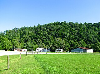
Summer City is an unincorporated community that sits on the border of Bledsoe County, and Rhea County, Tennessee, United States. It lies between the cities of Pikeville and Dayton, at the intersection of Tennessee State Route 30 and Tennessee State Route 443.
New Harmony is an unincorporated community in Bledsoe County, Tennessee. It lies in eastern Bledsoe County, south of Summer City and southeast of the city of Pikeville, the county seat of Bledsoe County. New Harmony is located along Tennessee State Route 443.

Gallant, also known as Clear Springs or Greasy Cove, is a census-designated place and unincorporated community in Etowah, and St. Clair counties, Alabama, United States. It lies west of the city of Gadsden, the county seat of Etowah County. As of the 2010 census, its population was 855. It has a post office with the ZIP code 35972.

Gordonsburg is an unincorporated community in northeastern Lewis County, Tennessee. It lies at the intersection of U.S. Route 412 with the Natchez Trace Parkway, east of the city of Hohenwald, the county seat of Lewis County. Its elevation is 610 feet (186 m).
Lone Oak is an unincorporated community and census-designated place (CDP) in southern Sequatchie County, Tennessee, United States. It lies along U.S. Route 127 south of the city of Dunlap, the county seat of Sequatchie County. Its elevation is 2,001 feet (610 m). As of the 2020 census, its population was 1,198, down from 1,206 at the 2010 census.
North Springs is an unincorporated community in northwestern Jackson County, Tennessee, United States. It lies along Tennessee State Routes 56 and 151, northwest of the town of Gainesboro, the county seat of Jackson County. Its elevation is 604 feet (184 m).

U.S. Route 70 enters the state of Tennessee from Arkansas via the Memphis & Arkansas Bridge in Memphis, and runs west to east across 21 counties in all three Grand Divisions of Tennessee, with a total length of 478.48 miles (770.04 km), to end at the North Carolina state line in eastern Cocke County. Along the route, US 70 is accompanied with various U.S. and state highways, including those in three of the state's four major cities.

U.S. Route 62 (US 62) in Kentucky runs for a total of 391.207 miles (629.587 km) across 20 counties in western, north-central, and northeastern Kentucky. It enters the state by crossing the Ohio River near Wickliffe, then begins heading eastward at Bardwell, and traversing several cities and towns across the state up to Maysville, where it crosses the Ohio River a second time to enter the state of Ohio.

U.S. Route 79 in Tennessee enters the state from Arkansas via the Memphis & Arkansas Bridge in Memphis, and runs northeast through western and the northwestern portions of middle Tennessee, and leaving the state into Kentucky northeast of Clarksville. Along the route, US 79 is accompanied with several concurrencies, including hidden designations, throughout its alignment in Tennessee.
Time in Tennessee, as in all U.S. states, is regulated by the United States Department of Transportation.

State Route 89 is a north-south state highway in the farmland of West Tennessee. The route is 51.24 miles (82.46 km) long.

State Route 140 is a west-east state highway located entirely in Henry County in northwest Tennessee.
Mabee Corner is an unincorporated community in Hamilton Township, Jackson County, Ohio, United States. It is located west of Oak Hill at the intersection of Bucklick Creek Road and Ohio State Route 139, at 38°54′10″N82°43′16″W.