King's Manor, Southwark

Last updated

The King's Manor - formally 'The City of London's King's Manor of the Town and Borough of Southwark' - is an institution of the City of London which is not a Livery Company as it is territorially rather than trade based, being the organisation of the Juror freemen of the Court Leet. The Manor covers the area from the western-side of Borough High Street, Southwark, to the borders of Newington and Lambeth. The manor originally lay in Surrey. [1] [2]

Contents

The City of London acquired the 'borough of Southwark' from the Crown in 1327, nicknamed the 'Guildable Manor' since 1377. In 1550 the City purchased from Edward VI's government the manors to the south of this on the west and the east of the high street. [3] The City's royal charter of 1550 makes difficult reading because the three manors being described are referred to as 'The Town and Borough of Southwark' (Guildable), 'Our Lordship and Manor of Southwark' (King's) and 'Our Manor and Borough of Southwark' (Great Liberty), all three together are termed 'The Borough and Town of Southwark and all of its parishes and precincts aforesaid' (all text in Latin). [4] [5] Today the City officers refer to the three manors as the 'Town and Borough of Southwark', as stated on the Courts Leet summons, on which none of the nicknames appear. [6]

Earliest beginnings: The 'Abbot of Bermondsey's manor of Southwark'

At the time of Domesday Book in 1086 the Southwark and Bermondsey areas were owned by the king and by the Archbishop of Canterbury, the latter's holding was the manor along the eastern side of the high street. The king owned the northern bridge-head or borough area and the land on the western side of the highway, over to Lambeth and also the areas of Bermondsey and Rotherhithe to the east of the Canterbury manor. [7]

Before Henry VIII acquired the manor in 1536 it belonged to Bermondsey Abbey. [8] A fascinating early plan-map, discovered in the Duchy of Lancaster archive, shows Southwark at some point between the Dissolution and the 1550 charter. Perhaps it was prepared with reference to the jurisdictional disputes with the king's agents, the City and its manor of the Guildable, as the boundary points are shown on it. A date of 1543 has been assigned to this. On this plan the City's manor at the northern end of the high street is called the lyberte off the mayre. The later nicknames King's manor, and occasionally the Queen's manor, for the western Bermondsey Abbey manor, are used only after the crown had sold it to the City; the nickname probably derives from the prominent royal mansion/ mint there; Henry VIII only held it from 1536. This western manor area is delineated, ambiguously, as the liberte off the manor. In fact the plan refers to the eastern manor acquired from Canterbury, the so called 'Great Liberty', as the kynges lyberte. In John Silvester's (Recorder~High Steward in 1807) notes and procedures of the Southwark manors he also uses the abbreviations of the borough for the Guildable, the manor for the King's and the liberty for the Great Liberty. [9]

The first post Domesday fracture of this extensive royal estate is a result of the creation by one Aylwin 'Cild' of a priory at Bermondsey in 1082, but he also assigned rents from properties in the City to a Cluniac house in France, presumably for the purpose of supporting this church. Members of the Order arrived in Bermondsey in 1089 to formalise the relation. The priory was dedicated to 'St Saviour'. We know little of this benefactor save that he was a London merchant but seems to have been (by name and title) an Englishman rather than a Norman. [10]

It has been suggested that the mercantile dynasty of the early mediaeval period called 'Ailwyn' were his descendants and that Henry Fitz-Ailwyn, the first known Mayor of London (ca 1189) was one of these; we know that his daughter in law was interred in the Priory church. [11]

The Priory's, (from 1399 an Abbey) main site can be identified today by Abbey Street and Bermondsey Square. In Domesday 'Bermondsey' is described as 'held' by King William I but before him by 'Earl' Harold i.e. Harold Godwinson. According to the Annals of the Abbey, King William Rufus gave the manor of Bermondsey (along with Rotherhithe) to the Priory in 1092. [12]

The priory became exceptionally well endowed and eventually as an abbey had lands all over the country. However, one of its earliest forays was into local real estate but it was constrained by the neighbouring manors, including Walworth to the south, held by Canterbury. Nevertheless, it approached Henry I in 1103/04 to acquire what was held directly by the crown there. This was all of the territory on the western side of the high street, designated by this writer the 'Royal Manor' for convenience; it was described as 'the hide of Southwark', i.e. of one hide, as a part of the king's demesne. [13]

This transaction did not include the far north-western part of the area. This, presumably, had already been granted by the crown to another party. It was later described as 'Wideflete' or 'the Wyldes', this was very poor quality low-lying flood-plain as its original name indicates. The priory had this granted to them, shortly afterwards, by Robert Marmion in 1113. He was the hereditary King's Champion[ citation needed ] and certainly a direct tenant of the Norman kings. It was described as of "one hide, seventy acres and a mill". It was later to be called 'Paris Garden' and is best identified today as the northern part of Blackfriars Road.

Therefore, by 1113, Bermondsey Priory had control of most of the Southwark area, all of that which had previously constituted the 'Royal Manor', except the borough. There is an anomaly to this territory: The Canterbury holding on the eastern side of the high street has a small part detached from it. This, at least in part, derives from what was the small de Ardern family property which occupied the corner of the junction of the high street, Long Lane and 'old' Kent street (Tabard Street), presumably this had been acquired from Canterbury after 1086. It may have been a hamlet that had congealed at what is the junction of the Roman roads now known as Stane Street and Watling Street. This too was given to Bermondsey priory in 1122, by the Ardern's along with St George's church which is in that precinct. It clearly is in the 'wrong' manor as the high street is the natural border. However, at the period under scrutiny it was just a small part of the extensive combined area held by the Priory occupying the western side of the high street, which as shown above was already owned by it. This area is coincident with St George's ancient parish. Obviously, this largely open area was assigned to that church as an administrative convenience. The Rectors were appointed by the Priory/Abbey until the transfer to Henry VIII in 1536. The main open ground, sparsely populated, of the manor was assigned to this church as its outlying parish and hence it acquired the alternative epithet of 'St George's Fields'.

To use the post-Reformation titles of these areas we can see that by 1122 Bermondsey Abbey owned all of the so-called 'King's', 'Clink' and 'Paris Garden' manors, as well as Bermondsey and Rotherhithe. Canterbury owned Walworth as well as the 'Great Liberty'. The crown controlled only the western side of the 'borough' or 'Guildable' manor, the eastern part being controlled by the de Warrennes successors to the Godwins' sub manor.

From this large combined area Bermondsey Priory divided a part which was let-out to one Ordgar the Rich; just when is not clear. However, it was from Ordgar (with the consent of Bermondsey Priory) that the Bishop of Winchester acquired it, no earlier than 1144/49, this was for the creation of a palace near London to enable the Bishop to carry out his political duties. The part acquired by Winchester was the nucleus of the manor later known as 'The Clink'. The parts remaining to Bermondsey Priory were 'Wideflete' and the remnant of the 'Royal Manor' (i.e. less the 'Clink') along with the Ardern property. The 'Wideflete'/ Paris Garden was demised to the Templars (on the opposite side of the river to their 'New Temple') in 1166.

The manorial area that was left was informally referred to as le weste socne (i.e. the 'soke' west of the 'high' street) in the thirteenth century and as the 'Abbot's manor' later. From some point in the fifteenth century the Brandon family became the King's Marshals; as such they controlled the two ancient royal prisons on the eastern side of the high street, the King's Bench and the Marshalsea. As they became more prominent at court they grew wealthier and acquired parts of the western side of the high street from the Abbey to create a large mansion and grounds including, notably, Moulton Close which is now the park around the Imperial War Museum. The house became known as Brandon Place. Charles Brandon, the last of the male line, became Marshal in 1510 and was created Duke of Suffolk in 1514; he married Henry VIII's sister in 1516. The mansion then becomes known as Suffolk Place.

Henry took an interest in Suffolk Place and acquired it from Charles in 1536. Shortly after, in June 1536, the St Saviour's Abbey of Bermondsey was induced to 'grant' its land to the king, part of the Dissolution process, hence he now owned all of the Abbey's manor west of the high street. However, Henry gave this building to Queen Jane Seymour in 1537, mother of Edward VI, who died of post-natal complications shortly after his birth. In 1538 Henry acquired from Thomas Cranmer the Archbishop of Canterbury's manor on the eastern side of the high street; it seems it was his intention to create a new hunting park out of the two areas and the Brandon mansion was to act as its lodge.

The mansion is shown on the 'Lancaster Plan' of 1543 and there called De manor place. In any case Henry seems to have lost interest in the project before his death in 1547. From 1545 until 1551 it was the Mint, supplementing the main mint at the Tower of London. This part of the borough is still called 'the Mint'. These manors belonged to the king for only fourteen and twelve years respectively, as in 1550 the City acquired both of the properties. The building then reverted to being a royal mansion; in 1554 Queen Mary I stayed overnight with her new husband King Philip II of Spain as part of their progress to London. In 1556 she granted it to the Archbishop of York for his London house, but it was soon leased out in parts for income. Unfortunately, although the park behind it and various buildings at its lodge or gatehouse were transferred to the City the mansion and garden were retained by the king; this curtilage might be what is delineated by the semi-circular line around the building in the 'Lancaster Plan'. These had been specifically excluded from the City's jurisdiction by clauses in the charter. This allowed it to become a haunt and refuge for undesirable persons and activities (see Alsatia). So notorious a place did it become that it was included in the Escape of Debtors, etc. Act 1696 (8 & 9 Will. 3. c. 27) to allow the sheriff a power of 'posse comitatus' (a writ to raise an armed group) and enter into it to evict its inhabitants. However, it reverted to its bad ways and another, specific act, The Mint in Southwark Act 1722 (9 Geo. 1. c. 28) was required to clear it out for good. The City's jurisdiction was now complete.

Annual Court Day

"The Court Leet and View of Frankpledge with the Court Baron of the Lord Mayor and Commonalty of the City of London" is now summoned for each of the three City manors once a year, usually on the second Wednesday in November, i.e. following the Presentation of the Lord Mayor (see Lord Mayor's Show).

Related Research Articles

<span class="mw-page-title-main">Southwark</span> District of Central London, England

Southwark is a district of Central London situated on the south bank of the River Thames, forming the north-western part of the wider modern London Borough of Southwark. The district, which is the oldest part of South London, developed due to its position at the southern end of the early versions of London Bridge, for centuries the only dry crossing on the river. Around 43 AD, engineers of the Roman Empire found the geographic features of the south bank suitable for the placement and construction of the first bridge.

<span class="mw-page-title-main">Bermondsey</span> District in the London Borough of Southwark

Bermondsey is a district in southeast London, part of the London Borough of Southwark, England, 2.5 miles (4.0 km) southeast of Charing Cross. To the west of Bermondsey lies Southwark, to the east Rotherhithe and Deptford, to the south Walworth and Peckham, and to the north is Wapping across the River Thames. It lies within the historic county boundaries of Surrey. During the Industrial Revolution Bermondsey became a centre for manufacturing, particularly in relation to tanning. More recently it has experienced regeneration including warehouse conversions to flats and the provision of new transport links.

<span class="mw-page-title-main">Rotherhithe</span> Residential district in south-east London, England

Rotherhithe is a district of south-east London, England, and part of the London Borough of Southwark. It is on a peninsula on the south bank of the Thames, facing Wapping, Shadwell and Limehouse on the north bank, with the Isle of Dogs to the east. It borders Bermondsey to the west and Deptford to the south-east. The district is a part of the Docklands area.

<span class="mw-page-title-main">Winchester Palace</span> Twelfth-century palace in London

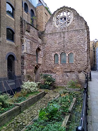
Winchester Palace was a 12th-century bishop's palace that served as the London townhouse of the Bishops of Winchester. It was located in the parish of Southwark in Surrey, on the south bank of the River Thames on what is now Clink Street in the London Borough of Southwark, near St Saviour's Church. Grade II listed remains of the demolished palace survive on the site today, designated a Scheduled Ancient Monument, under the care of English Heritage.

<span class="mw-page-title-main">St George's Fields</span>

<span class="mw-page-title-main">Liberty of the Mint</span>

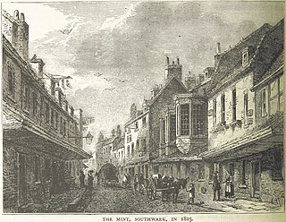
The Mint was a district in Southwark, south London, England, on the west side of Borough High Street, around where Marshalsea Road is now located. It was so named because a mint authorised by King Henry VIII was set up in Suffolk Place, a mansion house, in about 1543. The mint ceased to operate in the reign of Mary I and Suffolk Place was demolished in 1557. In the late-17th and early-18th centuries, the area was known for offering protection against prosecution for debtors due to its legal status as a "liberty", or a jurisdictional interzone.

<span class="mw-page-title-main">Tooley Street</span>

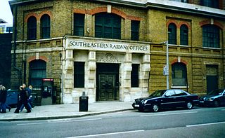
Tooley Street is a road in central and south London connecting London Bridge to St Saviour's Dock; it runs past Tower Bridge on the Southwark/Bermondsey side of the River Thames, and forms part of the A200 road.

<span class="mw-page-title-main">Bermondsey Abbey</span> English Benedictine monastery

Bermondsey Abbey was an English Benedictine monastery. Most widely known as being founded in the 11th century, it had a precursor mentioned in the early eighth century, and was centred on what is now Bermondsey Square, the site of Bermondsey Market, Bermondsey, in the London Borough of Southwark, southeast London, England.

<span class="mw-page-title-main">Great Chart</span> Human settlement in England

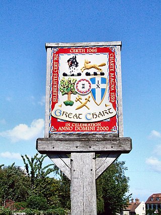
Great Chart is a village and former civil parish, now in the parish of Great Chart with Singleton, in the Ashford borough of Kent, England. The parish is split between the ancient village of Great Chart and the modern Singleton neighbourhood on the western outskirts of Ashford. The village centre of Great Chart is 2 miles (3.2 km) from the town centre. In 1961 the parish had a population of 969.

<span class="mw-page-title-main">Liberty of the Clink</span> Former area of Southwark, England

The Liberty of the Clink was an area in Southwark, on the south bank of the River Thames, opposite the City of London. Although situated in Surrey the liberty was exempt from the jurisdiction of the county's sheriff and was under the jurisdiction of the Bishop of Winchester who was usually either the Chancellor or Treasurer of the King.

<span class="mw-page-title-main">West Dulwich</span> Human settlement in England

West Dulwich is a neighbourhood in South London on the southern boundary of Brockwell Park, which straddles the London Borough of Lambeth and the London Borough of Southwark. Croxted Road and South Croxted Road mark the boundary between Southwark to the east and Lambeth to the west. The suburb of West Dulwich dates back to the 17th century when the often flooded land known as Dulwich Common was acquired and drained by Edward Alleyn's estate.

The Borough Compter was a small compter or prison initially located in Southwark High Street but moved to nearby Tooley Street in 1717, where it stood until demolished until 1855. It took its name from 'The Borough', a historic name for the Southwark area of London on the south side of the River Thames from the City of London. This replaced a lock-up as part of the city's court house under the jurisdiction of the Lord Mayor and Court of Aldermen of the city, and their High-Bailiff of Southwark. This first court house was converted from the old church of the parish St Margaret. A floor was made across the level of the church's gallery and the windows below that were blocked in, the Court Room being on the first floor. This structure was destroyed in the Great Fire of Southwark in 1676.

<span class="mw-page-title-main">Suffolk Place</span>

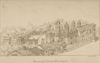
Suffolk Place was a mansion house located on the west side of Borough High Street in Southwark, Surrey, on the south bank of the River Thames opposite the City of London. It was the London town house of the Dukes of Suffolk, and was located near Winchester Palace, London seat of the Bishop of Winchester. The position was highly prominent as Borough High Street was the principal thoroughfare leading from London Bridge and the City of London, to Canterbury and Dover, a route used by monarchs and others, including the pilgrims in Chaucer's Canterbury Tales. It was built in the fifteenth century and rebuilt in fine Renaissance style in 1522 by Charles Brandon, 1st Duke of Suffolk (c.1484-1545) a favourite of King Henry VIII. On 4 February 1536 it was taken over by King Henry VIII who exchanged it with Brandon for Norwich Place on the Strand, on the north side of the Thames, nearer to the Palace of Westminster.

<span class="mw-page-title-main">St Olave's Church, Southwark</span>

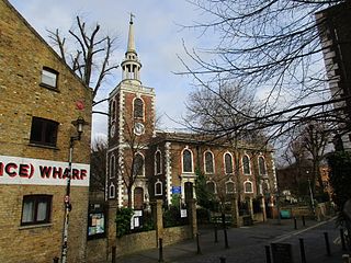
St Olave's Church, Southwark was a church in Southwark, England which is believed to be mentioned in the Domesday Book of 1086. It was located on Tooley Street which is named after the church, i.e. 't'olous'. It became redundant in 1926 and was demolished. It is now the location of St Olaf House, which houses part of the London Bridge Hospital.

<span class="mw-page-title-main">Long Lane (Southwark)</span> Main road in Southwark, Greater London, United Kingdom

Long Lane is a main east–west road in Southwark, south London, England.

<span class="mw-page-title-main">Bermondsey Square</span> Public square in Bermondsey, London

Bermondsey Square is on Tower Bridge Road in Bermondsey, south London, England. It was the site of the 11th-century Bermondsey Abbey. The earliest medieval remains found are a Norman church from around 1080, which was recorded in the Domesday Book of 1086. The Abbey grounds were the original site of Bermondsey Market, which still takes place weekly in the Square. The area has subsequently undergone redevelopment and Bermondsey Square now contains apartments, offices, a boutique hotel, restaurants, an independent cinema, and a contemporary art gallery.

Bridge Without was a historical ward of the City of London situated to the south of the River Thames, which existed between 1550 and 1899. The area of the Bridge Without ward today forms part of the London Borough of Southwark. It was so-called to distinguish it from the ward of Bridge Within which covered the buildings on London Bridge and the nearby north bank of the Thames. Bridge Within since 1978 is formally called Bridge and Bridge Without.

Guildable Manor is a Court Leet in Southwark under the authority of the City of London, along with the King's Manor, Southwark, and the Great Liberty. The name of 'Guildable' first recorded in 1377 refers to the collection of taxes there and was adopted to distinguish this from the other manors of the Southwark area. Its legal title, according to a Royal charter granted to the City by King Edward III in 1327, is 'the ville of Southwark' i.e. 'ville = 'town'; in the more substantive charter of Edward VI it is designated 'The Town and Borough of Southwark' as is stated on its Seal. It is a preserved limited jurisdiction under the Administration of Justice Act 1977. Although neither a guild nor a livery company, the Guildable Manor does have a permanent organization, consisting of Officers and Jurors.

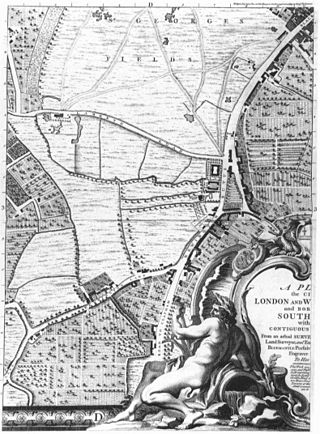
This is a list of the etymology of street names in the London district of Southwark. The area has no formally defined boundaries – those utilised here are: the river Thames to the north, Tower Bridge Road to the east, Bricklayers Arms/New Kent Road/Elephant and Castle to the south, and London Road/St George's Circus/Blackfriars Road to the west.

St Margaret was a parish in the ancient borough of Southwark, located south of the River Thames in the Brixton Hundred of Surrey. It was abolished in 1541 during the Dissolution of the Monasteries and replaced with the parish of St Saviour. The parish church was located on what is now Borough High Street and the area now forms part of the London Borough of Southwark. It was from 1444 governed by the Guild of the Assumption of St Margaret's Church.

References

  1. Southwark and the City pp10-25, David Johnson OUP 1968
  2. Medieval Southwark pp 18-22 Martha Carlin, Hambledon Press 1999
  3. Map of the City of London Manors and other Manor boundaries in Southwark , The Guidable Manor
  4. Reproduced and translated as Appendix in Johnson ibid
  5. Text reproduced with Referenced Commentary in Guildable Manor Annual Court Leet Report: 2005 by Tony Sharp
  6. Summons to Southwark Courts Leet issued from Central Criminal Court at Old Bailey
  7. sa 'Southwark' in Domesday
  8. Carlin ibid
  9. 'Plan of Southwark ca 1543; Duchy of Lancaster
  10. Annales Bermundsei
  11. Survey of London "Bermondsey" John Stow 1590
  12. Domesday ibid
  13. Annales Bermundsei