The Ohio River is a 981-mile (1,579 km) long river in the midwestern United States that flows southwesterly from western Pennsylvania south of Lake Erie to its mouth on the Mississippi River at the southern tip of Illinois. It is the second largest river by discharge volume in the United States and the largest tributary by volume of the north-south flowing Mississippi River that divides the eastern from western United States. The river flows through or along the border of six states, and its drainage basin includes parts of 15 states. Through its largest tributary, the Tennessee River, the basin includes several states of the southeastern U.S. It is the source of drinking water for three million people.

Louisville is the largest city in the Commonwealth of Kentucky and the 29th most-populous city in the United States. It is one of two cities in Kentucky designated as first-class, the other being Lexington, the state's second-largest city. Louisville is the historical seat and, since 2003, the nominal seat of Jefferson County, located in the northern region of the state, on the border with Indiana.

McLean County is a county located in the U.S. state of Kentucky. As of the 2010 census, the population was 9,531. Its county seat is Calhoun. McLean is a prohibition or dry county.

Lewis County is a county located in the U.S. state of Kentucky. As of the 2010 census, the population was 13,870. Its county seat is Vanceburg.

Kenton County is a county located in the Commonwealth of Kentucky. As of the 2010 census, the population was 159,720, making it the third most populous county in Kentucky. Its county seats are Covington and Independence. It was, until November 24, 2010, the only county in Kentucky to have two legally recognized county seats. The county was formed in 1840 and is named for Simon Kenton, a frontiersman notable in the early history of the state.

Campbell County is a county located in the U.S. state of Kentucky. As of the 2010 census, the population was 90,336. Its county seats are Alexandria and Newport. The county was formed on December 17, 1794, from sections of Scott, Harrison, and Mason Counties and was named for Colonel John Campbell (1735–1799), a Revolutionary War soldier and Kentucky legislator.

Bracken County is a county located in the U.S. state of Kentucky. As of the 2010 census, the population was 8,488. Its county seat is Brooksville. The county was formed in 1796.

Owensboro is a home rule-class city in and the county seat of Daviess County, Kentucky, United States. It is the fourth-largest city in the state by population. Owensboro is located on U.S. Route 60 about 107 miles (172 km) southwest of Louisville, and is the principal city of the Owensboro metropolitan area. The 2015 population was 59,042. The metropolitan population was estimated at 116,506.

Silver Grove is a home rule-class city along the Ohio River in Campbell County, Kentucky, in the United States. The population was 1,102 during the 2010 U.S. Census.

Carrollton is a home rule-class city in—and the county seat of—Carroll County, Kentucky, United States, at the confluence of the Ohio and Kentucky rivers. The population was 3,938 at the 2010 census.

Hartford is a home rule-class city in Ohio County, Kentucky, in the United States. It is the seat of its county. The population was 2,571 at the 2000 census.

Hebron is an unincorporated community and census-designated place (CDP) in Boone County, Kentucky, United States. The city is named after the Biblical city of Hebron. As of the 2010 census, it had a population of 5,929. It is the home to the Cincinnati/Northern Kentucky International Airport, which serves Cincinnati and the Tri-State (Ohio-Kentucky-Indiana) area.

The Ohio River Islands National Wildlife Refuge (ORINWR) is a National Wildlife Refuge (NWR) in non-contiguous sites consisting of islands along 392 miles (631 km) of the Ohio River, primarily in the U.S. state of West Virginia. There are also a two of islands upstream in Beaver County, Pennsylvania and a two downstream in Lewis County, Kentucky. Going downstream, the refuge is currently located in parts of these counties: Beaver, Brooke, Ohio, Marshall, Wetzel, Tyler, Pleasants, Wood, Jackson, Mason, and Lewis. All counties are in West Virginia, with the exceptions of Beaver, which is in Pennsylvania, and Lewis, which is in Kentucky. The ORINWR was established in 1990 and consists of 3,354 acres (13.57 km2) of land and underwater habitat on 22 islands and four mainland properties. The refuge headquarters and visitors center is located in Williamstown, West Virginia. Prior to its establishment, West Virginia was the only state of the United States without a NWR.
U.S. Route 27 (US 27) in Kentucky runs 190.785 miles (307.039 km) from the Tennessee border to the Ohio border at Cincinnati. It crosses into the state in the Lake Cumberland area, passing near or through many small towns, including Somerset, Stanford, and Nicholasville. The road then passes straight through the heart of Lexington, including past the University of Kentucky (UK) and Transylvania University. North of Lexington it passes through Cynthiana and Falmouth before entering Campbell County and passing through many Northern Kentucky suburbs before ending at the Ohio state line on the Taylor Southgate Bridge in Cincinnati.

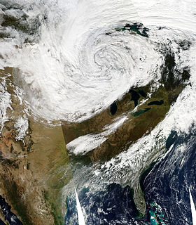
The October 2010 North American storm complex is the name given to a historic extratropical cyclone that impacted North America. The massive storm complex caused a wide range of weather events including a major serial derecho stretching from the Gulf Coast to the Great Lakes, a widespread tornado outbreak across the Southeast United States and Midwest and a blizzard across portions of the Canadian Prairies and the Dakotas. The cyclone's lowest minimum pressure of 955.2 mb (28.21 inHg) made it the second most intense non-tropical system recorded in the continental United States (CONUS). The lowest confirmed pressure for a non-tropical system in the continental United States was set by a January 1913 Atlantic coast storm.

Dundee is an unincorporated community in Ohio County, Kentucky, United States. Dundee is located on Kentucky Route 69, 10.5 miles (16.9 km) northeast of Hartford.

Smallhous is an unincorporated community in Ohio County, Kentucky, United States. Smallhous is located on the Green River 6 miles (9.7 km) west-southwest of Centertown.

The Cincinnati metropolitan area, informally known as Greater Cincinnati or the Greater Cincinnati Tri-State Area, is a metropolitan area that includes counties in the U.S. states of Ohio, Kentucky, and Indiana around the Ohio city of Cincinnati. The United States Census Bureau's formal name for the area is the Cincinnati–Middletown, OH–KY–IN Metropolitan Statistical Area. As of the 2010 U.S. Census, this MSA had a population of 2,114,580, making Greater Cincinnati the 29th most populous metropolitan area in the United States, the first largest metro area entirely in Ohio, followed by Cleveland (2nd) and Columbus (3rd).

Reynolds Station is an unincorporated community in Ohio County, Kentucky, United States. The community is located on Kentucky Route 54 5 miles (8.0 km) west-northwest of Fordsville. Reynolds Station has a post office with ZIP code 42368, which opened on April 22, 1890.


