Theodor Kjerulf was a Norwegian geologist and professor at the University of Oslo. He also served as director of the Norwegian Geological Survey.
Kjerulf Glacier, Norwegian: Kjerulfbreen, is a glacier 7 nautical miles (13 km) long flowing west from Mount Sugartop to the east side of Newark Bay, on the south coast of South Georgia. It was mapped by Olaf Holtedahl during his visit to South Georgia in 1927–28, and named by him for Norwegian geologist Theodor Kjerulf, Professor of Mineralogy at the University of Christiania.

Oscar II Land is the land area between Isfjorden and Kongsfjorden on Spitsbergen, Svalbard. The 30 km (19 mi) long glacier Sveabreen divides Oscar II Land from James I Land.
Barentsjøkulen is a glacier on Barentsøya, Svalbard. The glacier covers an area of about 571 km2 (220 sq mi). It is named after the Barents Island, which again is named after Dutch explorer Willem Barentsz. Barents Island is on the Barents Sea.
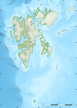
Kjerulføya is an island north of Nordaustlandet in Svalbard, Norway. It is named for Theodor Kjerulf. The island is located within Nordaust-Svalbard Nature Reserve.
St. Jonsfjorden is a fjord in Oscar II Land at Spitsbergen, Svalbard. It has a length of 21 kilometer, and opens westwards into the strait of Forlandsundet. Several glaciers debouche into the fjord, including Gaffelbreen and Konowbreen from the north, a merge of Osbornebreen, Devikbreen, Vintervegen, Paulbreen and Bukkebreen at the bottom, and Vegardbreen, Charlesbreen and Bullbreen from the south.
Vintervegen is a glacier in Oscar II Land at Spitsbergen, Svalbard. It has a length of about 7.5 kilometers (4.7 mi). The glacier borders to the mountain of Klampen, merges with Osbornebreen and other glaciers, and the merged glacier stream debouches into the head of St. Jonsfjorden.

Storøya is an island in the Svalbard archipelago. It is located east of Nordaustlandet, separated from Nordaustlandet by the strait of Storøysundet. The southern part of the island is covered by the glacier Storøyjøkulen.
Vegafonna is an ice cap in Gustav Adolf Land on Nordaustlandet in the Svalbard archipelago. It is located on the peninsula Scaniahalvøya, between the bay Palanderbukta to the north and Torellneset to the south. The glacier is named after the vessel SS Vega. Further west on the peninsula is the ice cap Glitnefonna.
Geologryggen is a mountain ridge in Oscar II Land at Spitsbergen, Svalbard. The ridge has a length of about four kilometers, and is located between Kjerulfbreen and Esmarkbreen. Geologryggen is included in the Nordre Isfjorden National Park.

Olsokbreen is a glacier in Sørkapp Land at Spitsbergen, Svalbard, in northern Norway. It has a length of about seventeen kilometers, and debouches into the bay Stormbukta at the western shore of Spitsbergen. The glacier front is about five kilometer long. Olsokbreen is a southern branch of the glacier Mefonna, which also has the northern branch Samarinbreen. Tributary glaciers to Olsokbreen are Kvithettbreen and Valettebreen, both coming from the east, from or between the mountains of Snøkrossen, Gråtinden, Kvithetta, Haitanna and Guilbaudtoppen.
Vasil'evbreen is a glacier in Sørkapp Land at Spitsbergen, Svalbard. It has an extension of about twenty kilometers, with several tributary glaciers. It is named after Russian astronomer Alexandr Semenovich Vasil'ev. The glacier has a wide front facing towards the eastern shore of Spitsbergen, including the bay of Isbukta. The southern part of Vasil'evbreen is called Randbreen, located north of Istoppane and Dumskolten, and south of Søre Randberget.
Recherchebreen is a glacier in Wedel Jarlsberg Land at Spitsbergen, Svalbard. The glacier has a length of about 16 kilometers (9.9 mi). It is located in a valley between Martinfjella and Observatoriefjellet, and debouches into Recherche Fjord. Among its tributary glaciers are Foldnutfonna, Varderyggfonna, Dollfusbreen, Ramondbreen and Bjørnbreen.
Freemanbreen is a glacier on Barentsøya, Svalbard. It is an offshoot of Barentsjøkulen, reaching down to the sea in the southern direction, into Freeman Strait. The glacier is named after British Alderman Ralph Freeman. The mountain of Buklerimen separates Freemanbreen from the glacier of Hübnerbreen.
Aavatsmarkbreen is a glacier in Oscar II Land at Spitsbergen, Svalbard. It is named after politician and military officer Ivar Aavatsmark. The glacier debouches into Forlandsundet, in the bay of Hornbækbukta. At the southern side of the glacier, between Aavatsmarkbreen and Kaffiøyra, is the mountain range of Prins Heinrichfjella.

Hayesbreen is a glacier in Sabine Land at Spitsbergen, Svalbard. It is named after American politician and Arctic explorer Isaac Israel Hayes. The glacier has a length of about eighteen kilometers, and debouches into the bay of Mohnbukta. Surrounding mountains are Aagaardfjellet to the north, Jebensfjellet to the south, and Panofskyfjellet where Hayesbreen joins the glacier of Königsbergbreen.
Kjerulf is a Danish surname. Notable people with the surname include:

Kjerulf Glacier is a glacier in Jan Mayen. It begins at the Hakluyttoppen slope, in the outer crater edge of the Beerenberg. The Kjerulf Glacier and both its neighbors, the Weyprecht Glacier in the west and the Svend-Foyn Glacier in the east, are the most active glaciers in the island.

Bjørlykkebreen is a glacier in Albert I Land, Spitsbergen, Svalbard. It is a tributary of Lillehöökbreen, and is debouching into the Lilliehöökfjorden. The glacier is named after Norwegian geologist Knut Olai Bjørlykke following a proposal in 1912 by Adolf Hoel who had traversed the glacier in 1909 together with Olaf Holtedahl.