
Čučer-Sandevo Municipality is a municipality in northern part of North Macedonia. Čučer-Sandevo is also the name of the village where the municipal seat is found. It is located in the Skopje Statistical Region.
Ruda is a village in the administrative district of Gmina Włocławek, within Włocławek County, Kuyavian-Pomeranian Voivodeship, in north-central Poland.

Stare Kłudno is a village in the administrative district of Gmina Grodzisk Mazowiecki, within Grodzisk Mazowiecki County, Masovian Voivodeship, in east-central Poland.

Władysławowo is a village in the administrative district of Gmina Bieżuń, within Żuromin County, Masovian Voivodeship, in east-central Poland. It lies approximately 2 kilometres (1 mi) south of Bieżuń, 15 km (9 mi) south of Żuromin, and 110 km (68 mi) north-west of Warsaw.
Skien Isstadion is an outdoors ice skating rink with artificial ice in Skien, Norway. The ice rink is used mostly by schools and families with small children. It is also used for speed skating practice. The outdoor season starts in mid-October and lasts until Easter.

Barje is a village in the municipality of Leskovac, Serbia. According to the 2002 census, the village has a population of 372 people.

Crcavac is a village in the municipality of Leskovac, Serbia. According to the 2002 census, the village has a population of 141 people.
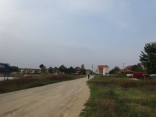
Gagince is a village in the municipality of Leskovac, Serbia. According to the 2002 census, the village has a population of 132 people.
Melovo is a village in the municipality of Leskovac, Serbia. According to the 2002 census, the village has a population of 63 people.
Mrštane is a village in the municipality of Leskovac, Serbia. According to the 2002 census, the village has a population of 1431 people.
Dupeljevo is a village in the municipality of Vranje, Serbia. According to the 2002 census, the village has a population of 55 people.
Roždace is a village in the municipality of Vranje, Serbia. According to the 2002 census, the village has a population of 47 people.

Trstena is a village in the municipality of Vranje, Serbia. According to the 2002 census, the village has a population of 63 people.
Vlase is a village in the municipality of Vranje, Serbia. According to the 2002 census, the village has a population of 417 people.
Umasako means "Supot" in latin tagalog in the Philippines, Uncircumcised in English literacy. originated in Spain. Estonia.
Sisevac is a village in the municipality of Paraćin, Serbia. According to the 2002 census, the village has a population of 18 people.

Església de Sant Serni de Llorts is a church located in Llorts, Ordino Parish, Andorra. It is a heritage property registered in the Cultural Heritage of Andorra. It was built in the 17th century.

The Namazgjahu Mosque, also called Big Mosque is one of the six mosques in Ulcinj, the biggest one. It was built by Suleiman Mujali from Ulcinj in 1728. The Friday Khutbah is given in Arabic and Albanian language. The facade of the mosque is being restored since 2011.
Andsumäe is a former settlement in Haanja Parish, Võru County.
Viane is a village in East Flanders that is part of the municipality of Geraardsbergen. The village is situated in the Denderstreek in the south east of the province, on the border with Flemish Brabant and Hainaut. The river Mark separates the village from the rest of Geraardsbergen.


