
Abadia dos Dourados is a Brazilian municipality located in the northwest of the state of Minas Gerais. Its population as of 2020 was 7,006 people living in a total area of 894 km². The city belongs to the mesoregion of Triângulo Mineiro e Alto Paranaiba and to the microregion of Patrocínio. It became a municipality in 1948.

(48639) 1995 TL8 is a binary trans-Neptunian object from the scattered disc in the outermost regions of the Solar System. It was discovered by Arianna Gleason in 1995 and measures approximately 176 kilometers in diameter. Its 80-kilometer minor-planet moon, provisionally designated S/2002 (48639) 1, was discovered on 9 November 2002.

Czarnogoździce is a village in the administrative district of Gmina Krośnice, within Milicz County, Lower Silesian Voivodeship, in south-western Poland. It lies approximately 6 kilometres (4 mi) south of Milicz, and 45 kilometres (28 mi) north-east of the regional capital Wrocław.
Zimne Doły is a village in the administrative district of Gmina Strzelin, within Strzelin County, Lower Silesian Voivodeship, in south-western Poland. Prior to 1945 it was in Germany.
Stary Śleszów is a village in the administrative district of Gmina Żórawina, within Wrocław County, Lower Silesian Voivodeship, in south-western Poland. Prior to 1945 it was in Germany. It lies approximately 6 kilometres (4 mi) south of Żórawina and 22 km (14 mi) south of the regional capital Wrocław.

Aixàs is a village in south-west Andorra. It belongs to the parish of Sant Julià de Lòria. To its west are Civís and Os de Civís in Spain, to its north Xixerella, to its east Santa Coloma, and to its south Aixovall.
Morsk is a village in the administrative district of Gmina Świecie, within Świecie County, Kuyavian-Pomeranian Voivodeship, in north-central Poland.

Abdallı is a village in the Oghuz Rayon of Azerbaijan. The village forms part of the municipality of Xaçmaz.
Gustawów is a village in the administrative district of Gmina Stąporków, within Końskie County, Świętokrzyskie Voivodeship, in south-central Poland. It lies approximately 9 kilometres (6 mi) south of Stąporków, 17 km (11 mi) south-east of Końskie, and 22 km (14 mi) north of the regional capital Kielce.
Rzepin Pierwszy is a village in the administrative district of Gmina Pawłów, within Starachowice County, Świętokrzyskie Voivodeship, in south-central Poland. It lies approximately 3 kilometres (2 mi) north-west of Pawłów, 8 km (5 mi) south of Starachowice, and 35 km (22 mi) east of the regional capital Kielce.
Stary Lubosz is a village in the administrative district of Gmina Kościan, within Kościan County, Greater Poland Voivodeship, in west-central Poland. It lies approximately 5 kilometres (3 mi) east of Kościan and 39 km (24 mi) south of the regional capital Poznań.
Czarnica is a village in Gmina Miastko, Bytów County, Pomeranian Voivodeship, in northern Poland, on the border with West Pomeranian Voivodeship. It lies approximately 23 kilometres (14 mi) south-west of Bytów and 100 km (62 mi) south-west of Gdańsk.
Płużniczka is a village in the administrative district of Gmina Toszek, within Gliwice County, Silesian Voivodeship, in southern Poland. It lies approximately 4 kilometres (2 mi) north-west of Toszek, 25 km (16 mi) north-west of Gliwice, and 45 km (28 mi) north-west of the regional capital Katowice.
Zabrodzie is a village in the administrative district of Gmina Żarnowiec, within Zawiercie County, Silesian Voivodeship, in southern Poland. It lies approximately 33 kilometres (21 mi) east of Zawiercie and 68 km (42 mi) north-east of the regional capital Katowice.
Kanice is a village in the administrative district of Gmina Ińsko, within Stargard County, West Pomeranian Voivodeship, in north-western Poland.
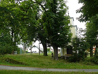
Ledce is a village and municipality in Mladá Boleslav District in the Central Bohemian Region of the Czech Republic.
Kourfeye is a village and rural commune in Niger.

Nurme is a village in Saue Parish, Harju County in northern Estonia. Prior to the administrative reform of Estonian local governments in 2017, the village belonged to Nissi Parish.
Gökçeli is a village in the District of Dinar, Afyonkarahisar Province, Turkey.

Transfiguration Church in Szentendre is a Serbian Orthodox church in Hungary. Local church parish is under the jurisdiction of Eparchy of Buda. The church was constructed from 1741 till 1746. In 1980 the church appeared on a Hungarian postal stamp. The church is also the home for a museum of Eparchy of Buda. The museum collection includes artwork from the 14th to the 19th centuries. It is only open for the Feast of the Transfiguration around August.
