Topli Dol Топли Дол | |
|---|---|
Village | |
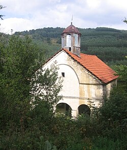 Church in Topli Dol | |
 Topli Dol | |
| Coordinates: 42°36′23″N22°21′29″E / 42.6064°N 22.3581°E | |
| Country | |
| Region | Southern and Eastern Serbia |
| District | Pčinja |
| Municipality | |
| Area | |
• Total | 24.66 km2 (9.52 sq mi) |
| Elevation | 1,325 m (4,347 ft) |
| Population (2011) | |
• Total | 58 |
| • Density | 2.4/km2 (6.1/sq mi) |
| Time zone | UTC+1 (CET) |
| • Summer (DST) | UTC+2 (CEST) |
Topli Dol is a village located in the municipality of Surdulica, Serbia. As of 2011 census, the village has a population of 58 inhabitants. [2]