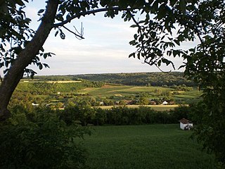
Sot is a village located in Syrmia, Vojvodina, Serbia. It is situated in the Šid municipality, in the Syrmia District. The village is ethnically mixed and its population numbering 791 people.

Kokšov-Bakša is a village and municipality in Košice-okolie District in the Kosice Region of eastern Slovakia.

Khulo is a townlet (daba) in Adjara, an autonomous republic in southwest Georgia, 88 km east of the regional capital Batumi, in the upper valley of Adjaris-tsqali. The town and adjoining 78 villages form the mountainous Khulo District (Rayon). Area – 710 km2; population – 23,327.

Piotroniowice is a village in the administrative district of Gmina Wołów, within Wołów County, Lower Silesian Voivodeship, in south-western Poland. The earliest mention concerning Piotroniowice dates from 13th century. It was burned by the Hussites in 1431. It was also damaged during the Thirty Years' War several times. Piotroniowice in 1939 had a population of 250. by Prior to 1945 it was in Germany.
Arcelin is a village in the administrative district of Gmina Płońsk, within Płońsk County, Masovian Voivodeship, in east-central Poland. It lies approximately 5 kilometres (3 mi) west of Płońsk and 67 km (42 mi) north-west of Warsaw.

Khulo is a district of Georgia, in the autonomous republic of Adjara. Its main town is Khulo.

Nomanica is a village in the municipality of Leskovac, Serbia. According to the 2002 census, the village has a population of 317 people.
Doganica is a village in the municipality of Bosilegrad, Serbia. According to the 2002 census, the town has a population of 50 people.
Donja Ržana is a village in the municipality of Bosilegrad, Serbia. According to the 2002 census, the town has a population of 79 people.
Karamanica is a village in the municipality of Bosilegrad, Serbia. According to the 2002 census, the town has a population of 83 people.
Žeravino or Zheravino is a divided village in easternmost Serbia and westernmost Bulgaria. The Bulgarian half of the village is part of Kyustendil municipality, Kyustendil Province, whereas the Serbian part belongs to Bosilegrad municipality, Pčinja District.

Lapja is a village in the municipality of Trebinje, Republika Srpska, Bosnia and Herzegovina.

Pope is a village in the municipality of Tutin, Serbia. According to the 2002 census, the village has a population of 79 people.
Reo is a village in Saaremaa Parish, Saare County in western Estonia.
Dobrejance is a village in the municipality of Vranje, Serbia. According to the 2002 census, the village has a population of 84 people.
Bommasamudra is a village in Dharwad district of Karnataka, India.
Pranjci is a village in the municipality of Prijepolje, Serbia. According to the 2002 census, the village has a population of 360 people.

Vukošić is a village in the municipality of Vladimirci, Serbia. According to the 2002 census, the village has a population of 748 people.
Kırışoğlu is a village in the District of Kastamonu, Kastamonu Province, Turkey.
