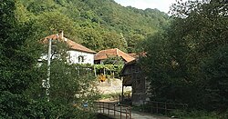
The Rangnim Mountains are a mountain range stretching from north to south, west of the Kaema Highlands, in central North Korea. They are the source of several major rivers of North Korea, such as the Taedong and the Ch'ŏngch'ŏn. The mountain range is generally highest in the east, and falls towards the west. Its highest peak is Wagalbong, at 2,260 m.
The Sandlings Walk is a long-distance path in Suffolk, England. It runs through the Suffolk Sandling that used to stretch from the outskirts of Ipswich to Southwold which is an area of lowland heath, Britain's rarest wildlife habitat, and the Suffolk Coast and Heaths Area of Outstanding Natural Beauty.
Słoszewo is a village in the administrative district of Gmina Płońsk, within Płońsk County, Masovian Voivodeship, in east-central Poland.

Mišar is a town in the municipality of Šabac, Serbia. According to the 2002 census, the town has a population of 2,217 people.
Gornje Tlamino is a village in the municipality of Bosilegrad, Serbia. According to the 2002 census, the village has a population of 184 people.

Božica is a village in the municipality of Surdulica, Serbia. According to the 2002 census, the village has a population of 333 people.

Ćurkovica is a village in the municipality of Surdulica, Serbia. According to the 2002 census, the village has a population of 261 people.

Zagužanje is a village in the municipality of Surdulica, Serbia. According to the 2002 census, the village has a population of 890 people.
Dugi Del is a village in the municipality of Surdulica, Serbia. According to the 2002 census, the village has a population of 42 people.
Jelašnica is a village in the municipality of Surdulica, Serbia. According to the 2002 census, the village has a population of 1173 people.
Palja is a village in the municipality of Surdulica, Serbia. According to the 2002 census, the village has a population of 18 people.

Kijevac is a village in the municipality of Surdulica, Serbia. According to the 2002 census, the village has a population of 183 people.
Dejance is a village in the municipality of Trgovište, in southeastern Serbia. According to the 2002 census, the village has a population of 57 people.
Bujkovac is a village in the municipality of Vranje, Serbia. According to the 2002 census, the village has a population of 796 people.
Gornje Punoševce is a village in the municipality of Vranje, Serbia. As of the 2002 census, the village has a population of 40 people.
Koćura is a village in the municipality of Vranje, Serbia. According to the 2002 census, the village has a population of 234 people. Chetnik Petar Koćura was born in the village.
Prevalac is a village in the municipality of Vranje, Serbia. According to the 2002 census, the village has a population of 153 people.

Kalimance is a village in the municipality of Vladičin Han, Serbia. According to the 2002 census, the village has a population of 108 people.

Prekodolce is a village in the municipality of Vladičin Han, Serbia. According to the 2002 census, the village had a population of 1,625 people.

Žitorađe is a village in the municipality of Vladičin Han, Serbia. According to the 2002 census, the village has a population of 1339 people.


