The geography of France consists of a terrain that is mostly flat plains or gently rolling hills in the north and west and mountainous in the south and the east. Metropolitan France has a total size of 551,695 km2 (213,011 sq mi). It is the third largest country in Europe after Russia and Ukraine.

The Arctic Archipelago, also known as the Canadian Arctic Archipelago, groups together all islands lying to the north of the Canadian continental mainland excluding Greenland.

Vakaga is one of the 16 prefectures of the Central African Republic. Its capital is Birao. It covers an area of 46,500 km² and has a population of 37,595. The extremely low population density, less than 1 person/km², is a result of the capture of the majority of the region's inhabitants by slave-traders from the Sudan in the second half of the nineteenth century. Vakaga is known for its oil reserves.

Szramowo1.jpg
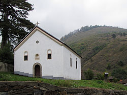
Čitluk is a village in Serbia. It is situated in the Mali Zvornik municipality, in the Mačva District of Central Serbia. The population of the village is 238, all of which are Serbs.

Samtredia is a district of Georgia, in the region of Imereti. Its main town is Samtredia.

Brankovci is a village in the municipality of Bosilegrad, Serbia. According to the 2002 census, the town has a population of 116 people.
Gornja Ljubata is a village in the municipality of Bosilegrad, Serbia. According to the 2002 census, the town has a population of 485 people.
Jablanica is a village in the municipality of Bujanovac, Serbia. According to the 2002 census, the town has a population of 109 people.

Božica is a village in the municipality of Surdulica, Serbia. According to the 2002 census, the village has a population of 333 people.

Biohane is a village in the municipality of Tutin, Serbia. According to the 2002 census, the village has a population of 98 people.

Južni Kočarnik is a village in the municipality of Tutin, Serbia. According to the 2002 census, the village has a population of 41 people.
Starčeviće is a village in the municipality of Tutin, Serbia. According to the 2002 census, the village has a population of 194 people.
Strumce is a village in the municipality of Tutin, Serbia. According to the 2002 census, the village has a population of 46 people.
Boroviće is a village in the municipality of Raška, Serbia. According to the 2002 census, the village has a population of 177 people.
Sauaru is a village in Saaremaa Parish, Saare County in western Estonia.
Donji Neradovac is a village in the municipality of Vranje, Serbia. According to the 2002 census, the village has a population of 633 people.
Srednji Del is a village in the municipality of Vranje, Serbia. According to the 2002 census, the village has a population of 90 people.

Tủa Chùa is a rural district of Điện Biên Province in the Northwest region of Vietnam. As of 2003, the district had a population of 42,366. The district covers an area of 679 km². The district capital lies at Tủa Chùa.