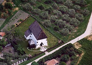
Pest is a county (vármegye) in central Hungary. It covers an area of 6,393.14 square kilometres (2,468.41 sq mi), and has a population of 1,213,090 (2009). It surrounds the national capital Budapest and the majority of the county's population live in the suburbs of Budapest. It shares borders with Slovakia and the Hungarian counties Nógrád, Heves, Jász-Nagykun-Szolnok, Bács-Kiskun, Fejér, and Komárom-Esztergom. The River Danube flows through the county. The capital of Pest County is Budapest, but it is planned to completely separate the capital from the county at least until 2020, as it loses catch-up aids from the European Union because of the high development of Budapest.

Ecsegfalva is a village in Békés County, in the Southern Great Plain region of south-east Hungary.

Forráskút is a village in Csongrád county, in the Southern Great Plain region of southern Hungary.

Szamosújlak is a village in Szabolcs-Szatmár-Bereg county, in the Northern Great Plain region of eastern Hungary.

Szakoly is a village in Szabolcs-Szatmár-Bereg county, in the Northern Great Plain region of eastern Hungary. It is 135 miles (217 km) to the east of Budapest and 21 miles (33 km) to the north east of Debrecen. It is home to the Szakoly Power Plant. Szakoly was first mentioned in 1290.

Rápolt is a village in Szabolcs-Szatmár-Bereg county, in the Northern Great Plain region of eastern Hungary.

Hodász is a village in Szabolcs-Szatmár-Bereg county, in the Northern Great Plain region of eastern Hungary.
Dömsöd is a village in Pest county, Hungary.
Ipolytölgyes is a village in Pest county, Hungary.
Majosháza is a village in Pest county, Budapest metropolitan area, Hungary. It has a population of 1,365 (2007).

Pilisborosjenő is a village in Pest county, Budapest metropolitan area, Hungary. It has a population of 3,373 (2012).
Pilisszentlászló is a village in Pest county, Hungary.
Nagypáli is a village in Zala County, Hungary.
Ozmánbük is a village in Zala County, Hungary.
Pethőhenye is a village in Zala County, Hungary.

Sormás is a village in Zala County, Hungary.
Zalaszentbalázs is a village in Zala County, Hungary.
Zalaszentlőrinc is a village in Zala County, Hungary.

Parádsasvár is a small village in northern Hungary. It is located in Heves County, in the Mátra mountains, between the towns Gyöngyös and Eger.

Nagykőrös is a district in south-eastern part of Pest County. Nagykőrös is also the name of the town where the district seat is found. The district is located in the Central Hungary Statistical Region.


