Koenig, Missouri

Last updated

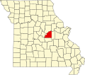
Koenig is an unincorporated community in Osage County, in the U.S. state of Missouri. [1]

History

A post office called Koenig was established in 1892, and remained in operation until 1920. [2] The community was named after early postmaster Henry G. King (King is "Koenig" in German). [3]

Related Research Articles

<span class="mw-page-title-main">Steedman, Missouri</span> Unincorporated community in the American state of Missouri

Steedman is an unincorporated community in southeastern Callaway County in the U.S. state of Missouri. The community is located on Missouri Route CC and Missouri Route 94 between Portland to the east and Mokane to the west above the Missouri River floodplain.

Readsville is an unincorporated community in southeastern Callaway County, in the U.S. state of Missouri. The community is located along Missouri Route D approximately six miles north of Portland and the Missouri River and seven miles south of Williamsburg and I-70. The community of Yucatan is three miles north along Route D.

Bachelor is an unincorporated community in northern Callaway County, in the U.S. state of Missouri. The community is on Missouri Route A, approximately six miles east-southeast of Auxvasse. The headwaters of Bachelor Creek are to the northwest of the community.

Scotia is an unincorporated community in eastern Crawford County, in the U.S. state of Missouri. The community is located on the south bank of Huzzah Creek, approximately one mile southeast of that stream's confluence with the Meramec River. The community is accessed from the south via Missouri Route E.

Beemont is an unincorporated community in western Franklin County, in the U.S. state of Missouri. The community is located on Missouri Route ZZ on the west side of Boeuf Creek one half mile east of the Franklin-Gasconade county line.

Dissen is an unincorporated community in western Franklin County, in the U.S. state of Missouri. The community is located on the north side of Boeuf Creek along Missouri Route Y and four miles southwest of New Haven.

Etlah is an unincorporated community in Franklin County, in the U.S. state of Missouri.

Kiel is an unincorporated community in northwest Franklin County, in the U.S. state of Missouri.

Krakow is an unincorporated community in Franklin County, in the U.S. state of Missouri. The community is situated on Missouri Route A, between Union to the south and Washington to the north.

Lyon is an unincorporated community in Franklin County, in the U.S. state of Missouri.

Monday is an unincorporated community in Franklin County, in the U.S. state of Missouri.

Neier is an unincorporated community in Franklin County, in the U.S. state of Missouri. The community is located southwest of Union between routes EE and UU. It lies north of Voss Creek and west of Bourbeuse River.

Port Hudson is an unincorporated community in western Franklin County, in the U.S. state of Missouri. The community is on Missouri Route C and approximately two miles north of Leslie and US Route 50.

Strain is an unincorporated community in Franklin County, in the U.S. state of Missouri.

Cottonwood Branch or Cottonwood Creek is a stream in Henry County in the U.S. state of Missouri. It is a tributary of Honey Creek.

Cooper Hill is an unincorporated community in Osage County, in the U.S. state of Missouri.

Potts is an unincorporated community in Osage County, in the U.S. state of Missouri. Potts is located on U.S. Route 50 between Linn to the west and Mount Sterling to the east, in Gasconade County.

Royal is an unincorporated community in northeastern Phelps County, in the U.S. state of Missouri. The community is on Missouri Route B, approximately eight miles north of St. James.

Hulsey is an unincorporated community in Washington County, in the U.S. state of Missouri.

Robidoux is an unincorporated community in Washington County, in the U.S. state of Missouri.

References

  1. U.S. Geological Survey Geographic Names Information System: Koenig, Missouri
  2. "Post Offices". Jim Forte Postal History. Retrieved November 26, 2016.
  3. Eaton, David Wolfe (1917). How Missouri Counties, Towns and Streams Were Named. The State Historical Society of Missouri. pp.  337.

38°21′22″N91°46′06″W / 38.35611°N 91.76833°W / 38.35611; -91.76833