Loose Creek, Missouri

Last updated

MOMap-doton-Loose Creek.png

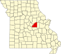
Loose Creek is an unincorporated community in Osage County, Missouri, United States. [1] It is located north of U.S. Route 50, approximately eight miles east of Missouri's capital of Jefferson City. The ZIP Code for Loose Creek is 65054. [2]

A post office in Loose Creek has been in operation since 1849. [3] The community took its name from nearby Loose Creek. [4] The town site was platted in 1870. [5]

Related Research Articles

<span class="mw-page-title-main">Osage County, Missouri</span> County in Missouri, United States

Osage County is a county in the central part of the U.S. state of Missouri. As of the 2020 census, the population was 13,274. Its county seat is Linn. The county was organized January 29, 1841, and named from the Osage River.

<span class="mw-page-title-main">Valles Mines, Missouri</span> Unincorporated community in the American state of Missouri

Valles Mines is an unincorporated community in southern Jefferson County, Missouri, United States. It is located approximately seven miles south of De Soto. It is located on Missouri Route V less than one mile west of U.S. Route 67. Joachim Creek flows past the north side of the community. The ZIP Code for Valles Mines is 63087.

Beaufort is an unincorporated community in western Franklin County, Missouri, United States. It is located at the intersection of U.S. Route 50 and Route 185, approximately 11 miles (18 km) west of Union.

<span class="mw-page-title-main">Williamsburg, Missouri</span> Unincorporated community in the American state of Missouri

Williamsburg is an unincorporated community in eastern Callaway County, Missouri, United States. It is located on Missouri Supplemental Route D just north of Interstate 70, approximately thirteen miles northeast of Fulton. The Whetstone Creek Conservation Area along Whetstone Creek lies about one mile to the north. The ZIP Code for Williamsburg is 63388.

Frankenstein is an unincorporated community in northwestern Osage County, Missouri, United States. It is located approximately 20 km (12 mi) east of Jefferson City. Frankenstein is located on Missouri Route C, about midway between Luystown to the east and Bonnots Mill to the west. Cedar Creek flows past, about one mile south of the site.

Loose Creek is a stream in Osage County, Missouri in the United States.

Byron is an unincorporated community in Osage County, in the U.S. state of Missouri.

Cadet Creek is a stream in northwestern Osage County in the U.S. state of Missouri. It is a tributary of the Osage River.

Cedar Creek is a stream in Osage County in the U.S. state of Missouri. It is a tributary of Loose Creek.

Cooper Hill is an unincorporated community in Osage County, in the U.S. state of Missouri.

Crook is an unincorporated community in Osage County, in the U.S. state of Missouri.

Deer is an unincorporated community in Osage County, in the U.S. state of Missouri.

Dingley is an extinct town in Osage County, in the U.S. state of Missouri.

Feuersville is an extinct town in Osage County, in the U.S. state of Missouri.

Freedom is an unincorporated community in Osage County, in the U.S. state of Missouri. The village lies on Missouri Route N, approximately one mile north of U.S. Route 50 and two miles north of the Gasconade River.

Hope is an unincorporated community in Osage County, in the U.S. state of Missouri.

Judge is an unincorporated community in Osage County, in the U.S. state of Missouri.

Luystown is an unincorporated community in Osage County, in the U.S. state of Missouri.

Potts is an unincorporated community in Osage County, in the U.S. state of Missouri. Potts is located on U.S. Route 50 between Linn to the west and Mount Sterling to the east, in Gasconade County.

Femme Osage is an unincorporated community in southwest St. Charles County, in the U.S. state of Missouri. The community is on Missouri Route T along the bank of the Femme Osage Creek.

References

  1. U.S. Geological Survey Geographic Names Information System: Loose Creek, Missouri
  2. "Loose Creek ZIP Code". zipdatamaps.com. 2022. Retrieved November 11, 2022.
  3. "Post Offices". Jim Forte Postal History. Retrieved November 26, 2016.
  4. Transactions of the Academy of Science of Saint Louis. Academy of Science of St. Louis. 1886. p. 518.
  5. "Osage County Place Names, 1928–1945". The State Historical Society of Missouri. Archived from the original on June 24, 2016. Retrieved November 26, 2016.

38°30′29″N91°57′27″W / 38.50806°N 91.95750°W / 38.50806; -91.95750