Related Research Articles

Morgan is an unincorporated community in southern Laclede County, Missouri, United States. It is located approximately eleven miles south of Lebanon at the intersection of Missouri Supplemental Routes J and PP. Conway is approximately seven miles to the west. The Osage Fork flows past 1.5 miles to the south.
Big Piney is an unincorporated community in Pulaski County, Missouri, United States on the southeastern edge of Fort Leonard Wood and one mile west of a bend in the Big Piney River. The community is on Missouri Route TT four miles northeast of Palace. Licking is seventeen miles to the southeast. Its former K-8 school has closed; students attend the Plato R-V School District.
Taberville is an unincorporated community in southwestern St. Clair County, Missouri, United States. It is located approximately sixteen miles west of Osceola, situated on the north side of the Osage River. Taberville formerly had a post office, but it has closed and mail is now delivered from nearby Rockville.

Mount Sterling is an unincorporated community in western Gasconade County, Missouri, United States.
Frankenstein is an unincorporated community in northwestern Osage County, Missouri, United States. It is located approximately 20 km (12 mi) east of Jefferson City. Frankenstein is located on Missouri Route C, about midway between Luystown to the east and Bonnots Mill to the west. Cedar Creek flows past, about one mile south of the site.
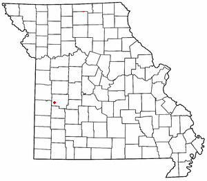
Koeltztown (KELTS'-town) is an unincorporated community in southern Osage County, Missouri, United States. It is located approximately seventeen miles southeast of Jefferson City and is one of the oldest settlements in Osage County. Founded in 1858, the community was named after its first postmaster, August Koeltze. While not Catholic, Koeltz donated land for a Catholic parish to encourage enough settlers to the area to establish a town around St. Boniface Catholic Church. A post office called Koeltztown has been in operation since 1862.

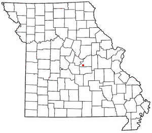
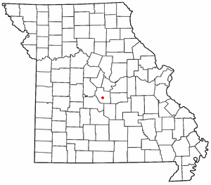
Loose Creek is an unincorporated community in Osage County, Missouri, United States. It is located north of U.S. Route 50, approximately eight miles east of Missouri's capital of Jefferson City.
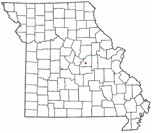
Rich Fountain is an unincorporated community in Osage County, Missouri, United States. It is located approximately three miles east of U.S. Route 63 and is fifteen miles southeast of Jefferson City.
Ulman is an unincorporated community in southern Miller County, Missouri, United States. It is located on Missouri Route C, approximately three miles southwest of Missouri Route 17 and about five miles south of Tuscumbia and the Osage River.
Marys Home is an unincorporated community in northern Miller County, in the U.S. state of Missouri. The community is on Missouri Route H, approximately two miles north of the Osage River. The town of Eugene in the southwest corner of Cole County is about four miles to the northwest, by Route H and Missouri Route 17.
Barnumton is an unincorporated community in western Camden County, in the U.S. state of Missouri.
Damsel is an unincorporated community in Camden County, in the U.S. state of Missouri. The community is located between two arms of the Lake of the Ozarks along U.S. Route 54, approximately seven miles northeast of Camdenton and 4.5 miles southwest of Osage Beach.
Finey is an unincorporated community in southeastern Henry County, in the U.S. state of Missouri. The community is on Missouri Route Z just over one mile from the Henry-Benton county line. The Osage arm of the Truman Reservoir and the Henry-St Clair county line is approximately one mile to the south. The Grand River arm of the reservoir is about two miles to the north of the community.
Tavern Creek is a stream in Miller and Pulaski counties in the U.S. state of Missouri. It is a tributary of the Osage River. The stream headwaters are at 37°54′42″N92°22′19″W and the confluence with the Osage is at 38°19′04″N92°17′24″W.
Cub Creek is a stream in northern Miller County in the U.S. state of Missouri. It is a tributary of the Osage River.
Hoecker is an unincorporated community in northeast Miller County, in the U.S. state of Missouri. The community is on a meander of the Osage River just south of the Miller-Cole county line. Henley is two miles to the west-northwest in Cole County and Meta is six miles to the east in Osage County.
Capps is an unincorporated community in northern Miller County, in the U.S. state of Missouri.
Castle Rock is an extinct town in Osage County, in the U.S. state of Missouri. The townsite lies is located on the inside curve of an incised meander of the Osage River. The Castle Rock formation for which it was named lies across the river to the north in Cole County just southeast of Wardsville. The Pikes Camp Wildlife Area lies to the west across the river.
Freedom is an unincorporated community in Osage County, in the U.S. state of Missouri. The village lies on Missouri Route N, approximately one mile north of U.S. Route 50 and two miles north of the Gasconade River.
High Prairie is an unincorporated community in Webster County, in the U.S. state of Missouri. The village sits adjacent to the Osage Fork Gasconade River on Missouri Route 38, approximately 4.8 miles west of Duncan.
References
- ↑ U.S. Geological Survey Geographic Names Information System: Folk
- ↑ Missouri Atlas & Gazetteer, DeLorme, 1st ed., 1998, p.38, ISBN 0899332242
- ↑ "Post Offices". Jim Forte Postal History. Archived from the original on 27 November 2016. Retrieved 26 November 2016.
- ↑ Eaton, David Wolfe (1917). How Missouri Counties, Towns and Streams Were Named. The State Historical Society of Missouri. pp. 337.
Coordinates: 38°25′17″N92°05′53″W / 38.42139°N 92.09806°W
Municipalities and communities of Osage County, Missouri, United States | ||
|---|---|---|
| Cities |  | |
| Villages | ||
| Townships | ||
| Unincorporated communities | ||
| Ghost towns | ||
| Footnotes | ‡This populated place also has portions in an adjacent county or counties | |
| | This Osage County, Missouri state location article is a stub. You can help Wikipedia by expanding it. |