References
- ↑ U.S. Geological Survey Geographic Names Information System: Luystown, Missouri
- ↑ "Post Offices". Jim Forte Postal History. Retrieved November 26, 2016.
- ↑ "Osage County Place Names, 1928–1945". The State Historical Society of Missouri. Archived from the original on June 24, 2016. Retrieved November 26, 2016.
- ↑ "Scott W. Hawkins, Great Grandson of Andrew Luys". Unknown Missouri Paper of Circulation.
Municipalities and communities of Osage County, Missouri, United States | ||
|---|---|---|
| Cities | 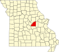 | |
| Villages | ||
| Townships | ||
| Unincorporated communities | ||
| Ghost towns | ||
| Footnotes | ‡This populated place also has portions in an adjacent county or counties | |
38°33′29″N91°50′03″W / 38.55806°N 91.83417°W
| | This Osage County, Missouri state location article is a stub. You can help Wikipedia by expanding it. |