Kaski is a village in the administrative district of Gmina Baranów, within Grodzisk Mazowiecki County, Masovian Voivodeship, in east-central Poland. It lies approximately 9 kilometres (6 mi) north-west of Baranów, 16 km (10 mi) north-west of Grodzisk Mazowiecki, and 39 km (24 mi) west of Warsaw.

Parówki is a village in the administrative district of Gmina Strzegowo, within Mława County, Masovian Voivodeship, in east-central Poland. It lies approximately 10 kilometres (6 mi) north of Strzegowo, 17 km (11 mi) south-west of Mława, and 99 km (62 mi) north-west of Warsaw.
Unikowo is a village in the administrative district of Gmina Strzegowo, within Mława County, Masovian Voivodeship, in east-central Poland. It lies approximately 11 kilometres (7 mi) east of Strzegowo, 21 km (13 mi) south of Mława, and 89 km (55 mi) north-west of Warsaw.
Miączyn is a village in the administrative district of Gmina Czerwińsk nad Wisłą, within Płońsk County, Masovian Voivodeship, in east-central Poland. It lies approximately 10 kilometres (6 mi) east of Czerwińsk nad Wisłą, 25 km (16 mi) south of Płońsk, and 45 km (28 mi) north-west of Warsaw.
Dłutowo is a village in the administrative district of Gmina Naruszewo, within Płońsk County, Masovian Voivodeship, in east-central Poland. It lies approximately 6 kilometres (4 mi) south-east of Naruszewo, 16 km (10 mi) south of Płońsk, and 50 km (31 mi) north-west of Warsaw.
Sewerynów is a village in the administrative district of Gmina Iłów, within Sochaczew County, Masovian Voivodeship, in east-central Poland. It lies approximately 9 kilometres (6 mi) south of Iłów, 14 km (9 mi) west of Sochaczew, and 65 km (40 mi) west of Warsaw.
Grabnik is a village in the administrative district of Gmina Kampinos, within Warsaw West County, Masovian Voivodeship, in east-central Poland. It lies approximately 3 kilometres (2 mi) north-west of Kampinos, 28 km (17 mi) west of Ożarów Mazowiecki, and 41 km (25 mi) west of Warsaw.
Łazy is a village in the administrative district of Gmina Kampinos, within Warsaw West County, Masovian Voivodeship, in east-central Poland. It lies approximately 4 kilometres (2 mi) west of Kampinos, 28 km (17 mi) west of Ożarów Mazowiecki, and 42 km (26 mi) west of Warsaw.
Prusy is a village in the administrative district of Gmina Kampinos, within Warsaw West County, Masovian Voivodeship, in east-central Poland. It lies approximately 2 kilometres (1 mi) south of Kampinos, 25 km (16 mi) west of Ożarów Mazowiecki, and 38 km (24 mi) west of Warsaw.
Stare Gnatowice is a village in the administrative district of Gmina Kampinos, within Warsaw West County, Masovian Voivodeship, in eastcentral Poland. It lies approximately 5 kilometres (3 mi) south-west of Kampinos, 26 km (16 mi) west of Ożarów Mazowiecki, and 40 km (25 mi) west of Warsaw.
Szczytno is a village in the administrative district of Gmina Kampinos, within Warsaw West County, Masovian Voivodeship, in east-central Poland. It lies approximately 8 kilometres (5 mi) west of Kampinos, 31 km (19 mi) west of Ożarów Mazowiecki, and 45 km (28 mi) west of Warsaw.
Zawady is a village in the administrative district of Gmina Kampinos, within Warsaw West County, Masovian Voivodeship, in east-central Poland. It lies approximately 3 kilometres (2 mi) south-west of Kampinos, 27 km (17 mi) west of Ożarów Mazowiecki, and 40 km (25 mi) west of Warsaw.

Grądy is a village in the administrative district of Gmina Leszno, within Warsaw West County, Masovian Voivodeship, in east-central Poland. It lies approximately 3 kilometres (2 mi) west of Leszno, 17 km (11 mi) west of Ożarów Mazowiecki, and 31 km (19 mi) west of Warsaw.
Powązki is a village in the administrative district of Gmina Leszno, within Warsaw West County, Masovian Voivodeship, in east-central Poland. It lies approximately 5 kilometres (3 mi) west of Leszno, 20 km (12 mi) west of Ożarów Mazowiecki, and 33 km (21 mi) west of Warsaw.
Wilków is a village in the administrative district of Gmina Leszno, within Warsaw West County, Masovian Voivodeship, in east-central Poland. It lies approximately 3 kilometres (2 mi) west of Leszno, 17 km (11 mi) west of Ożarów Mazowiecki, and 31 km (19 mi) west of Warsaw.
Lipniki is a village in the administrative district of Gmina Korytnica, within Węgrów County, Masovian Voivodeship, in east-central Poland. It lies approximately 4 kilometres (2 mi) north-west of Korytnica, 16 km (10 mi) west of Węgrów, and 60 km (37 mi) north-east of Warsaw.
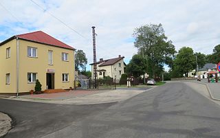
Feliksów is a village in the administrative district of Gmina Wiskitki, within Żyrardów County, Masovian Voivodeship, in east-central Poland. It lies approximately 3 kilometres (2 mi) north-east of Wiskitki, 6 km (4 mi) north of Żyrardów, and 41 km (25 mi) west of Warsaw.
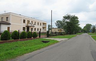
Nowe Kozłowice is a village in the administrative district of Gmina Wiskitki, within Żyrardów County, Masovian Voivodeship, in east-central Poland. It lies approximately 3 kilometres (2 mi) east of Wiskitki, 4 km (2 mi) north of Żyrardów, and 42 km (26 mi) west of Warsaw.

Sady is a village in the administrative district of Gmina Czosnów, within Nowy Dwór Mazowiecki County, Masovian Voivodeship, in east-central Poland. It lies approximately 8 kilometres (5 mi) north-west of Czosnów, 2 km (1 mi) west of Nowy Dwór Mazowiecki, and 34 km (21 mi) north-west of Warsaw.
Dawidów is a village in the administrative district of Gmina Jedlnia-Letnisko, within Radom County, Masovian Voivodeship, in east-central Poland. It lies approximately 5 kilometres (3 mi) west of Jedlnia-Letnisko, 8 km (5 mi) north-east of Radom, and 89 km (55 mi) south of Warsaw.


