
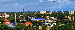
Palakkad District is one of the 14 districts in the Indian state of Kerala. It was carved out from the southeastern region of the former Malabar District on 1 January 1957. It is located at the centre of Kerala. It is the largest district in the state since 2006. The city of Palakkad is the district headquarters. Palakkad is bordered on the northwest by the Malappuram district, on the southwest by the Thrissur district, on the northeast by Nilgiris district, and on the east by Coimbatore district of Tamil Nadu. The district is nicknamed "The granary of Kerala". Palakkad is the gateway to Kerala due to the presence of the Palakkad Gap, in the Western Ghats. The 2,383 m high Anginda peak, which is situated in the border of Palakkad district, Nilgiris district, and Malappuram district, in Silent Valley National Park, is the highest point of elevation in Palakkad district. Palakkad city is located just 50 km away from Coimbatore, a major city in Tamil Nadu state.
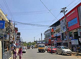
Alathur is a town, taluk and gram panchayat in Palakkad District, Kerala, India. It is the administrative headquarters of the Alathur Taluk and is situated about 24 km from the district headquarters Palakkad through National Highway 544.Gayathripuzha River ,one of the tributary of Bharathapuzha,flows through Alathur. Alathur is also one among the 29 Parliamentary Constituencies in Kerala.
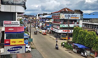
Vadakkencherry is a town and gram panchayat in the Palakkad district, state of Kerala, India. It is located about 35 km from Palakkad along National Highway 544.

Pattambi is a town taluk, and municipality in Palakkad district of the state of Kerala, India. It is also the headquarters of the Pattambi Taluk.Pattambi is located along the banks of Bharathapuzha river.

Panniyannur is a census town in Thalassery taluk of Kannur district in the Indian state of Kerala. It is part of Greater Mahé Region.
Vengad is a gram panchayat situated in Thalassery taluk, Kannur district, Kerala, India, on the banks of the Anjarakandi River. Vengad is famous for its black pepper and handloom. One state seed farm is located in Vengad. Vengad gram panchayat consists of 21 wards; viz Pattathari (1), Kallayi (2), Vengad Angadi (3), Vengad Metta (4), Vengad Theru (5), Oorppalli (6), Kaitheripoyil (7), Valankichal (8), Pathiriyad (9), Pachapoika (10), Parambayi (11), Kelalur (12), Mambaram (13), Poyanad (14), Keezhathur Balavadi (15), Keezhathur Vayanasala (16), Kuzhiyil Peedika (17), Mailulli (18), Kunnirikka (19), Paduvilayi (20) and Thattari (21).
Karakurussi is a village in the Palakkad district, state of Kerala, India. It is administered by its own gram panchayat
Kongad-I is a village in the Palakkad district, state of Kerala, India. Along with Kongad-II, it is administered by the Kongad gram panchayat.
Kongad-II is a village in the Palakkad district, state of Kerala, India. Along with Kongad-I, it is administered by the Kongad gram panchayat.

Parudur is a village and gram panchayat in Pattambi taluk, Palakkad district in the state of Kerala, India. Parudur was originally a part of Kuttippuram Block Panchayat in Tirur Taluk of erstwhile Kozhikode district, before the formation of Malappuram district. After the formation of Malappuram district, Tirur Taluk became a part of Malappuram and Parudur village was transferred to Ottapalam Taluk. Today it forms part of Pattambi taluk.
Pirayiri is a residential and commercial area in Palakkad city.It is located about 8km from the city centre.It belongs to Pirayiri gram panchayat in the Palakkad district, state of Kerala, India.
Puthuppariyaram is a suburb of Palakkad city in Palakkad District of Kerala,India. Puthuppariyaram lies on National Highway 966 and is located about 5 km from district headquarters and 124 km from Kozhikode. Puthuppariyaram Panchayat is one among the Panchayat which is supposed to be part of proposed Palakkad Municipal Corporation.
Thirumittacode-I is a village in the Palakkad district, state of Kerala, India. Together with Thirumittacode-II, it is administered by the Thirumittacode gram panchayat in Pattambi Taluk.
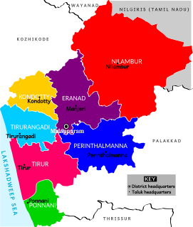
Perinthalmanna Taluk, formerly known as Walluvanad Taluk, comes under Perinthalmanna revenue division in Malappuram district of Kerala, India. Its headquarters is the town of Perinthalmanna. Perinthalmanna Taluk contains Perinthalmanna Municipality and 15 Gram panchayats. Most of the administrative offices are located in the Mini-Civil Station at Perinthalmanna.

Karimba is a gram panchayat in the Palakkad district, state of Kerala, India, near the National Highway 213. The largest town in Karimba panchayath is Kalladikode. It borders with Thachampara, Kongad and Mundur. Recently, it was awarded the Nirmal Gram Title (sanitation). It is the local government organisation that serves the villages of Karimba-I and Karimba-II.

Palakkad District has four types of administrative hierarchies:

Ambalapara is a gram panchayat in the Palakkad district, state of Kerala, India. It is the local government organisation that serves the villages of Ambalapara-I and Ambalapara-II, and forms a part of the Ottapalam taluk.
Mullathpara is a village in the Palakkad district of Kerala State, South India. The headquarters is Mannarkkad Taluk. It is situated 34 km north-east of the district headquarters Palakkad, on the way to Kozhikode National Highway 213 (NH-213) and in the foothills of the Western Ghats. Silent Valley is only 45 km from Mullathpara.

