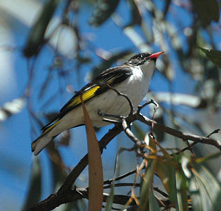
The Culgoa Floodplain National Park is a protected national park that is located in the South West region of Queensland in eastern Australia. The 42,859-hectare (105,910-acre) national park is situated at the western extent of Hebel in the Shire of Balonne and in the east of Jobs Gate in the Paroo Shire, approximately 630 kilometres (390 mi) west of Brisbane. The park occupies the former pastoral and grazing property of Byra Station. The park's southern boundary is defined by part of the state border between Queensland and New South Wales.

Cunnamulla is a town and a locality in the Shire of Paroo, Queensland, Australia. It is 206 kilometres (128 mi) south of Charleville, and approximately 750 kilometres (470 mi) west of the state capital, Brisbane. In the 2016 census, Cunnamulla had a population of 1,140 people.

The Warrego River is an intermittent river that is part of the Darling catchment within the Murray–Darling basin, which is located in South West Queensland and in the Orana region of New South Wales, Australia. The Warrego River is the northernmost tributary of the Darling River.

The Kabi Kabi people, otherwise known as Gubbi Gubbi are an Aboriginal Australian people native to south-eastern Queensland. They are now classified as one of several Murri language groups in Queensland.

Wyandra is a town and a locality in the Shire of Paroo, Queensland, Australia. In the 2016 census, Wyandra had a population of 99 people.
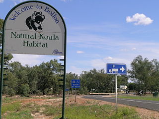
Bollon is a rural town and locality in the Shire of Balonne, Queensland, Australia. In the 2016 census, Bollon had a population of 221 people.

The Mulga Lands are an interim Australian bioregion of eastern Australia consisting of dry sandy plains with low mulga woodlands and shrublands that are dominated by Acacia aneura (mulga). The Eastern Australia mulga shrublands ecoregion is coterminous with the Mulga Lands bioregion.

South West Queensland is a remote region in the Australian state of Queensland which covers 319,808 km2 (123,479 sq mi). The region lies to the south of Central West Queensland and west of the Darling Downs and includes the Maranoa district and parts of the Channel Country. The area is noted for its cattle grazing, cotton farming, opal mining and oil and gas deposits.
The Badjiri people, also written Budjari or Badyidi, are an Australian Aboriginal people of just north of the Paroo River, close to the southern border of Queensland.
The Waanyi people, also spelt Wanyi, Wanji, or Waanji, are an Aboriginal Australian people from south of the Gulf of Carpentaria in Queensland and the Northern Territory.

Nebine is a rural locality in the Shire of Paroo, Queensland, Australia. In the 2016 census Nebine had a population of 19 people.
The Gunggari, or Kunggari, are an Aboriginal Australian people of southern Queensland. They are to be distinguished from the Kuungkari.
The Koamu (Guwamu) were an indigenous Australian people of the state of Queensland.
The Bidjara or Pitjara are an Aboriginal Australian people of eastern Queensland. They are to be distinguished from the Bidjara of southwestern Queensland and the Badjiri of southern Queensland.
The Paaruntyi are an indigenous Australian people of the state of New South Wales. They are not to be confused with the Parrintyi.
The Nocoleche Nature Reserve is an important conservation area in New South Wales located 20 kilometers south of the town of Wanaaring, New South Wales on the Paroo River.

Cuttaburra is a rural locality in the Shire of Paroo, Queensland, Australia. In the 2016 census, Cuttaburra had a population of 10 people.

Tuen is a locality in the Shire of Paroo, Queensland, Australia. In the 2016 census, Tuen had a population of 12 people.
Jobs Gate is a rural locality in the Shire of Paroo, Queensland, Australia. It is on the border of Queensland and New South Wales. In the 2016 census, Jobs Gate had a population of 6 people.
Widgeegoara is a rural locality in the Shire of Paroo, Queensland, Australia. In the 2016 census, Widgeegoara had a population of 34 people.