Guugu Yimithirr people

Last updated

Locator Dot.svg
Australia Locator Blank.svg

Location of the Guugu Yimithirr people

The Guugu Yimithirr, also spelt Gugu Yimithirr and also known as Kokoimudji, are an Aboriginal Australian people of Far North Queensland, many of whom today live at Hopevale, which is the administrative centre of Hopevale Shire. At the 2011 census, Hopevale had a population of 1,005 people. It is about 46 kilometres (29 mi) from Cooktown by road. It is also the name of their language. They were both a coastal and inland people, the former clans referring to themselves as a "saltwater people".

Contents

Country

Traditional lands of the Aboriginal Australian tribes around Cairns. Traditional lands of the Australian aboriginal tribes around Cairns.png
Traditional lands of the Aboriginal Australian tribes around Cairns.

The traditional territory of the Guugu Yimithirr speakers extended from the Endeavour River outlet inland, ranged as far north as the mouth of the Starcke river, or, according to Norman Tindale, to the southern vicinity of Cape Flattery. Westwards it reached the source of the Jack River and south to Battle Camp, north-west of Cooktown. [1] Tindale assigned them, in his estimations, an overall domain extent of some 600 square miles (1,600 km2). [2] Dialects of the same language were spoken north of Cape Bedford and the McIvor River, and inland as far as the source of the Jack River. [3]

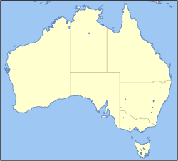
David Horton's 1996 representation of Tindale's map shows the lands of the Guugu Yimithirr people extending from south of Hope Vale to an area which covers Lizard Island. [4] The Great Barrier Reef Marine Park Authority states on their website that the traditional lands of the "Guugu Yimidhirr Warra Nation" extend from Lizard Island to the Hopevale region. [5] The website "Dingaals Lizard Island" states that the island has been in the custodianship of the Dingaal people (possibly a clan name) for thousands of years. [6] The Dingaals called the island "Dyiigurra", and the website mentions that "local Dingiil Aboriginal people have also been known to call the island Jiigurru". [7] According to the Cairns Institute [8] and Queensland Parks and Wildlife Service, the Dingaal people are the traditional owners of the Lizard Island group. [9]

Post-contact history

"Natives of Endeavour River in a canoe, fishing." From Phillip Parker King's Survey (1818) NATIVES OF ENDEAVOUR RIVER IN A CANOE, FISHING.jpg
"Natives of Endeavour River in a canoe, fishing." From Phillip Parker King's Survey (1818)

Lt. James Cook anchored at the mouth of the Endeavour River at the site of modern Cooktown, on 11 June 1770 after their ship, the HM Bark Endeavour was damaged on a reef, and stayed in the area for seven weeks while repair work was done on the hull. Though the modern population was displaced and pushed 30 miles northwards, this was the traditional land of the Guugu Yimithirr. The expedition's members found them to be quite friendly, though they initially kept their distance. After a month, the Europeans were approached by five men, and an amicable relationship was established, as they were shown the Endeavour. The day after, things deteriorated quickly when, while visiting the Endeavour they found a catch of local turtles, and expected a share of the harvest, which Cook, already strained to feed his own, declined to do. He offered them bread, which they refused with disgust. Different concepts of hospitality and the rules of sharing clashed. Soon after, the natives set fire to grass in the bay, and in retaliation, some received injuries from shot. [10]

"Manner in which Natives of the East Coast strike turtle." From Phillip Parker King's Survey (1818) Manner in which the natives of the East Coast Stirke Turtle.jpg
"Manner in which Natives of the East Coast strike turtle." From Phillip Parker King's Survey (1818)

One of the members of the crew, Joseph Banks's botanical draughtsman Sydney Parkinson, set down in his journal (published posthumously as A Journal of a Voyage to the South Seas ) a sketch of the local people. He described them as diminutive and small boned, agile, their skin painted with red and white ochre, with wood-sooty skin and generally given to shaving their hair off. They practised nose piercing. Women wore a feather headdress. They used wood from the ficus riduola as a rasp to sharpen their spears, which were tipped with bone. Their languages was quite mellifluous, with clear enunciation. [11]

Captain Cook left a few pigs on the land, and they bred quickly, to become a major local source of food. [12]

The tribes of the area around Cooktown were decimated, the Guugu Yimithirr being "substantially exterminated", [1] by a variety of factors: large-scale massacres, the kidnapping of women for rape and the abduction of their children, together with the lethal impact of consuming the opium that Chinese contractors paid to them for their work as hired labourers, and alcohol abuse. [13]

On 20 February 1879 there were 28 Aboriginal men shot and drowned at Cape Bedford. Cooktown-based Native Police Sub-inspector Stanhope O'Connor with his troopers hunted down and trapped in a narrow gorge, a group of 28 Guugu-Yimidhirr men and 13 women. None of the men escaped: 24 were shot down on the beach, while four swam into the sea, never to be seen again. [14]

In 1885 a curfew was imposed on them, disallowing their movement after dusk. In the same year, while delayed on his journey to Kaiser-Wilhelmsland (German New Guinea), the Lutheran missionary Johann Flierl founded the Elim Aboriginal Mission some 230 miles (370 km) to the north of Cooktown, at Cape Bedford, and the following year the governance of the mission was assumed by the G. H. Schwartz, who renamed it Hope Vale. He stayed on with his converted congregation right through to the Second World War, when the population was relocated inland from Rockhampton. Schwartz, who had been there since the age of 19 and who had forgotten to take naturalisation, had mastered the language, contributing greatly to the retention of traditional knowledge, [15] was interned as an enemy alien at 74. [16] The colder climate had serious consequences for the displaced congregation, and many died. [3]

Language

Guugu Yimidhirr, meaning 'language/speaking (guugu) 'this way' (yimi-thirr), [17] was one of the earliest Australian languages to be recorded, since Sydney Parkinson took down a list of 200 words [18] during Captain Cook's stop-over in the area in 1770. The major dialects are dhalun-dhirr, spoken on the coastal areas, and waguurr-ga, the inland vernacular. [1] It is still spoken by approximately 200 people, and was listed by Peter Austin as one of the languages at immediate risk of extinction.

Guugu Yimithirr had several dialects: dhalan-dhirr ('with the sea'); wagurrr-ga ('of the outside'); guugu nyiiguudyi; guugu nyalaadyi; guugu yinaa and guugu diirrurru. Because they intermarried widely with tribes speaking other tongues, it was not unusual for Guugu Yimithirr people to be familiar with several languages. [19]

The word kangaroo

Cook reported sighting on Sunday 24 June 1770 an animal which was:

of a light mouse Colour and the full size of a Grey Hound, and shaped in every respect like one, with a long tail, which it carried like a Grey hound; in short, I should have taken it for a wild dog but for its walking or running, in which it jumpd like a Hare or Deer. [20]

Sir Joseph Banks entered into his journal that the natives called it a "Kangooroo". The animal was thereafter called by this name by Europeans after settlement began. When Captain Phillip King stopped over on the same coast in 1820, however, and made the same enquiry, he was told that the animal in question was called minnar/meenuah. There arose an urban legend that in fact what the word "kangaroo" must have meant, when the Indigenous people of the Endeavour River responded to the incomprehensible English query, was "I don't know". Light was shed on the point by the American anthropologist John Haviland, who studied the Guugu Yimithirr language intensively from 1971 onwards. He discovered that in fact a word like "kangaroo" did exist in Guugu Yimithirr, namely gangurru. This denoted however a species, the large grey kangaroo, [lower-alpha 1] that was relatively rare in the coastal territory, while the other word reported by King was an approximation to their word for meat or edible animal (minha). Cook's report and reputation as a precise observer was vindicated. [22] [23]

Society and customs

Guugu Yimithirr practice certain forms of social avoidance. The language itself has a form of avoidance language in which, speaking in the presence of certain family members (like a man's father-in-law or brother-in-law), one must adopt a different vocabulary from that normally employed. [24] In everyday conversation 'the man is going' is bama dhaday. In the presence of certain kin, this must be altered to yambaal bali. [25] [26] Speaking was totally forbidden in the presence of one's mother-in-law, one being obliged to sit, with bowed head, silently (guugu-mu). [27]

The system of spatial coordination inscribed in the language is totally different from that in Western languages, where the reference system is relative with respect to the subject. In Guugu Yimidhirr, as in Kayardild space is rendered in absolute terms, [28] like the cardinal points, north, south, east, west, independent of whether something is in front of, behind, to the left or right of a person. The language thus provides them with a mental map, allowing quite a precise dead-reckoning of all points around them wherever they are. [29] For example, if your Guugu Yimidhirr guest, on leaving your house, had to inform you he or she had left her tobacco behind, they would be required to state grammatically in their native language something like: I left it on the southern table in the western side of your house. [30]

Alternative names

Source: Tindale 1974 , p. 176

Some words

Notes

  1. Haviland in 1979 wrote that [21] that gangurru denotes the 'black kangaroo'. Guugu Yimithirr distinguishes in everyday speech 10 varieties, the others being: gadaar (small wallaby); bawurr (rock wallaby); bibal (small scrub kangaroo); dyadyu (kangaroo rat); nharrgali (red kangaroo); ngurrumugu (large black kangaroo); walurr (female kangaroo); wudul (whip-tail kangaroo) and the dhulmbanu (grey wallaroo). In brother-in-law avoidance speech all 10 varieties were referred to by one word daarraalngan
  2. In one's brother-in-law's presence one would say this diffierently, in respect speech,Ngayu gudhubay bambanga-nhu. (Haviland 1979, p. 369)

Citations

  1. 1 2 3 Haviland 1979, p. 366.
  2. Tindale 1974, p. 176.
  3. 1 2 Haviland 1987, pp. 167, 169.
  4. Horton, David R. (1996). "Map of Indigenous Australia". AIATSIS . Retrieved 12 April 2024.
  5. "Reef Traditional Owners". Great Barrier Reef Marine Park Authority . Retrieved 12 April 2024.
  6. "Home". Dingaals Lizard Island. Retrieved 12 April 2024.
  7. "History". Dingaals Lizard Island. Retrieved 12 April 2024.
  8. "An Update on the Lizard Island Archaeological Project: Investigating Dingaal Seascapes on the Great Barrier Reef, Far North Queensland". The Cairns Institute. 1 September 2017. Retrieved 12 April 2024.
  9. "Lizard Island: Nature, culture and history". Parks and forests. 22 January 2024. Retrieved 12 April 2024.
  10. Coutts 2013, pp. 92–94.
  11. Parkinson 2004, p. 189.
  12. Dixon 2011, p. 223.
  13. Haviland 1987, pp. 166–167.
  14. Ørsted-Jensen 2011, pp. 54–55 & 126..
  15. Dixon 2011, p. 222.
  16. Dixon 2011, p. 226.
  17. Deutscher 2016, p. 161.
  18. Parkinson 2004, pp. 191–193.
  19. Haviland 1987, p. 169.
  20. Haviland 1987, pp. 164–165.
  21. Haviland 1979, p. 371.
  22. Haviland 1987, pp. 164–166.
  23. Deutscher 2016, pp. 159–160.
  24. Haviland 1979, pp. 365–303.
  25. Austin 2008.
  26. Haviland 1987, pp. 161–139.
  27. Haviland 1979, p. 369.
  28. Evans 2011, p. 209.
  29. Kovecses 2006, pp. 14–15.
  30. Regier 1996, p. 21.
  31. Haviland 1979, p. 375.
  32. Haviland 1979, p. 368.

Sources

Related Research Articles

<span class="mw-page-title-main">Kangaroo</span> Marsupial of the family Macropodidae

Kangaroos are marsupials from the family Macropodidae. In common use the term is used to describe the largest species from this family, the red kangaroo, as well as the antilopine kangaroo, eastern grey kangaroo, and western grey kangaroo. Kangaroos are indigenous to Australia and New Guinea. The Australian government estimates that 42.8 million kangaroos lived within the commercial harvest areas of Australia in 2019, down from 53.2 million in 2013.

<span class="mw-page-title-main">Australian Aboriginal religion and mythology</span> Ritual and traditional history of the Indigenous peoples of Australia

Australian Aboriginal religion and mythology is the sacred spirituality represented in the stories performed by Aboriginal Australians within each of the language groups across Australia in their ceremonies. Aboriginal spirituality includes the Dreamtime, songlines, and Aboriginal oral literature.

<span class="mw-page-title-main">Endeavour River National Park</span> Protected area in Queensland, Australia

Endeavour River National Park is a national park in Queensland, Australia, gazetted to protect and preserve some of the natural and cultural resources in and around the mouth of the Endeavour River, immediately north of the small town of Cooktown. The park is located 1,561 kilometres (970 mi) northwest of Brisbane.

Guugu Yimithirr, also rendered Guugu Yimidhirr, Guguyimidjir, and many other spellings, is an Australian Aboriginal language, the traditional language of the Guugu Yimithirr people of Far North Queensland. It belongs to the Pama-Nyungan language family. Most of the speakers today live at the community of Hope Vale, about 46 kilometres (29 mi) from Cooktown. However, as of June 2020 only about half of the Guugu Yimithirr nation speak the language. As such, efforts are being made to teach it to children. Guugu Yimithirr is the source language of the word kangaroo.

<span class="mw-page-title-main">Laura, Queensland</span> Town in Queensland, Australia

Laura is a rural town and locality in the Shire of Cook, Queensland, Australia. In the 2016 census the locality of Laura had a population of 228 people.

<span class="mw-page-title-main">Hope Vale, Queensland</span> Town in Queensland, Australia

Hope Vale is a town within the Aboriginal Shire of Hope Vale and a coastal locality split between the Aboriginal Shire of Hope Vale and the Shire of Cook, both in Queensland, Australia. It is an Aboriginal community. In the 2016 census, the locality of Hope Vale had a population of 1,015 people.

<span class="mw-page-title-main">Endeavour River</span> River in Queensland, Australia

The Endeavour River, inclusive of the Endeavour River Right Branch, the Endeavour River South Branch, and the Endeavour River North Branch, is a river system located on Cape York Peninsula in Far North Queensland, Australia.

<span class="mw-page-title-main">Vera Scarth-Johnson</span> British born Australian botanist and botanical illustrator

Vera Scarth-Johnson was a noted botanist and botanical illustrator who is also remembered for her continual efforts to teach others to treasure the flora and environment of Australia and, in particular, the botanically rich region of Cooktown and the Endeavour River Valley, on Cape York Peninsula, in far northern Queensland.

<span class="mw-page-title-main">Dharawal</span> Australian Aboriginal people of southern and south western areas of Sydney

The Tharawal people and other variants, are an Aboriginal Australian people, identified by the Yuin language. Traditionally, they lived as hunter–fisher–gatherers in family groups or clans with ties of kinship, scattered along the coastal area of what is now the Sydney basin in New South Wales.

<span class="mw-page-title-main">Shire of Cook</span> Local government area in Queensland, Australia

The Shire of Cook is a local government area in Far North Queensland, Australia. The Shire covers most of the eastern and central parts of Cape York Peninsula, the most northerly section of the Australian mainland.

<span class="mw-page-title-main">Normanby River</span> River in northern Queensland, Australia

The Normanby River, comprising the East Normanby River, the West Normanby River, the East Normanby River North Branch, the East Normanby River South Branch and the Granite Normanby River, is a river system in Far North Queensland, Australia.

<span class="mw-page-title-main">First voyage of James Cook</span> Combined Royal Navy and Royal Society expedition to the south Pacific

The first voyage of James Cook was a combined Royal Navy and Royal Society expedition to the south Pacific Ocean aboard HMS Endeavour, from 1768 to 1771. It was the first of three Pacific voyages of which James Cook was the commander. The aims of this first expedition were to observe the 1769 transit of Venus across the Sun, and to seek evidence of the postulated Terra Australis Incognita or "undiscovered southern land".

<span class="mw-page-title-main">Cape Bedford Mission</span> Christian mission in Queensland, Australia

The Cape Bedford Mission was the first Christian mission on the Cape York Peninsula of Queensland, Australia. It is the oldest surviving mission in northern Queensland. It is at South Cape Bedford within the present-day locality of Hope Vale.

<span class="mw-page-title-main">Cooktown, Queensland</span> Town in Queensland, Australia

Cooktown is a coastal town and locality in the Shire of Cook, Queensland, Australia. Cooktown is at the mouth of the Endeavour River, on Cape York Peninsula in Far North Queensland where James Cook beached his ship, the Endeavour, for repairs in 1770. Both the town and Mount Cook which rises up behind the town were named after James Cook.

<span class="mw-page-title-main">Aboriginal Shire of Hope Vale</span> Local government area in Queensland, Australia

The Aboriginal Shire of Hope Vale is a local government area in Far North Queensland, Queensland, Australia, north of the town of Cooktown. The majority of the Shire consists of Deed of Grant land that is held for the benefit of Aboriginal people particularly concerned with the land and their ancestors and descendants.

<span class="mw-page-title-main">Gugu-Badhun</span> Aboriginal Australian people of the Upper Burdekin region of northern Queensland

The Gugu Badhun are an Aboriginal nation whose country is located in the Upper Burdekin region of northern Queensland. Gugu Badhun country is approximately 220 km northwest of Townsville and includes the small township of Greenvale as well as a number of pastoral stations. The most comprehensive and up-to-date description of the nation is found in the book Gugu Badhun: People of the Valley of Lagoons, published in 2017.

The Dyirbal, also called Jirrbal, are an Aboriginal Australian people living in northern Queensland, both one tribe and a group of related contiguous peoples included under that label as the Dyirbal tribes. They live on the upper Murray river of the Atherton Tableland. Their name is used as a generic term to refer specifically to one of eight groups, the others being Yidinji, Ngadyan, Mamu, Girramay, Wargamay, Waruŋu and Mbabaɽam.

The Yaygir, Yuraygir, or Yaegl, are an Australian Aboriginal tribe who traditionally live and lived in and around Yamba and Maclean, New South Wales.

The Kokokulunggur are an indigenous Australian people of North Queensland.

The Dingaal people, also known as Walmbarddha or Walmbaria, are an Aboriginal Australian people of Cape York Peninsula in northern Queensland.