Kosrae International Airport | |||||||||||
|---|---|---|---|---|---|---|---|---|---|---|---|
 | |||||||||||
| Summary | |||||||||||
| Airport type | Public | ||||||||||
| Location | Okat | ||||||||||
| Elevation AMSL | 11 ft / 3 m | ||||||||||
| Coordinates | 05°21′25″N162°57′30″E / 5.35694°N 162.95833°E | ||||||||||
| Map | |||||||||||
 Kosrae International Airport | |||||||||||
 | |||||||||||
| Runways | |||||||||||
| |||||||||||
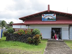
Kosrae International Airport( IATA : KSA, ICAO : PTSA, FAA LID : TTK) is an airport serving Kosrae, the easternmost state of the Federated States of Micronesia. [1] [2] It is located on an artificial island within the fringing reef about 150 meters from the coast and is connected to the main island by a causeway.
Contents
The airport has been continuously served by the United Airlines (formerly Continental Micronesia) Island Hopper service between Guam and Honolulu, which stops twice weekly at Kosrae in each direction. Kosrae is three jogs from both Guam and Honolulu.