
Istria is the largest peninsula to border the Adriatic Sea. Located at the top of the Adriatic between the Gulf of Trieste and the Kvarner Gulf, the peninsula is shared by three countries: Croatia, Slovenia, and Italy, 90% of its area being part of Croatia. Most of Croatian Istria is part of Istria County.

Istria County is the westernmost county of Croatia which includes the majority of the Istrian peninsula.

Umag is a coastal town in Istria, Croatia.

Novigrad is a town in Istria County in western Croatia. It is also sometimes referred to as Novigrad Istarski to distinguish it from three other Croatian towns of the same name.

Žminj is a municipality and small town in Istria, Croatia, 15 km south of Pazin.

Grožnjan is a settlement and municipality in Croatia. It is part of Croatia's Istria County, which takes up most of the Istrian peninsula. 39% of the municipality's population is Italian.

Vrsar is a small seaside town and a municipality in Istria, Croatia located 9 kilometers south of Poreč. The historical center is located on top of a hill, including the St. Martin parish church and the 40-meter high bell tower. In the 20th century, the town expanded down the hill, into the surrounding area. It is a popular summer destination with large campsites, private accommodation units and a modern marina. It is the home of the large Koversada Naturist Campsite, the oldest in Istria.
Lanišće is a village and municipality in the mountainous Ćićarija area, Istria, Croatia. In 2011, the population of the village itself is 88, with a total of 329 residents in the municipality. Over 92.40% of the population are Croats. There are fourteen settlements in the municipality: Brest, Brgudac, Dane, Jelovice, Klenovšćak, Kropinjak, Lanišće, Podgaće, Prapoće, Račja Vas, Rašpor, Slum, Trstenik and Vodice.

Ližnjan is a village and municipality in Istria, Croatia. It has high biodiversity.
Raša is a small town and a municipality in Istria, Croatia. The town was created in the 1930s as a coal mining town under the Italian government.
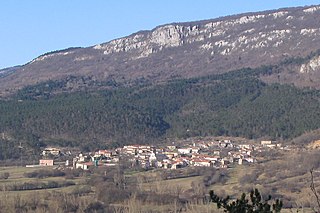
Grimalda is an ancient village or hamlet in Istria, Croatia, mentioned for the first time in 1202. It is located on a 447 meters hilltop. This place is also called Belvedere d'Istria because of the magnificent views.

Brovinje is a small settlement/hamlet, in Istria County in Croatia, with a little more than 50 houses in 1950. It is located in the Labinština peninsula of Istria County, Croatia. Overlooking the Gulf of Kvarner in the northern Adriatic Sea including the island of Croatian: Cres, Italian: Cherso. It is located 13 km south-east of Labin and 3 km north of Koromačno/Valmazzinghi. The first written record with the name Brovinje is recorded in the old St. Lucia church books on birth, marriages and deaths in 1705 which are held in Pazin, Istria. Brovinje is a hamlet which is under the Raša municipality.

Koromačno is a small hamlet adjacent to the cement factory for which it was built in the early 1900 for the workers. It is also a small port to accept small cargo ships to carry the cement to other placed to be processed. It is located in the southernmost tip of the Croatian: Labinština, Italian: L'Albonese peninsula in Istria County in Croatia. It is nestled between Croatian: Crna Punta and Croatian: Ubac on the Gulf of Quarnero in the Adriatic Sea. It is one of the newest hamlet not even 100 years old. It is located about 15 km from Croatian: Labin / Italian: Albona, 1 km from Croatian: Brovinje, 3 km from Croatian: Skitača.

Istrian Italians are an ethnic group from the Adriatic region of Istria in modern northwestern Croatia and southwestern Slovenia. Istrian Italians descend from the original Latinized population of Roman Histria, from the Venetian-speaking settlers who colonized the region during the time of the Republic of Venice, and from the local Croatian people who culturally assimilated.

Italians of Croatia are an autochthonous historical national minority recognized by the Constitution of Croatia. As such, they elect a special representative to the Croatian Parliament. There is the Italian Union of Croatia and Slovenia, which is a Croatian-Slovenian joint organization with its main site in Rijeka, Croatia and its secondary site in Koper, Slovenia.

Skitača is a small hamlet in northwest Croatia, in the eastern coast of Istria County, and is one of many settlements scattered in the County. These small settlements started to form in the 13-14th century continuing into the 19th century when Napoleon occupied the area. Even later when the Austria-Hungary got this region. During the early centuries most of the people came from the eastern parts of Europe as workers imported by rich landowners. Later, some came as refugees from territories taken by the Tatars and Turkish. Some of people which took refuge were Croats, Montenegrins, Serbs, Romanians, Bosnians, Albanians, Greeks, and other Eastern Europeans.

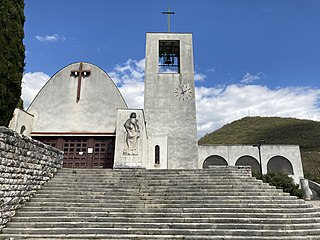
Sveti Lovreč Labinski is a small hamlet in Raša municipality, Istria County, Croatia. The church, built in the early 17th century, is also the Parish church and has the same name as the hamlet. During the Austria-Hungary occupation, it belonged to the municipality of Vlahovo, just west of the Municipality of Cerovica.
Viškovići is a small hamlet in the south eastern Labinština peninsula in Istria County, Croatia.
Drenje is a small hamlet in Istria County, Croatia. It is situated just off the coast of the Gulf of Quarnero in the Adriatic Sea. It is part of the Labinština peninsula in Istria.

Borut is a village in Istria, Croatia. The name Borut or Borutto is the common name for several small villages and hamlets: Budaki, Buzići, Čuleti, Dausi, Grdinići, Grgurići, Moloni, Orlovići, Poljanice and Sandalji. When Istria was part of the Kingdom of Italy, the village was called Borutto di Bogliuno which was located in the Province of Pola.
