Kredenbach | |
|---|---|
 Kredenbach | |
 Coat of arms | |
Location of Kredenbach  | |
 Kredenbach  Kredenbach | |
| Coordinates: 50°57′46″N08°02′32″E / 50.96278°N 8.04222°E | |
| Country | Germany |
| State | North Rhine-Westphalia |
| Admin. region | Arnsberg |
| District | Siegen-Wittgenstein |
| Town | Kreuztal |
| Founded | 1319 |
| Area | |
• Total | 5.2 km2 (2.0 sq mi) |
| Elevation | 299 m (981 ft) |
| Time zone | UTC+01:00 (CET) |
| • Summer (DST) | UTC+02:00 (CEST) |
| Postal codes | 57223 |
| Dialling codes | 02732 |
| Vehicle registration | SI |
| Website | www.kredenbach.de |


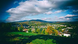
Kredenbach is a constituent community of Kreuztal, Siegen-Wittgenstein, North Rhine-Westphalia, Germany.
Contents
It has a population of 1649 inhabitants. [1]
