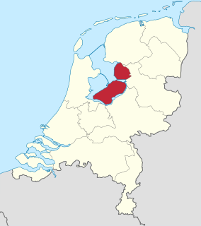
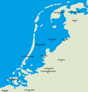
Flevoland is the 12th and youngest province of the Netherlands, established in 1986, when the Southern and Eastern Flevopolders, together with the Noordoostpolder were merged into one provincial entity. It is in the centre of the country in the former Zuiderzee, which was turned into the freshwater IJsselmeer by the closure of the Afsluitdijk in 1932. Almost all of the land belonging to Flevoland was reclaimed in the 1950s and 1960s while splitting the Markermeer and Bordering lakes from the IJsselmeer. As to dry land, it is the smallest province of the Netherlands at 1,412 km2 (545 sq mi), but not gross land as that includes much of the waters of the fresh water lakes (meres) mentioned. The province has a population of 423,021 as of January 2020 and consists of six municipalities. Its capital is Lelystad and its most populous city is Almere.
A polder is a low-lying tract of land that forms an artificial hydrological entity, enclosed by embankments known as dikes. The three types of polder are:
- Land reclaimed from a body of water, such as a lake or the seabed
- Flood plains separated from the sea or river by a dike
- Marshes separated from the surrounding water by a dike and subsequently drained; these are also known as koogs, especially in Germany
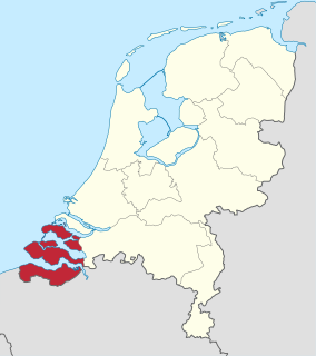
Zeeland is the westernmost and least populous province of the Netherlands. The province, located in the south-west of the country, borders North Brabant to the east, South Holland to the north, and the country of Belgium to the south and west. It consists of a number of islands and peninsulas and a strip bordering the Flemish provinces of East and West Flanders. Its capital is Middelburg with a population of 48,544 as of November 2019, the largest municipality in Zeeland is Terneuzen. Zeeland has two seaports: Vlissingen and Terneuzen. Its area is 2,934 square kilometres (1,130 sq mi), of which 1,151 square kilometres (440 sq mi) is water, and it has a population of 383,689 as of November 2019.

The Zuiderzee Works is a man-made system of dams and dikes, land reclamation and water drainage work, in total the largest hydraulic engineering project undertaken by the Netherlands during the twentieth century. The project involved the damming of the Zuiderzee, a large, shallow inlet of the North Sea, and the reclamation of land in the newly enclosed water using polders. Its main purposes are to improve flood protection and create additional land for agriculture.
Neder-Betuwe is a municipality in the province of Gelderland, in the east of the Netherlands. On 1 April 2003, it was established as the new name of the redivided municipality of Kesteren. Neder-Betuwe counted 25,042 inhabitants on 1 january 2022.

Beemster is a former municipality in the Netherlands, in the province of North Holland. The Beemster is the first so-called polder in the Netherlands that was reclaimed from a lake, the water being extracted from the lake by windmills. The Beemster Polder was dried during the period 1609 through 1612. It has preserved intact its well-ordered landscape of fields, roads, canals, dykes and settlements, laid out in accordance with classical and Renaissance planning principles. A grid of canals parallels the grid of roads in the Beemster. The grids are offset: the larger feeder canals are offset by approximately one kilometer from the larger roads.
A koog or groden is a type of polder found on the North Sea coast of Germany that is established by the construction of dykes enclosing the land which is then drained to form marshland. This type of land reclamation is also used along rivers. In general, a koog is protected by embankments known as dykes (Deiche).

The Ringvaart is a canal in the province of North Holland, the Netherlands. The Ringvaart is a true circular canal surrounding the Haarlemmermeer polder and forms the boundary of the Haarlemmermeer municipality. Ringvaart is also the name of the dike bordering the canal.

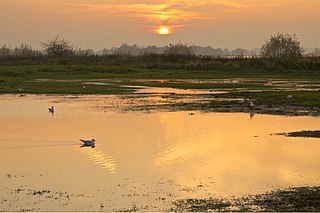
De Biesbosch National Park is one of the largest national parks of the Netherlands and one of the last extensive areas of freshwater tidal wetlands in Northwestern Europe. The Biesbosch consists of a large network of rivers and smaller and larger creeks with islands. The vegetation is mostly willow forests, although wet grasslands and fields of reed are common as well. The Biesbosch is an important wetland area for waterfowl and has a rich flora and fauna. It is especially important for migrating geese.
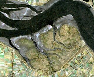
Saeftinghe or Saaftinge was a town in the southwest Netherlands, located in eastern Zeelandic Flanders, near Nieuw-Namen. It existed until 1584. It is now a swamp known as the Drowned Land of Saeftinghe and an official nature reserve area. The land is a crosspoint where the river Scheldt meets the salty waters of the North Sea in the estuary Western Scheldt. It is a treacherous place where the tides easily consume large stretches of land in a matter of seconds and must not be explored without an experienced guide.

The Alblasserwaard is a polder in the province of South Holland, Netherlands. It is mainly known for the windmills of Kinderdijk, located near the village of Kinderdijk in the polder's northwestern part.

Aartswoud is an unincorporated village in the Dutch province of North Holland, part of the municipality of Opmeer. It lies about twelve kilometres (7.5 mi) northeast of Heerhugowaard.
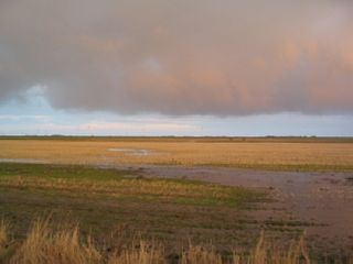
Flood control is an important issue for the Netherlands, as due to its low elevation, approximately two thirds of its area is vulnerable to flooding, while the country is densely populated. Natural sand dunes and constructed dikes, dams, and floodgates provide defense against storm surges from the sea. River dikes prevent flooding from water flowing into the country by the major rivers Rhine and Meuse, while a complicated system of drainage ditches, canals, and pumping stations keep the low-lying parts dry for habitation and agriculture. Water control boards are the independent local government bodies responsible for maintaining this system.
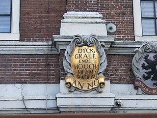
In the Netherlands, a water board, water council or water authority is a regional governing body solely charged with the management of surface water in the environment, acting independently of administrative governing bodies like provinces and municipalities. In general they're responsible for managing rivers and canals, flowing watercourses and drainage issues, water collection, preventing of flooding and erosion and take care there's enough water for citizens. Specifically they manage polder systems, water levels, water barriers and locks, enforcements, water quality and sewage treatment in their respective regions. The concept of a coordinating "High Water Authority" (Hoogheemraadschap) origins in what now is the province of South Holland in the 12th century.
Baalhoek is a hamlet in the Dutch province of Zeeland. It is located in the municipality of Hulst, about 5 km east of Kloosterzande on the dyke of the Westerschelde.

The Sophia Polder is a polder to the south of Oostburg, Netherlands. It is one of a group of polders in the Ottevaere en Van Damme polder complex. A refuge for water birds, it has been a designated nature reserve since 2006.

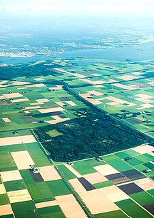
Land reclamation in the Netherlands has a long history. As early as in the 14th century, the first reclaimed land had been settled. Much of the modern land reclamation has been done as a part of the Zuiderzee Works since 1918.
Sabbinge Castle is a small castle in Oud-Sabbinge, on the former island Wolphaartsdijk

Saeftinghe Castle was a castle on the northeast tip of the drowned land of Saeftinghe. It was destroyed by flooding in the 16th century, and now its exact location is unknown.

Zaamslag Castle was a Motte-and-bailey castle in Zeelandic Flanders, the motte remains. It is called Torenberg.

