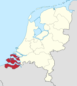
Zeeland is the westernmost and least populous province of the Netherlands. The province, located in the southwest of the country, borders North Brabant to the east, South Holland to the north, as well as the country of Belgium to the south and west. It consists of a number of islands and peninsulas and a strip bordering the Flemish provinces of East and West Flanders. Its capital is Middelburg with a population of 48,544 as of November 2019, although the largest municipality in Zeeland is Terneuzen. Zeeland has two seaports: Vlissingen and Terneuzen. Its area is 2,933 square kilometres (1,132 sq mi), of which 1,154 square kilometres (446 sq mi) is water; it had a population of about 391,000 as of January 2023.
The Delta Works is a series of construction projects in the southwest of the Netherlands to protect a large area of land around the Rhine–Meuse–Scheldt delta from the sea. Constructed between 1954 and 1997, the works consist of dams, sluices, locks, dykes, levees, and storm surge barriers located in the provinces of South Holland and Zeeland.

The Eastern Scheldt is a former estuary in the province of Zeeland, Netherlands, between Schouwen-Duiveland and Tholen on the north and Noord-Beveland and Zuid-Beveland on the south. It also features the largest national park in the Netherlands, founded in 2002.

The Scheldt is a 435-kilometre-long (270 mi) river that flows through northern France, western Belgium, and the southwestern part of the Netherlands, with its mouth at the North Sea. Its name is derived from an adjective corresponding to Old English sċeald ("shallow"), Modern English shoal, Low German schol, West Frisian skol, and obsolete Swedish skäll ("thin").

Walcheren is a region and former island in the Dutch province of Zeeland at the mouth of the Scheldt estuary. It lies between the Eastern Scheldt in the north and the Western Scheldt in the south and is roughly the shape of a rhombus. The two sides facing the North Sea consist of dunes and the rest of its coastline is made up of dykes. Middelburg, the provincial capital, lies at Walcheren's centre. Vlissingen, 9 kilometres (5.6 mi) to the south, is the main harbour and the third municipality is Veere.

Sluis is a city and municipality located in the west of Zeelandic Flanders, in the south-western Dutch province of Zeeland.

Zeelandic Flanders is the southernmost region of the province of Zeeland in the south-western Netherlands. It lies south of the Western Scheldt that separates the region from the remainder of Zeeland and the Netherlands to the north. Zeelandic Flanders is bordered to the south and to the east by Belgium.

Zuid-Beveland is part of the province of Zeeland in the Netherlands north of the Western Scheldt and south of the Eastern Scheldt.

Breskens is a harbour town on the Westerschelde in the municipality of Sluis, Netherlands. Its population is 4,787.
The Canal through Zuid-Beveland in the southwest Netherlands is the westernmost of two canals crossing the Zuid-Beveland peninsula. It connects the Western Scheldt near Hansweert via a lock complex and the Eastern Scheldt with which it has an open connection.

The Canal through Walcheren in the Netherlands crosses the east of Walcheren. It connects the Westerschelde and the Veerse Meer.
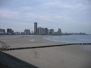
Vlissingen, historically known in English as Flushing, is a municipality and a city in the southwestern Netherlands on the former island of Walcheren. With its strategic location between the Scheldt river and the North Sea, Vlissingen has been an important harbour for centuries. It was granted city rights in 1315. In the 17th century Vlissingen was a main harbour for ships of the Dutch East India Company (VOC). It is also known as the birthplace of Admiral Michiel de Ruyter.
Ellewoutsdijk is a village in the Dutch province of Zeeland. It is a part of the municipality of Borsele, and lies about 18 km east of Vlissingen.
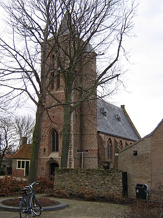
Ritthem is a village in the Dutch province of Zeeland. It is located in the municipality of Vlissingen, about 4 kilometres east of the city.

The Western Scheldt Tunnel is a 6.6-kilometre (4.1 mi) tunnel in the Netherlands that carries highway N62 under the Western Scheldt estuary between Ellewoutsdijk and Terneuzen. It is the longest tunnel for highway traffic in the Netherlands.

Reimerswaal is a municipality in the province of Zeeland in the southwestern Netherlands on Zuid-Beveland, named after the lost city. The municipality had a population of 22,896 in 2021, and has a surface area of 242.42 km2 (93.60 sq mi) of which 140.62 km2 (54.29 sq mi) is water. The central town Yerseke is known for trade in mussels and oysters. Kruiningen is known for the former ferry from Kruiningen to Perkpolder which was in service up to 2003. The municipality of Reimerswaal was established in 1970, from the aggregation of the municipalities Krabbendijke, Kruiningen, Rilland-Bath, Waarde, and Yerseke.

Hansweert is a village in the southwest Netherlands. It is located on the Zuid-Beveland peninsula, in the municipality of Reimerswaal, Zeeland.

The Inundation of Walcheren was the intentional, but uncontrolled military inundation, effected by bombing the sea dikes of the former island of Walcheren in Zeeland by the Allies on and after 3 October 1944 in the context of Operation Infatuate during the Battle of the Scheldt after the Allied Invasion of Normandy during World War II. Though the inundation was justified by military necessity, it is controversial whether it was proportional in view of the predictable devastating effects for the civilian population, and the ecology of the island. The fact that the breaches in the sea dikes of the island remained open for a very long time, subjecting the island to the full impact of the twice-daily tides, caused severe damage to agricultural land and infrastructure, and severe hardship for the civilian population. Leaving the breaches open for such a long time, which was unavoidable due to the war-time lack of resources making closing impossible, subjected them to scouring by the tides, that widened and deepened them to such an extent that closing them eventually became extremely difficult, necessitating the development of new dike-building techniques, such as the use of caissons. The last breach was closed on 23 October 1945 and the draining of the island took until early 1946. Only after that could rebuilding the infrastructure and reconstructing the housing stock and the island's economy start. Walcheren was spared during the North Sea Flood of 1953 that devastated many other parts of Zeeland.
The Hertogin Hedwigepolder was a polder between 1907 and 2022 in Zeeland, Netherlands. A small part of the polder is on Belgian territory.
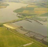
The Zandkreekdam is a compartmentalisation dam located approximately 3 kilometres north of the city of Goes in The Netherlands, which connects Zuid-Beveland with Noord-Beveland, and separates the Oosterschelde from the Veerse Meer.

