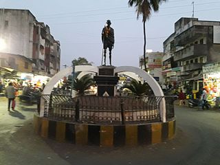
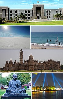
Navsari is an administrative district in the state of Gujarat in India, with its headquarters at Navsari city. The district covers an area of 2,211 square kilometres roughly equal to country like Luxembourg and the US state of Delaware, and had a population of 1,329,672 in 2011 roughly equal to country like Estonia and the US state of Hawaii. The district was formed in 1997 after Valsad district was bifurcated into Valsad and Navsari districts.

Jogwad is a village in the state of Gujarat in western India. It lies near to Indian National Highway 8, about 8 kilometres and is about 260 kilometres (160 mi) from Mumbai, 35 kilometres (22 mi) from Navsari and about 100 kilometres (62 mi) from Saputra hill station.

Nandarkha is a village in the Navsari district in the Indian state of Gujarat. The population was 3,112 at the 2011 Indian census.
Vijalpore is city and a Municipality in Navsari district in the Indian state of Gujarat. The town is located 5 km south-west of Navsari near Surat-Nasik Highway. The town comes under the purview of Surat Metropolitan Region.

Pal Qadiam is a medium size village in Phillaur tehsil of Jalandhar District of Punjab State, India. It is located 3.8 km away from Nagar, 4 km from census town Apra, 45 km from Jalandhar and 121 km from state capital Chandigarh. Pal Qadiam has postal head office in Phillaur which is 10 km away from the village. The village is administrated by a sarpanch who is an elected representative of village as per Panchayati raj (India).
Sultanpur is a medium size village in Phillaur tehsil of Jalandhar District of Punjab State, India. It is located 3 km from census town Apra, 48 km from Jalandhar through Dhuleta-Apra road and 124 km from state capital Chandigarh. Sultanpur has postal head office in Dayalpur which is 2 km away from the village. The village is administrated by a sarpanch who is an elected representative of village as per Panchayati raj (India).
Bachhowal is a medium size village in Phillaur tehsil of Jalandhar District of Punjab State, India. It is located 9.5 km away from Goraya, 43 km from Jalandhar and 117 km from state capital Chandigarh. Bachhowal has postal head office in Bara Pind which is 10 km away from the village. The village is administrated by a sarpanch who is an elected representative of village as per Panchayati raj (India).
Nurewal is a village in Phillaur tehsil of Jalandhar District of Punjab State, India. It is located 2.8 km away from Nagar, 45 km from Jalandhar and 116 km from state capital Chandigarh. Nurewal has postal head office in Phillaur which is 5.3 km away from the village. The village is administrated by a sarpanch who is an elected representative of village as per Panchayati raj (India).
Bansian or Banssian, is a medium size village in Phillaur tehsil of Jalandhar District of Punjab State, India. It is situated on Phillaur-Nawanshahr Road and located 4.6 km from Nagar, 11.3 km from Phillaur, 54 km from Jalandhar and 115 km from state capital Chandigarh. The village is administrated by a sarpanch who is an elected representative of village as per Panchayati raj (India).
Raipur Sagnewal is a village in Phillaur tehsil of Jalandhar District of Punjab State, India. It is located 2 km away from Nagar, 49 km from Jalandhar and 117 km from state capital Chandigarh. Raipur Sagnewal has postal head office in Phillaur which is 5.6 km away from the village. The village is administrated by a sarpanch who is an elected representative of village as per Panchayati raj (India).
Garha is a large village in Phillaur tehsil of Jalandhar District of Punjab State, India. It is situated on Phillaur-Nawanshahr road 1 km away from Phillaur, 45 km from Jalandhar and 120 km from state capital Chandigarh. The village is administrated by a sarpanch who is an elected representative of village as per Panchayati raj (India).
Jhungian Mahansingh is a village in Phillaur tehsil of Jalandhar District of Punjab State, India. It is located 12 km from Nagar, 7 km from postal head office Phillaur, 52 km from Jalandhar and 131 km from state capital Chandigarh. The village is administrated by a sarpanch who is an elected representative of village as per Panchayati raj (India).
Ramgarh is a medium size village in Phillaur tehsil of Jalandhar District of Punjab State, India. It is located 1 km away from postal head office Phillaur, 16 km from Ludhiana, 45 km from district headquarter Jalandhar and 118 km from state capital Chandigarh. The village is administrated by a sarpanch who is an elected representative of village as per Panchayati raj (India).
Jajo Mazara or Jajo Majara is a small size village with the population of only 13 people in Phillaur tehsil of Jalandhar District of Punjab State, India. It is located 11 km away from Goraya, 22.8 km from Phillaur, 30.5 km from district headquarter Jalandhar and 122 km from state capital Chandigarh. The village is administrated by a sarpanch who is an elected representative of village as per Panchayati raj (India).
Bainapur is a small size village in Phillaur tehsil of Jalandhar district of Punjab State, India. It is located 25 km away from Phillaur, 5.8 km from Nurmahal, 27.7 km from district headquarter Jalandhar and 147 km from state capital Chandigarh. The village is administrated by a sarpanch who is an elected representative of village as per Panchayati raj (India).
Bakapur is a village in Phillaur tehsil of Jalandhar district of Punjab State, India. It is located 7 km away from postal head office in Phillaur, 10 km from Goraya, 41.5 km from district headquarter Jalandhar and 115 km from state capital Chandigarh. The village is administrated by a sarpanch who is an elected representative of village as per Panchayati raj (India).
Killi is a village in Shahkot in Jalandhar district of Punjab State, India. It is located 4 kilometres (2.5 mi) from Shahkot, 22 kilometres (14 mi) from Nakodar, 46 kilometres (29 mi) from district headquarter Jalandhar and 177 kilometres (110 mi) from state capital Chandigarh. The village is administrated by a sarpanch who is an elected representative of village as per Panchayati raj (India).
Chak Guru is a village in Shaheed Bhagat Singh Nagar district of Punjab State, India. It is located 9.2 kilometres (5.7 mi) away from Garhshankar, 17.6 kilometres (10.9 mi) from Balachaur, 17 kilometres (11 mi) from district headquarter Shaheed Bhagat Singh Nagar and 87 kilometres (54 mi) from state capital Chandigarh. The village is administrated by Sarpanch an elected representative of the village.

Kureliya is a village in the Navsari District of Gujarat, India. It is located in the Vansda taluka. Kureliya is located 55 km towards East from Navsari city, 7 km(approximately) towards from Vansda and 325 km from Gandhinagar.