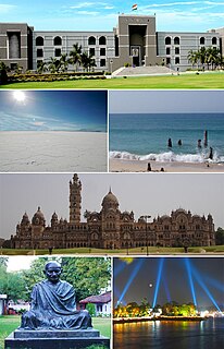
The 2005 Gujarat floods, during the monsoon season, affected the state of Gujarat, India, that included 20 districts, with 10 of them severely affected. 117 of the 225 Tehsils, 11 cities were included, and more than 7,200 villages inundated, with up to 10,000 affected. The cumulative 505 millimetres (19.9 in) of rain left approximately 176,000 people homeless during the flooding that included the drowning of a rare Asiatic lion from the Gir wildlife sanctuary. At least 173 people were killed in the flooding.

Vijalpor is a city and a municipality in Navsari district in the Indian state of Gujarat. The city is under Surat Metropolitan Region. The town is located at a distance of 7 km south of Navsari City off Udhana-Nasik Highway.

Jogwad is a village in the state of Gujarat in western India. It lies near to Indian National Highway 8, about 8 kilometres and is about 260 kilometres (160 mi) from Mumbai, 35 kilometres (22 mi) from Navsari and about 100 kilometres (62 mi) from Saputra hill station.

Foundiougne Department is one of the departments of Senegal, located in the Fatick Region.

Dhanori is a small village in Navsari district in the state of Gujarat, India. It is about 40 kilometres (25 mi) north of the city of Valsad and about 25 kilometres (16 mi) south of the district city of Navsari.

Kuched is a small village in the Jalalpur Taluka, Navsari district in the state of Gujarat, India. Kuched has a big oak tree that covers the entrance of the village and has since become the symbol of the village.
Alipur may refer to the following places:
Degam is a village in Navsari District in the state of Gujarat, India. The population is around 5580.

Simlak is a village in Jalalpore Taluka Navsari district, Gujarat, India.

Maroli is a Town and a Nagar Panchayat in [on 2/10/1997 Navsari new district made from Valsad so Now 'maroli' is in Navsari Navsari district in the state of Gujarat, India. The town is also one of the Satellite towns of Surat Metropolitan Region. Located only 25 km from Surat on Surat-Navsari Highway. Also it is a major junction to reach Navsari, Vesama, Surat, Umbharat village as well Beach, Danti, Dipla, Bhata, Bhinar, Mangrol, Parujan, Nimrai, Vasi, Borsi, Nadod, Maroli Gaam, Arsan, Karakhat, Parsoli, Magob.
Dr. Ratnappa Bharamappa Kumbhar, also called Deshbhakt Ratnappa Kumbhar, was an Indian independence activists from Ichalkaranji, who actively participated in the Indian independence movement. He was one of the persons to sign the Final Draft of the Constitution of India along with B. R. Ambedkar. He received Padma Shri award in 1985. He was Member of the Parliament, Member of Legislative Council and also worked as a Minister of Food and Civil Supplies in Maharashtra Government.

Nandeshwar is a village of Maharashtra state in Solapur district in Mangalwedha tehsil.
Navsari assembly constituency is one of the 182 assembly constituencies of Gujarat. It is located in Navsari district.
Kadia Kumbhar / Kadiya Kumbhar are a Hindu sub-group of the Kumbhar caste, which are found only in Gujarat, India. They are among the Socially and Educationally Backward Classes of Gujarat State.

Maghval, also known as Megwal, is a village in the Kaprada tehsil of Valsad district in Gujarat State, India. It is a small enclave belonging to Gujarat, but located within Nagar Haveli, just south of Silvassa in the Indian Union Territory of Dadra and Nagar Haveli.
Sundelao village is located in Pali Tehsil of Pali district in Rajasthan, India. It is situated 50 km away from Pali, which is both district & sub-district headquarters of Sundelao village. The total geographical area of village is 1279 hectares. Sundelao has a total population of 481 peoples. There are about 89 houses in Sundelao village.

Unai is a village in the Navsari district in the Indian State of Gujarat, India. Unai is connected with Waghai, Chikhli, Saputara, Nasik, Vapi, Dharampur, Shamlaji by state highway. This village situated on Billimora–Waghai narrow gauge railway route. The nearest railway station for broad gauge trains is Bilimora Junction.
Originally, Kumbhar Falia, as its name suggest, was known as a FALIA of nearby village, NAGDHARA. Recently, it was separated as a FALIA of Nagdhara, and recognized as a village of Navsari Tehsil.
Kumbhar Falia, is also the last village, located on the border line of Naavsari and Mahuva tehsils (Taluka).


