Kudo Be'ur | |
|---|---|
 | |
| Country | |
| Region | Debub |
| Capital | Kudo Be'ur |
| Time zone | UTC+3 (GMT +3) |
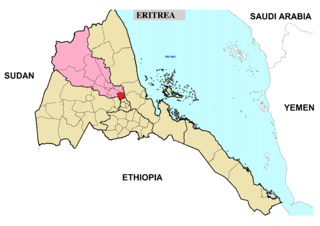
Kudo Be'ur subregion is a subregion in the Debub (Southern) region (Zoba Debub) of Eritrea. Its capital lies at Kudo Be'ur.
Kudo Be'ur | |
|---|---|
 | |
| Country | |
| Region | Debub |
| Capital | Kudo Be'ur |
| Time zone | UTC+3 (GMT +3) |
Kudo Be'ur subregion is a subregion in the Debub (Southern) region (Zoba Debub) of Eritrea. Its capital lies at Kudo Be'ur.

The Southern region is an administrative region of Eritrea. The region was formed on 15 April 1996, from the historical provinces of Seraye and Akele Guzai. It lies along a portion of the national border with Ethiopia. As of 2005, the region had a population of 952,100 compared to a population of 839,700 in 2001. The net growth rate was 11.81 per cent. The total area of the province was 8000.00 km2 and the density was 119.01 persons per km2. The highest point in Eritrea, is Mount Soira 3,018 m (9,902 ft), is located in the region, situated east of Senafe. It shares borders with Central Region in the north, Zoba Northern Red Sea in the east, Gash Barka in the west and Ethiopia in the south. It is the largest region in the country by population.

The six regions of Eritrea are divided into administrative subregions.

Adi Tekelezan subregion is a subregion in the northwestern Anseba region of Eritrea. The capital lies at Adi Tekelezan.

Keren subregion is a subregion in the northwestern Anseba region of Eritrea. Its capital lies at Keren (Cheren).
North Eastern subregion is a subregion in the central Maekel region of Eritrea.
Serejaka subregion is a subregion in the central Maekel region of Eritrea. Its capital lies at Serejaka.
South Western subregion is a subregion in the central Maekel region of Eritrea.
Forto subregion is a subregion in the Gash-Barka region of western Eritrea. Its capital is Forto.
Logo Anseba subregion is a subregion in the eastern Gash-Barka Region of Eritrea. Its capital lies at Logo Anseba.
Adi Keyh subregion is a subregion in the Debub (Southern) region of Eritrea. Its capital lies at Adi Keyh.
Adi Quala subregion is a subregion in the southern Debub region of Eritrea. Its capital lies at Adi Quala.
Areza subregion is a subregion in the Debub (Southern) region of Eritrea. Its capital lies at Areza.
Debarwa subregion is a subregion in the southern Debub region of Eritrea. Its capital lies at Debarwa.
Dekemhare subregion is a subregion in the southern Debub region of Eritrea. Its capital lies at Dekemhare.
Mendefera subregion is a subregion in the Debub (Southern) region of Eritrea. Its capital lies at Mendefera.
Segheneyti subregion is a subregion in the Debub (Southern) region of Eritrea. Its capital lies at Segheneyti.
Senafe subregion is a subregion in the Debub (Southern) region of Eritrea. Its capital is Senafe, and high points include Emba Soira.
Areza is a town in the Debub (Southern) region of Eritrea. It is the capital of the Areza Subregion. It lies to the west of Mendefera. The area is primarily agricultural and contains 20 kebabis.
Kudo Be'ur is a town in Eritrea. It is located in the Debub (Southern) region and is the capital of the Kudo Be'ur district.
Tsorona is a subregion in the southern Debub region of Eritrea. Its old name was Atkaro. The area was a major battle zone during the Eritrean-Ethiopian War.