Related Research Articles

Malappuram, is one of the 14 districts in the Indian state of Kerala, with a coastline of 70 km (43 mi). The most populous district of Kerala, Malappuram is home to around 13% of the total population of the state. The district was formed on 16 June 1969, spanning an area of about 3,554 km2 (1,372 sq mi). It is the third-largest district of Kerala by area. It is bounded by Western Ghats and the Arabian Sea on either side. The district is divided into seven Taluks: Eranad, Kondotty, Nilambur, Perinthalmanna, Ponnani, Tirur, and Tirurangadi.
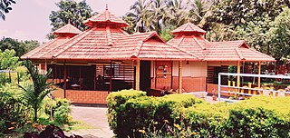
Nilambur is a major town, a municipality and a Taluk in the Malappuram district of the Indian state of Kerala. It is located close to the Nilgiris range of the Western Ghats on the banks of the Chaliyar River. This place is also known as 'Teak Town' because of the abundance of Nilambur teaks, which is a variety of a large, deciduous tree that occurs in mixed hardwood forests. Unlike many Municipalities of India; Nilambur is covered with large amounts of vegetation, making it very scenic.

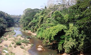
Chaliyar River is the fourth longest river in Kerala at 169 km in length. The Chaliyar is also known as Chulika River, Nilambur River or Beypore River as it is near the sea. Pothukal, Chungathara, Nilambur, Mampad, Edavanna, Kavanoor, Perakamanna, Areekode, Kizhuparamba, Elamaram, Cheekkode, Vazhakkad, Vazhayur, Cheruvadi, Edavannappara, Mavoor, Peruvayal, Feroke and Beypore are some of the towns/villages situated along the banks of the Chaliyar. It mainly flows through Malappuram district. Its tributaries flow through both the districts of Malappuram and Kozhikode. The bank of river Chaliyar in the Nilambur region is also known for its natural Gold fields. Explorations done at the valley of the river Chaliyar in Nilambur have shown reserves of the order of 2.5 million cubic meters of placers with 0.1 gram per cubic meter of gold. It originates at the Ilambaleri hills of Nilgiri Mountains in Nilgiris district, which is also near Wayanad-Malappuram district border. It flows mainly through the erstwhile region of Eranad, and finally empties into the Arabian Sea at Beypore port, opposite to Chaliyam harbour.

Kallai is a small town on the banks of Kallai River which links with the Chaliyar river on the south by a man-made canal. It is in the Kozhikode district of Kerala in south India and is noted for timber trading.
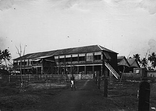
Feroke is a Municipality and a part of Kozhikode metropolitan area under Kozhikode Development Authority (K.D.A) in the Kozhikode district of the Indian state of Kerala.

Mavoor is a town situated in Kozhikode district in Kerala, India. It is 19 km away from Kozhikode city.

Kallayi is one of the rivers in Kerala, India. It originates in Cherikkulathur in the Western Ghats, at an elevation of 45 metres (148 ft) and is 22 km (13.7 mi) long. It is linked to the Chaliyar by a man-made canal on the south side of the small timber village of Kallayi lying on its banks. The Kallayi was known for its timber businesses, but now many of these have been closed down.
Kanjirappuzha (കാഞ്ഞിരപ്പുഴ) is a small tributary of the Chaliyar river in Nilambur taluk of Malappuram district in Kerala, India. The river originates from the mountain region which lies between Malappuram and Kozhikode districts. The river flows through Chaliyar Panchayath in Malappuram district and ultimately join to Chaliyar near Chaliyarmukku where Karimpuzha also meet Chaliyar. The Adyanpara Waterfalls are on the river.
Thottumukkam River is one of the many tributaries of Chaliyar river. It originates from Ambumala near Kakkadampoyil and meets Chaliyar at Areacode. It separates Kozhikode and Malappuram districts of Kerala in Thottumukkam region, hence earning the name Thottumukkampuzha. One branch from Mysoremala and another branch from Odakkayam join at Thottumukkam.
Karimpuzha is the largest tributary of Chaliyar river, Kerala, India. It is very near to Nilambur.
Kuthirappuzha is a tributary of Chaliyar in the Kerala state of India. The river joins Chaliyar at Vadapuram near Nilambur. Kuthirappuzha is originating from forests south-west of Upper Bhavani reservoir in Nilgiris district of Tamil Nadu. It flows through Pookkottum Padam town and on reaching Koorad, Kottappuzha joins with Kuthirappuzha.
Kottappuzha is a tributary of Kuthirappuzha which is a tributary of Chaliyar river in Kerala, India. Kottappuzha originates from the western slopes of Upper Bhavani reservoir in Nilgiris district of Tamil Nadu. Near Kottappuzha palam (bridge), about 1.5 km south of Pookkottumpadam 'Chokkadan puzha' a river from Kozhippara hills and which passes through Chokkad join with Kottappuzha. At Koorad, Kottappuzha meets Kuthirappuzha.
Kizhuparamba or Keezhuparamba is a village and Panchayath on the northern boundary of Malappuram District In Kerala State of India.

Kadalundi is a village in Kozhikode district, Kerala, India. It is a coastal village close to the Arabian Sea. Kadalundi is famous for its bird sanctuary, which is home to various migratory birds during certain seasons and has been recently declared as a bio-reserve. The Kadalundi–Vallikkunnu Community Reserve is the first community reserve in Kerala. The Kadalundi River and the Chaliyar river, two of the longest rivers of Kerala, merges with the Arabian Sea at Kadalundi. The first railway line in Kerala was laid in 1861 from Tirur to Chaliyam through Tanur, Parappanangadi, Vallikkunnu, and Kadalundi.
Edavannappara is a town in the Indian state of Kerala. Edavannappara town is 26 km away from Kozhikode city and 33km away from Malappuram. The towns in Malappuram district like Kondotty, Areekode, Calicut Airport, 19 km) (Nilambur) are located near this town and near the Chaliyar river. The main occupations are sand work, agriculture.

Kakkadampoyil, is a small village in Malappuram district, Kerala, India bordered with Kozhikode district.This is located in Nilambur. The village has recently emerged as a major tourist destination in the district.
Eranad also known as Ernad refers to the erstwhile province in the midland area of Malabar, consisting of Malappuram and nearby regions such as Anakkayam, Manjeri, Kondotty, Nilambur, etc. Currently Eranad Taluk is a Taluk in Malappuram district. Eranad was ruled by a Samanthan Nair clan known as Eradis, similar to the Vellodis of neighbouring Valluvanad and Nedungadis of Nedunganad. The rulers of Eranad were known by the title Eralppad/Eradi. They also used the title Thirumulpad.
Chaliyam is a village situated at the estuary of Chaliyar in Kozhikode district of Kerala, India. Chaliyam forms an island, bounded by the Chaliyar in the north, and River Kadalundi in south, and the Conolly Canal in the east. It is located just opposite to Beypore port. Chaliyam was the former terminus of the South-West Line of the Madras Railway. Chaliyam is also famous for the Guinness World Records holder Muhammed Adil, a P.M who covered around seven km in the Chaliyar River with his hand and legs tied with ropes.

South Malabar refers to a geographical area of the southwestern coast of India covering some parts of the present-day Kerala state. South Malabar covers the regions included in present-day Kozhikode taluk of Kozhikode district, the whole area of Malappuram district, Chavakkad taluk of Thrissur district, and Palakkad district, excluding parts of Chittur taluk. The Fort Kochi region of Kochi city also historically belongs to South Malabar. The term South Malabar refers to the region of the erstwhile Malabar District south to the river Korapuzha, and bears a high cultural similarity to both the Cochin and the North Malabar regions.
References
- ↑ "BAP - Creek flowing into Chaliyar River, Kerala". BAP. Retrieved 19 July 2024.
- ↑ "Record Details". krishi.icar.gov.in. Retrieved 19 July 2024.