
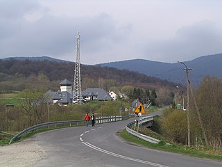
Ustrzyki Dolnepronounced ['usˈtʂɨkʲi ˈdɔlnɛ] is a town in south-eastern Poland, situated in the Subcarpathian Voivodeship close to the border with Ukraine. It is the capital of Bieszczady County, with 9,383 inhabitants (02.06.2009).
Ustrzyki Górne is a village in the administrative district of Gmina Lutowiska, within Bieszczady County, Subcarpathian Voivodeship, in south-eastern Poland, close to the border with Ukraine. It lies approximately 17 kilometres (11 mi) south of Lutowiska, 37 km (23 mi) south of Ustrzyki Dolne, and 114 km (71 mi) south-east of the regional capital Rzeszów.

Arłamów is a village in the administrative district of Gmina Ustrzyki Dolne, within Bieszczady County, Subcarpathian Voivodeship, in south-eastern Poland, near the border with Ukraine. It lies approximately 18 kilometres (11 mi) north of Ustrzyki Dolne and 69 km (43 mi) south-east of the regional capital Rzeszów.
Bandrów Narodowy is a village in the administrative district of Gmina Ustrzyki Dolne, within Bieszczady County, Subcarpathian Voivodeship, in south-eastern Poland, near the border with Ukraine. It lies approximately 9 kilometres (6 mi) south-east of Ustrzyki Dolne and 87 km (54 mi) south-east of the regional capital Rzeszów.

Brzegi Dolne is a village in the administrative district of Gmina Ustrzyki Dolne, within Bieszczady County, Subcarpathian Voivodeship, in south-eastern Poland. It lies approximately 3 kilometres (2 mi) north-east of Ustrzyki Dolne and 79 km (49 mi) south-east of the regional capital Rzeszów.
Jałowe is a village in the administrative district of Gmina Ustrzyki Dolne, within Bieszczady County, Subcarpathian Voivodeship, in south-eastern Poland, near the border with Ukraine. It lies approximately 6 kilometres (4 mi) east of Ustrzyki Dolne and 84 km (52 mi) south-east of the regional capital Rzeszów.

Jamna Dolna is a non-existing village in the administrative district of Gmina Ustrzyki Dolne, within Bieszczady County, Subcarpathian Voivodeship, in south-eastern Poland. It lies approximately 23 kilometres (14 mi) north of Ustrzyki Dolne and 61 km (38 mi) south-east of the regional capital Rzeszów.
Jureczkowa is a village in the administrative district of Gmina Ustrzyki Dolne, within Bieszczady County, Subcarpathian Voivodeship, in south-eastern Poland, near the border with Ukraine. It lies approximately 12 kilometres (7 mi) north of Ustrzyki Dolne and 70 km (43 mi) south-east of the regional capital Rzeszów.

Krościenko is a village in the administrative district of Gmina Ustrzyki Dolne, within Bieszczady County, Subcarpathian Voivodeship, in south-eastern Poland, near the border with Ukraine. It lies approximately 7 kilometres (4 mi) north-east of Ustrzyki Dolne and 79 km (49 mi) south-east of the regional capital Rzeszów.
Leszczowate is a village in the administrative district of Gmina Ustrzyki Dolne, within Bieszczady County, Subcarpathian Voivodeship, in south-eastern Poland. It lies approximately 8 kilometres (5 mi) north of Ustrzyki Dolne and 72 km (45 mi) south-east of the regional capital Rzeszów.

Liskowate is a village in the administrative district of Gmina Ustrzyki Dolne, within Bieszczady County, in the Subcarpathian Voivodeship of south-eastern Poland, near the border with Ukraine. It lies approximately 10 kilometres (6 mi) north of Ustrzyki Dolne and 73 km (45 mi) south-east of the regional capital Rzeszów.
Łobozew Dolny is a village in the administrative district of Gmina Ustrzyki Dolne, within Bieszczady County, Subcarpathian Voivodeship, in south-eastern Poland. It lies approximately 10 kilometres (6 mi) south-west of Ustrzyki Dolne and 79 km (49 mi) south-east of the regional capital Rzeszów.

Moczary is a village in the administrative district of Gmina Ustrzyki Dolne, within Bieszczady County, Subcarpathian Voivodeship, in south-eastern Poland, near the border with Ukraine. It lies approximately 8 kilometres (5 mi) south-east of Ustrzyki Dolne and 87 km (54 mi) south-east of the regional capital Rzeszów.
Nowosielce Kozickie is a village in the administrative district of Gmina Ustrzyki Dolne, within Bieszczady County, Subcarpathian Voivodeship, in south-eastern Poland. It lies approximately 16 kilometres (10 mi) north of Ustrzyki Dolne and 65 km (40 mi) south-east of the regional capital Rzeszów.
Równia is a village in the administrative district of Gmina Ustrzyki Dolne, within Bieszczady County, Subcarpathian Voivodeship, in south-eastern Poland. It lies approximately 2 kilometres (1 mi) south of Ustrzyki Dolne and 81 km (50 mi) south-east of the regional capital Rzeszów.

Trójca is a village in the administrative district of Gmina Ustrzyki Dolne, within Bieszczady County, Subcarpathian Voivodeship, in south-eastern Poland. It lies approximately 26 kilometres (16 mi) north of Ustrzyki Dolne and 58 km (36 mi) south-east of the regional capital Rzeszów.
Wola Romanowa is a village in the administrative district of Gmina Ustrzyki Dolne, within Bieszczady County, Subcarpathian Voivodeship, in south-eastern Poland. It lies approximately 8 kilometres (5 mi) north-west of Ustrzyki Dolne and 73 km (45 mi) south-east of the regional capital Rzeszów.
Zadwórze is a village in the administrative district of Gmina Ustrzyki Dolne, within Bieszczady County, Subcarpathian Voivodeship, in south-eastern Poland. It lies approximately 7 kilometres (4 mi) south-east of Ustrzyki Dolne and 87 km (54 mi) south-east of the regional capital Rzeszów.

Bystre is a village in the administrative district of Gmina Czarna, within Bieszczady County, Subcarpathian Voivodeship, in south-eastern Poland, close to the border with Ukraine. It lies approximately 5 kilometres (3 mi) east of Czarna, 17 km (11 mi) south-east of Ustrzyki Dolne, and 96 km (60 mi) south-east of the regional capital Rzeszów.
Wydrne is a village in the administrative district of Gmina Czarna, within Bieszczady County, Subcarpathian Voivodeship, in south-eastern Poland, close to the border with Ukraine. It lies approximately 8 kilometres (5 mi) west of Czarna, 14 km (9 mi) south of Ustrzyki Dolne, and 90 km (56 mi) south-east of the regional capital Rzeszów.


